Algeria
Wilaya de Batna, Algeria — Towns & Travel Guide


Wilaya de Batna is Algeria's Aurès heartland, where Roman Timgad and the cliff villages of Ghoufi rise high between two mountain ranges.
About Wilaya de Batna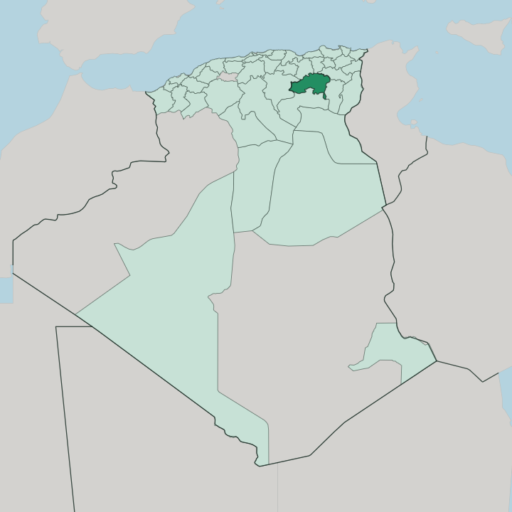


Towns & cities in Wilaya de Batna
Pick a town or city — each links to where to stay.
Batna city is the natural base. Its hotels cluster along the wide colonial avenues of the provincial capital, within an easy drive of Timgad, Lambaesis and Medghacen, which makes the city the usual launch point for the Roman circuit. Deeper in the Aurès, small guesthouses cling to the Ghoufi canyon.
Belezma National Park draws walkers. For the cedar forests and cooler air, the slopes of the Belezma Range northwest of the city suit a night away from the ruins.
About Wilaya de Batna
Roman ruins define the province.
What is Wilaya de Batna known for?
At its centre stands Timgad, the colony Trajan laid out on a strict grid east of Batna city, so complete in its streets and forum that visitors call it the Numidian Pompeii. Close by lie the legionary fortress of Lambaesis and the older Numidian tomb of Medghacen. The Chaoui Berbers hold the mountains.
Their canyon at Ghoufi, cut into red rock and lined with abandoned cliff dwellings above the Aurès, remains the province's other great sight.
Where is Wilaya de Batna?
Batna sits in northeastern Algeria. The province occupies the eastern reach of the Aurès, the mountain block that rises where the Tell Atlas to the north and the Saharan Atlas to the south close in on one another. Between them lies a high plateau of dry basins and salt flats.
The land tilts toward the Sahara. West of the capital the ground falls to Chott el Hodna, a shallow seasonal salt lake, while the wooded Belezma Range walls the plateau off to the northwest. Djebel Chélia crowns the eastern Aurès, the highest summit in northern Algeria.
Rivers do the rest. The Oued el Abiod knifes south through the range, carving the deep gorge at Ghoufi before its waters drain toward the desert margins beyond the mountains. This is the threshold between the Tell and the Sahara.
For centuries that in-between position made the Aurès a natural corridor and a natural refuge, open enough to cross yet broken enough to hide in. Batna city anchors the middle. The provincial capital stands on the high plateau roughly at the centre of the wilaya, the road hub from which every valley and ruin is reached.
What is Wilaya de Batna like?
The Aurès is Chaoui country. The Chaoui, the second-largest Berber people of Algeria, have held these mountains since long before Rome, and they still speak Chaouïa, a Tamazight tongue heard in the markets and mountain villages. At Ghoufi they built terraces and granaries straight into the canyon wall, a stacked village of mud and stone that families kept until the last century.
Farming still shapes the year. The orchards of N'Gaous are famous across Algeria for their apricots, pressed into juice and dried for the winter. Weaving and pastoral herding still run through the highland douars, where wool from mountain flocks becomes the striped burnous cloaks and flatweave rugs sold down in the Batna markets.
The mountains bred defiance. The Chaoui remember Dihya, the Berber queen who rallied the Aurès against the Arab armies at the end of the seventh century, as fiercely as they remember the Roman emperors who once ruled the same slopes. Batna city carries the modern side, a garrison town turned provincial capital with a university and wide French-built streets.
Roman stone underlies Berber ground here.
What is the history of Wilaya de Batna?
Numidian kings came first. Massinissa's kingdom of Numidia held the Aurès before Rome absorbed it, planting the colony of Timgad under Trajan and the fortress of Lambaesis for its African legion under Hadrian. When the Arab conquest swept west, the Aurès became the last redoubt of the Berber queen Dihya.
The French arrived much later. They founded Batna as a garrison in 1844, and a century on the same mountains lit the fuse of Algeria's war of independence. The Aurès rose first.
Mostefa Ben Boulaïd, a son of the region, opened the revolt in November 1954.
What is the climate of Wilaya de Batna?
Altitude rules the weather in Batna. The high plateau makes for a cold semi-arid climate, with hot dry summers and winters cold enough to bury the cedar slopes of Belezma under snow. Nights on the plateau drop below freezing, and the peaks of the Aurès hold snow well into spring.
Summer flips the script. Rain is sparse, the air dry, and the Sahara's heat pushes north over the ridges through the long months of drought.
How do you get to Wilaya de Batna?
Most people reach Batna by road rather than by air. Batna keeps its own airport, the Mostépha Ben Boulaïd field on the edge of the city, though its schedule leans on domestic hops to Algiers rather than flights from abroad. Many travellers instead land at Constantine to the north and drive up into the Aurès.
The railway reaches Batna too. National roads and the eastern rail line thread the plateau, linking the provincial capital to Constantine, Algiers and the towns of the high steppe like Merouana and N'Gaous.
Good for
Updated July 2026