Algeria
M’sila, Algeria — Towns & Travel Guide


M'sila is a high-plateau province of inland Algeria, its towns strung across the Hodna plain around the salt lake of Chott el-Hodna.
About M’sila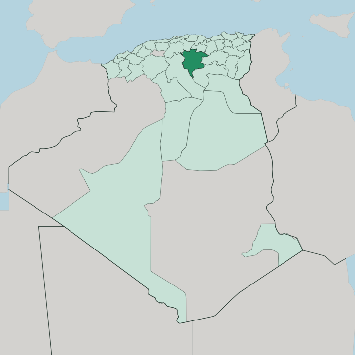


Towns & cities in M’sila
Pick a town or city — each links to where to stay.
Two towns matter. Bou Saâda, in the south-west, is the practical base: a real oasis with hotels strung along the Oued Bou Saâda and the Dinet museum in its old quarter. The provincial capital sits more centrally on the Hodna plain, plainer but the nearest bed to Qal'at Bani Hammad in the northern hills.
Choose Bou Saâda if you want the desert oasis; choose the capital if the Hammadid ruins are the reason you came.
About M’sila
What is M’sila known for?
Two places carry M'sila's name beyond the province. One is old, one older still. Qal'at Bani Hammad, the ruined first capital of the Hammadid dynasty, stands in the mountains north-east of the provincial town and holds a UNESCO World Heritage listing.
The other is Bou Saâda, an oasis on the desert's edge that drew the French painter Nasreddine Dinet and lent its Ouled Naïl weavers their fame. Between them lies the flat, saline sink of Chott el-Hodna.
Where is M’sila?
M'sila fills a broad inland basin in the north-centre of Algeria, part of the high plateau country the geographers call the Hautes Plaines. No coast reaches this inland basin. The province sits in the trough between two mountain systems: the Tell Atlas closing off the coast to the north, and the Saharan Atlas rising toward the desert in the south.
Most of its surface is the Hodna, a natural region of dry steppe and grazing land that gives the province its shape. At the centre of that plain lies Chott el-Hodna, a shallow salt lake with no outlet to the sea. Seasonal wadis run down off the surrounding heights and vanish into it.
In the dry months the water withdraws and leaves a crust of naked salt across the basin floor. The land is not uniform. The Hodna Mountains wall the plain along its northern side, and the ruins of Qal'at Bani Hammad stand up in those hills.
Away to the south-west, the ground climbs again toward the Ouled Naïl Range, and it is on that drier margin, where the steppe gives out to the pre-desert, that the oasis of Bou Saâda sits. The provincial capital keeps to the open plain near the northern edge of the chott. M'sila as an administrative unit is young: it was carved in 1974 from parts of the former départements of Batna, Médéa and Sétif, drawing a single province around the Hodna basin that had been split among its neighbours.
What is M’sila like?
Two cultural threads run through M'sila, and both belong to its dry margins. The first is the Ouled Naïl, the Arab tribal confederation that gives its name to the range above Bou Saâda. Their women were once known across the Sahara as dancers and singers who travelled the oasis towns, and the wool carpets woven in Nailiya patterns still come off looms in the region.
The second thread is the trade of the oasis itself. Bou Saâda has long been a market for nomads coming in off the steppe, and its workshops turn out silver jewellery, beaten metalwork, and the curved bousaadi knife that carries the town's name. That oasis life pulled in outsiders too.
Nasreddine Dinet, the French painter born Étienne Dinet, spent years in Bou Saâda, converted to Islam, and made the Ouled Naïl and their light known to Europe; a museum in the old town keeps his canvases. The deeper past speaks through stone. When the Hammadid court held Qal'at Bani Hammad in the northern hills, chroniclers such as Al-Bakri recorded a city that drew poets, jurists and theologians from across the Maghreb.
Everyday speech here is Arabic. Date palms, weekly souks and the long horizon of the plain frame the ordinary rhythm of the province.
What is the history of M’sila?
M'sila carries the memory of two capitals. The Fatimids founded the town in the tenth century to hold the Hodna and its caravan roads. Power later moved north into the hills, where Hammad ibn Buluggin raised Qal'at Bani Hammad in 1007 as the seat of the Hammadid dynasty.
It flourished briefly as a city of trade and learning, then the incoming Banu Hilal made the plains unsafe and the court withdrew. The Almohads levelled the citadel in 1152.
What is the climate of M’sila?
M'sila runs dry and continental. Summers on the Hodna plain are long, hot and almost rainless, while winters turn genuinely cold, with frost and the odd fall of snow on the higher ground. What rain there is arrives unevenly.
The northern Hodna Mountains catch more of it than the salt basin, which stays parched at the heart of the province. Bou Saâda, on the southern edge, tips further toward the desert and draws its visitors in the cooler winter months.
How do you get to M’sila?
There is no coast and no big airport here. Most travellers reach M'sila by road, driving south-east from Algiers across the Tell Atlas, or coming in from the eastern cities of Sétif and Batna, whose airports are the closest. The main national highway down toward the Sahara passes through Bou Saâda, which is why the oasis has always been the easiest part of the province to reach.
Sidi Aïssa, in the northern hills, is the usual gateway on the road from the capital. The last stretch is overland.
Good for
Updated July 2026