Algeria
Wilaya de Bejaïa, Algeria — Towns & Travel Guide


Wilaya de Bejaïa is Kabylia's Mediterranean province in northern Algeria, where the Soummam River reaches the sea below the Gouraya ridge.
About Wilaya de Bejaïa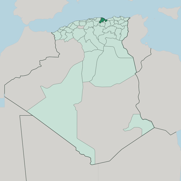


Towns & cities in Wilaya de Bejaïa
Pick a town or city — each links to where to stay.
Most visitors base themselves in Béjaïa, the provincial capital and its only real city. The Corniche runs east from there along the coast. Tichy and Aokas string beach hotels beside the sand, and the coast road carries on toward the resort strip that fills through the warm months.
Inland, Akbou anchors the Soummam valley. Choose the city for the port and the old upper town; choose the eastern beaches for the water, and the valley for the road up into the Kabyle mountains.
About Wilaya de Bejaïa
Béjaïa is the old port at the centre of it.
What is Wilaya de Bejaïa known for?
Medieval Europe knew the city as Bougie, and the French word for a candle still carries that name, after the wax the port shipped to Genoa, Marseille and Naples. Fibonacci learned Hindu-Arabic numerals here as a boy. Above the town, Gouraya National Park shelters Barbary macaques on the cliffs, and Cap Carbon drops sheer to the Mediterranean at the harbour mouth.
This is Kabyle country.
Where is Wilaya de Bejaïa?
Wilaya de Bejaïa sits on the Mediterranean coast of northern Algeria, east of the capital at Algiers, in the mountainous region of Kabylia. The provincial capital, Béjaïa, stands on a sickle-shaped bay. Cap Carbon, a cliff headland at the harbour mouth, shelters the anchorage from the open sea.
Behind the town rises Mount Gouraya, the limestone ridge that gives the national park its name. The coast is short but dramatic. It runs east from the city through the beach towns of Tichy and Aokas toward Souk El Ténine, and west along the rockier shore past Boulimat, hemmed the whole way by hills that fall straight to the water.
Inland, the province is all mountains. The Soummam River is its spine, gathering the waters of the Kabyle highlands and reaching the sea at Béjaïa, and its broad valley is the one natural corridor into the interior. Akbou sits on that river, the main town of the upper valley.
The Djurdjura range rises along the western approaches, and the Babors close the eastern side, so the roads mostly follow the water. This is Petite Kabylie. Ridge, valley and shore leave little flat ground, and nearly every road here either climbs a slope or traces the edge of the sea.
What is Wilaya de Bejaïa like?
This is a Berber province, and its first language is Kabyle. People here speak Taqbaylit, the Kabyle tongue, alongside Arabic, and the province counts as one of the strongholds of Berber identity in Algeria. Béjaïa and Tizi Ouzou are the twin cultural capitals of Kabylia, rivals for the title.
It was in the Soummam valley that the Berber cultural movement found much of its voice, in the protests of the Berber Spring and after. Language is the heart of it. Away from the coast, life is village life.
Kabyle villages hold to the higher ground, stone houses gathered on ridgelines above terraces of olive and fig trees that have fed these mountains for centuries. Olive oil is the pride of the region. The city keeps a different rhythm, with cafés along the Corniche, a working port, and a summer that fills the beaches at Tichy.
Music, poetry and the spoken word carry weight here.
What is the history of Wilaya de Bejaïa?
The Hammadid dynasty built Béjaïa into its capital in the eleventh century, and the port grew into one of the great trading and scholarly cities of the medieval Maghreb. The Almohads took it in 1152. Hafsid, Spanish and Ottoman rulers held the harbour in turn before France seized it in 1833.
The scholar Ibn Khaldun served the court here. Independence brought its own landmark: at Ifri in the Soummam valley, the 1956 congress reorganised the Algerian war of independence.
What is the climate of Wilaya de Bejaïa?
The coast has a Mediterranean climate, hot and dry through the summer, mild and wet in winter. Rain comes off the sea. The coastal strip is one of the wettest corners of Algeria, and the hills behind Béjaïa wring heavy downpours out of the winter storms that roll in from the Mediterranean.
Summer is the beach season, when the heat settles and the Corniche fills. Snow falls on the high Djurdjura and the Babors while the shore below stays green.
How do you get to Wilaya de Bejaïa?
Béjaïa has its own airport on the coast, Soummam-Abane Ramdane, with flights to Algiers and across the Mediterranean to France. Ferries and freight use the port. The road in from Algiers runs a few hours east along the shore, and a rail line follows the Soummam valley up to meet the main Algiers-to-Constantine line inland.
Mountains shape every route. Most approaches either trace the coast or climb the river valleys, because the ridges close off everything between.
Good for
Updated July 2026