Algeria
Wilaya de Chlef, Algeria — Towns & Travel Guide


Chlef is a north Algerian province where the Chélif, the country's longest river, waters a farm valley between the Dahra and Ouarsenis hills.
About Wilaya de Chlef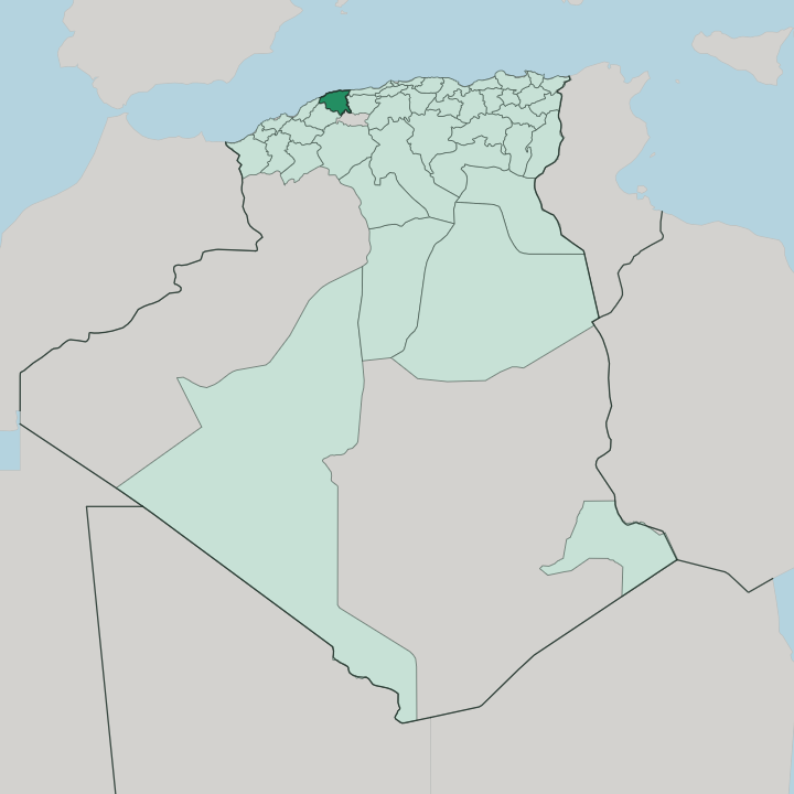


Towns & cities in Wilaya de Chlef
Pick a town or city — each links to where to stay.
Chlef city is the natural base, set on the valley floor beside the Chélif and a short drive from Aboubakr Belkaid airport, convenient for the interior and the onward roads west. The coast is the other draw. Ténès puts harbour hotels below its lighthouse, with Roman and Andalusian ruins stacked above the fishing port, while Béni Haoua holds a run of quiet coves further west along the Dahra shore.
Inland, Ouled Ben Abdelkader marks where the plain climbs into the Ouarsenis, for walkers who want the wooded massif rather than sand. Away from those two towns, rooms turn to rentals and small auberges.
About Wilaya de Chlef
Two forces shape Chlef: water and quakes.
What is Wilaya de Chlef known for?
The Chélif, Algeria's longest river, carries snowmelt off the Saharan Atlas down a broad farming valley planted with orange groves and cereals, while the Dahra hills to the north and the Ouarsenis massif to the south wall it in. Its coast meets the Mediterranean at Ténès, an old fishing port with a lighthouse on Cap Ténès. The province is known too for catastrophe: the 1980 El Asnam earthquake flattened the capital and gave it the new name it still carries.
Where is Wilaya de Chlef?
Chlef lies within the Tell Atlas, the coastal mountain belt of northern Algeria, a band of ridges and basins west of Algiers along the road toward Oran. The province stacks into four strips. A Mediterranean shore of roughly 130 km runs along the top, broken by the headland at Cap Ténès.
Behind it the Dahra range climbs in dry, folded hills. To the south the Ouarsenis massif rises much higher, its crest at Kef Sidi Amar the roof of the whole region. Between the two ranges lies the flat heart of the province: the Chélif valley.
The Chélif enters from the Aïn Defla side in the east and threads west across the Middle Chélif plain before leaving toward Relizane and the sea. This is Algeria's longest river, fed off the Saharan Atlas, and its silt makes the valley the farming core of the wilaya. Water is stored behind hill dams such as the Oued Fodda on a tributary of the same name.
Around the plain the province meets its neighbours: Tipaza and Aïn Defla to the east, Mostaganem and Relizane to the west, Tissemsilt over the mountains to the south. The land tilts from bare uplands down to irrigated orchards. It is a valley walled by hills.
What is Wilaya de Chlef like?
Daily life in Chlef runs in Arabic, in the North African dialect shared across the country, over a Berber substratum that older place names in the Dahra still carry. Faith is Muslim, and the rhythm of the farming year sets much of the calendar. The Chélif valley is orchard country.
Its groves send oranges and other citrus to markets across Algeria, alongside cereals and olives grown on the plain, and agriculture underpins how most of the wilaya lives and eats. The coast keeps a different trade. Boats work out of Ténès for sardine and other catch, and grilled fish is the coast's plain pleasure.
Ténès also holds the province's deepest layer of past. A Phoenician anchorage became Roman Cartennae, and above the modern harbour sits Vieux Ténès, a walled medieval quarter founded by Andalusian settlers, its old mosque and lanes still standing. One event overshadows all local memory.
The 1980 earthquake levelled the capital and reshaped its people, and rebuilding to survive the next tremor became a civic creed passed to the young. Craft survives in pottery and weaving from the hill villages. Bread, olives and citrus fill the table.
This is a working province before it is a scenic one.
What is the history of Wilaya de Chlef?
Chlef's story is one of names changing after disaster. The French laid out a garrison town here in 1843, calling it Orléansville and building it over the Roman ruins of Castellum Tingitanum. A first major earthquake struck in 1954.
At independence in 1962 the town took the Arabic name El Asnam, but on 10 October 1980 a far larger quake destroyed most of it and killed thousands in seconds. Rebuilt to resist the next shock, the town was renamed a third time, becoming Chlef, the local form of the Chélif that waters its valley.
What is the climate of Wilaya de Chlef?
Chlef has a Mediterranean climate pulled to extremes by its shape. The valley floor bakes. Trapped between the Dahra and the Ouarsenis, the Chélif plain around the capital counts among the hottest ground in the whole north of the country through the dry summer.
Winter brings the rain, most of it falling between autumn and spring. The coast at Ténès stays gentler, cooled by the Mediterranean, while the Ouarsenis heights turn cold enough for winter snow on the higher ridges.
How do you get to Wilaya de Chlef?
Chlef sits on the Algiers to Oran corridor, roughly 200 km west of the capital, where the east-west motorway and the old national road both run the length of the Chélif valley. Foreign arrivals usually land at Algiers, then head west by road or rail. Trains on the Algiers-Oran main line stop at Chlef.
The city keeps its own airport, Aboubakr Belkaid, a short way north of the centre. Ténès adds a Mediterranean port.
Good for
Updated July 2026