Egypt
Muḩāfaz̧at ad Daqahlīyah, Egypt — Towns & Travel Guide


Muḩāfaz̧at ad Daqahlīyah sits in the northeastern Nile Delta, its capital Mansoura on the Damietta branch of the Nile.
About Muḩāfaz̧at ad Daqahlīyah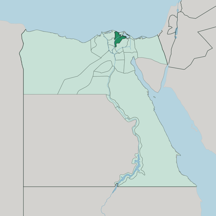
Towns & cities in Muḩāfaz̧at ad Daqahlīyah
Pick a town or city — each links to where to stay.
Mansoura is the obvious base, the capital and the one city with a real hotel offer, ranged along the Damietta branch where the corniche follows the water. Past Mansoura, rooms grow scarce. Talkha faces Mansoura across the river and reads as one agglomeration with it, joined by bridges over the Damietta branch.
Mit Ghamr lies upstream to the south, a working town on the same water. If you want a Delta base with a university crowd and a riverfront, choose Mansoura; the smaller towns are day-trip country, not places to sleep.
About Muḩāfaz̧at ad Daqahlīyah
What is Muḩāfaz̧at ad Daqahlīyah known for?
Two things define this governorate: fertile Delta farmland and a medieval battle. The Damietta branch of the Nile splits Mansoura from Talkha on the far bank, and the water that irrigates the cotton and rice fields is the same water that carried a crusade to ruin. Louis IX marched on Mansoura in 1250 and left it a prisoner.
Lake Manzala spreads across the northeastern edge, a brackish lagoon where fishing boats still work. Arabic is the language, farming the livelihood.
Where is Muḩāfaz̧at ad Daqahlīyah?
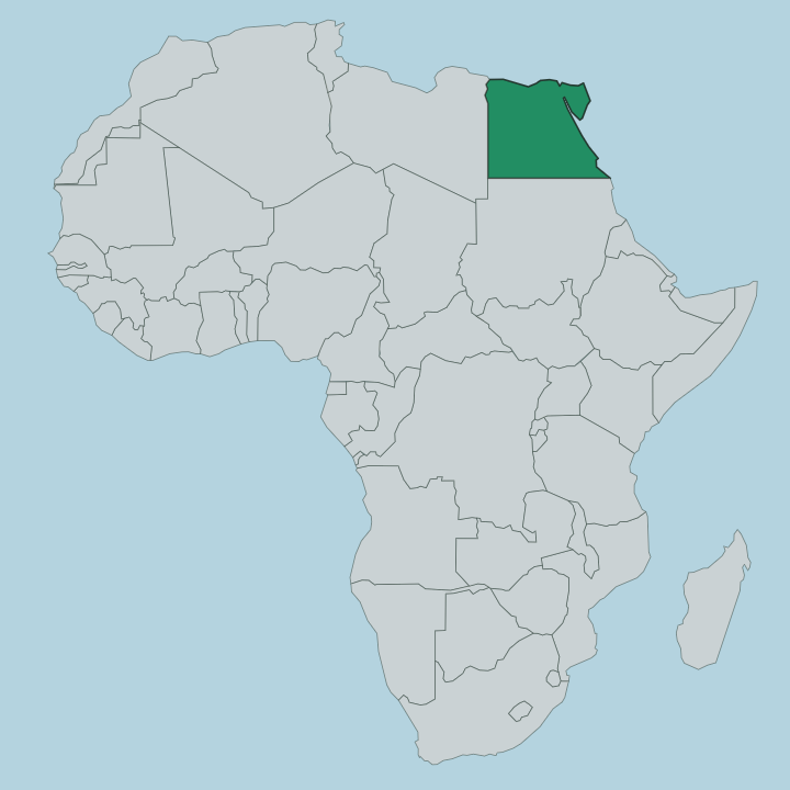
The governorate lies in the northeastern Nile Delta, part of Lower Egypt where the river fans out toward the Mediterranean. It is flat. There are no hills here, only cropland stitched with canals and drains across ground that the Nile laid down over millennia.
The Damietta branch, one of the two great channels the river splits into below Cairo, runs down the western side and through the capital at Mansoura, carrying the water that makes the fields some of the most productive in Egypt. To the northeast the land gives way to Lake Manzala, a wide brackish lagoon that opens toward the coast. Governorates border Dakahlia at every point of the compass.
Kafr El-Sheikh sits to the north, Damietta to the northeast, Sharqia to the east, Qalyubia to the south, and Gharbia to the west across the river country. Mansoura stands roughly in the middle, on the east bank of the Damietta branch, about a hundred and twenty kilometres north-east of Cairo. Talkha faces it from the opposite bank.
The Baḥr al-Ṣaghīr canal leaves the Damietta branch near Mansoura and runs east to feed Lake Manzala, the old artery that once linked the river to the lagoon. Nothing about this land rises far above the water table.
What is Muḩāfaz̧at ad Daqahlīyah like?
This is farming Delta first and foremost, and the rhythm of the land sets the rhythm of life. Cotton, rice and maize come off the fields around Mansoura and Mit Ghamr, and the river towns process what the countryside grows. Mansoura carries the intellectual weight.
Its university, and above all the Urology and Nephrology Center that Mohamed Ghoneim built there, drew doctors and students from across Egypt and gave the capital a reputation that outruns its size. Talkha across the river turns out fertilizer, Mit Ghamr aluminium, so the province is as much a working landscape of chimneys and canals as it is a green one. Arabic is spoken throughout, and the calendar of the governorate is bound to a single day: the seventh of May, its national day, marks the defeat of Louis IX at Mansoura.
The memory of that victory is woven into how the place understands itself. Daily life turns on the river, the fields and the market towns strung along the Damietta branch, and the culture here is Delta Egyptian to the core rather than anything a tourist itinerary invents.
What is the history of Muḩāfaz̧at ad Daqahlīyah?
The governorate takes its name from Daqahlah, a Delta town of the Fatimid era that the rising waters of Lake Manzala later swallowed. Mansoura itself was founded in 1219 as the fortified camp of the Ayyubid sultan al-Malik al-Kamil. Its name means the victorious.
The reason is 1250, when the crusade of Louis IX broke against the town, the French king was taken prisoner, and the campaign that had sailed up the Damietta branch collapsed. That defeat still anchors the governorate's memory of itself.
What is the climate of Muḩāfaz̧at ad Daqahlīyah?
The climate is hot desert, tempered a little by the Delta. Summers around Mansoura run long, dry and bright, with July and August the hottest stretch and rain effectively absent from May into September. Winters are cool and short.
A little light rain falls between December and February, and nights can drop sharply once the sun is down. Sitting inland from the coast on the Damietta branch, the governorate stays milder than the Egyptian interior but never escapes the Delta's heavy summer glare.
How do you get to Muḩāfaz̧at ad Daqahlīyah?
Most travellers reach the governorate overland from Cairo, roughly a hundred and twenty kilometres to the south-west. The capital is the destination. Road and rail thread up through the Delta from Cairo, and trains stop at Mansoura on the line that continues to Damietta on the coast.
There is no international airport in the province itself, so arrivals fly into Cairo first. Within Muḩāfaz̧at ad Daqahlīyah, the towns along the Damietta branch are linked by the river road that ties Mit Ghamr, Mansoura and Talkha together.
Good for
Updated July 2026