Egypt
Muḩāfaz̧at Sūhāj, Egypt — Towns & Travel Guide


Muḩāfaz̧at Sūhāj is a governorate of Upper Egypt, a ribbon of the Nile Valley threaded between the desert cliffs.
About Muḩāfaz̧at Sūhāj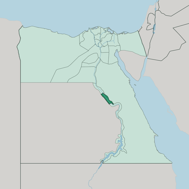
Towns & cities in Muḩāfaz̧at Sūhāj
Pick a town or city — each links to where to stay.
Sūhāj is the base. The capital sits on the west bank of the Nile, close to the White Monastery and the Red Monastery, with the province's museum on the east bank facing the governorate offices. Akhmīm lies just across the water, the weaving town where the tallest statue of an ancient queen ever found was raised again.
Girga, the old capital downriver, and El Balyana, the stop for Abydos, are day trips rather than places to sleep. Stay in Sūhāj city if you want the monasteries and the museum within reach; choose it too as the rail and road hub for the temples further out.
About Muḩāfaz̧at Sūhāj
This is Coptic and pharaonic ground.
What is Muḩāfaz̧at Sūhāj known for?
The Temple of Seti I at Abydos, one of the most complete temples left in Egypt, draws the pilgrims and the curious to the necropolis where the early kings were buried. The White Monastery and the Red Monastery stand on the desert edge north-west of Sūhāj, two of the oldest Christian houses in the country. Across the river at Akhmīm, the ancient Panopolis, weavers still work the looms that made the town famous.
The Nile carries all of it, north to south.
Where is Muḩāfaz̧at Sūhāj?
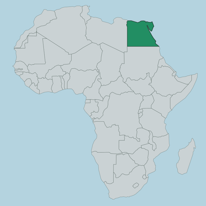
Muḩāfaz̧at Sūhāj lies in Upper Egypt, the southern reach of the country, covering a stretch of the Nile Valley that runs roughly 125 kilometres from end to end. The river splits it in two. Sūhāj city, the capital, stands on the west bank, and Akhmīm faces it across the water.
Almost all the farmland lies west of the Nile, where the flood once spread its silt over a flat-bottomed valley hemmed in by limestone cliffs. Beyond those cliffs there is only desert. Cotton, wheat, sugarcane and onions grow on the irrigated land, and the towns crowd the green ribbon rather than the barren edges.
Four neighbours ring it. Asyut Governorate borders it to the north and Qena Governorate to the south, the two provinces strung along the same valley, while the Red Sea Governorate reaches away to the east across the Eastern Desert and the vast New Valley Governorate opens to the west. Cairo lies far downstream, some 467 kilometres to the north.
Sūhāj is Middle Egypt's threshold into the deep south, and the Nile is the road that ties every one of its towns together.
What is Muḩāfaz̧at Sūhāj like?
Faith is layered thick here. The White Monastery, raised by Saint Shenoute around the year 400, and the nearby Red Monastery of Saint Pshoi are among the oldest surviving Coptic Orthodox houses anywhere, their limestone and burnt-brick walls holding painted saints from the Byzantine centuries. Coptic Christians make up a larger share of the people in this part of Upper Egypt than they do across the country as a whole.
That heritage lives beside a deep Muslim majority, and the two have shared the valley for a very long time. Akhmīm carries a different memory. The town was Panopolis to the Greeks, sacred to Min, and its weavers have turned out fine cloth for thousands of years; their handwork still fills the town's weekly market.
Arabic is the language of the streets, spoken in the broad Ṣa'īdi cast of the Upper Egyptian south. The Sohag National Museum, on the east bank of the Nile, gathers the province's antiquities under one roof after a build that dragged on for a quarter of a century. Life is rural.
Most people work the land, and the rhythm of planting and harvest still sets the pace of the year.
What is the history of Muḩāfaz̧at Sūhāj?
The past reaches deep. Girga, the province's old capital, stands near what may have been Thinis, the seat from which Narmer is said to have first united the country in the late fourth millennium BC. Abydos became the burial ground of those first kings, and in time it grew into the great pilgrimage centre of the cult of Osiris.
The governorate was itself called Girga Governorate until 1960, when the capital moved downriver to Sūhāj and the name changed with it. Two capitals, one valley.
What is the climate of Muḩāfaz̧at Sūhāj?
Sūhāj runs hot and dry. The desert on either side of the Nile Valley gives it a fierce summer, when the daytime heat climbs high and the air stays parched, and a mild, short winter that is the kinder season to travel. Rain barely figures.
The river, not the sky, is what keeps the fields west of the Nile alive, and the green ends abruptly where the irrigation stops. Come between late autumn and early spring for the monasteries and the temples.
How do you get to Muḩāfaz̧at Sūhāj?
The train is the classic way in. Sūhāj sits directly on the main Cairo-Aswan railway that runs the length of the Nile Valley, and its station is in the heart of the city, so services from the capital and the far south stop here through the day. Sohag International Airport lies about 25 kilometres out, handling domestic flights and a handful of international ones.
By road the province is roughly 467 kilometres south of Cairo, with the quickest approach dropping down from Asyut. Once you arrive, road and rail thread every town along the river.
Good for
Updated July 2026