Egypt
Muḩāfaz̧at ash Sharqīyah, Egypt — Towns & Travel Guide


Sharqia fills the eastern edge of the Nile Delta, a flat farm province around Zagazig, the biblical Land of Goshen.
About Muḩāfaz̧at ash Sharqīyah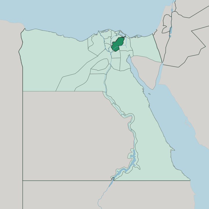
Towns & cities in Muḩāfaz̧at ash Sharqīyah
Pick a town or city — each links to where to stay.
Zagazig is the obvious base, the provincial capital on the Muweis Canal and a short drive from the Tell Basta ruins of Bubastis. Rooms elsewhere are thin. The 10th of Ramadan City, an industrial new town on the Cairo-Ismailia desert road, gives you the closest bed to Greater Cairo if you are passing through.
Bilbeis, the old caravan town that ran the province before Zagazig took the seat, sits further south toward the capital. Base yourself in Zagazig for the ruins; treat the rest as road stops.
About Muḩāfaz̧at ash Sharqīyah
What is Muḩāfaz̧at ash Sharqīyah known for?
Sharqia is one of Egypt's great farm belts, a checkerboard of cotton, wheat and rice fields on the eastern side of the Nile Delta. Two lost cities pull travellers off the highway. Tanis, the San el-Hagar mounds, once served as a royal capital and gave up silver coffins and gold masks to rival Tutankhamun's.
Bubastis, at Tell Basta beside Zagazig, was the cult centre of the cat goddess Bastet. Farms and ruins, side by side.
Where is Muḩāfaz̧at ash Sharqīyah?
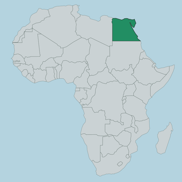
Sharqia occupies the eastern side of the Nile Delta, the great fan of silt where the Nile splits and spreads before reaching the sea. It is Lower Egypt, flat as a table. The land is alluvial plain, laid down over millennia by the river's floods and threaded with irrigation canals that carry Nile water out across the fields.
Cairo lies to the south-west, close enough that the province's southern towns bleed into the capital's orbit. To the north-east the farmland gives way to Lake Manzala, a broad brackish lagoon that separates the cultivated Delta from the Mediterranean. There are no mountains here.
Zagazig sits near the centre on the Muweis Canal, a distributary of the Nile that made the town a corn and cotton market in the first place. The whole province covers a little under five thousand square kilometres of some of the richest soil in Egypt. Every acre is worked.
Because it is the Delta's eastern shoulder, Sharqia was the natural land bridge toward Sinai and the Levant, which is why the ancients built their frontier capitals here rather than on the river itself.
What is Muḩāfaz̧at ash Sharqīyah like?
This is farming country, and the rhythm of the land sets the tone. Cotton, wheat and rice come off the fields in their seasons, and Sharqia grows more wheat than any other province in Egypt. Village life dominates.
Most of the people live rural, in mudbrick and concrete hamlets strung along the canals, and the market towns fill and empty on their trading days. Zagazig is the exception, a working Delta city with its university and its rail junction, though even it grew up around the corn and cotton trade rather than around tourism. The past sits very close to the surface.
Farmers plough within sight of the mounds at Tell Basta and San el-Hagar, and the cat goddess Bastet was worshipped at Bubastis for well over a thousand years before the temples fell quiet. This is the eastern Delta, long tied to the biblical Land of Goshen, where Egyptian tradition places the Israelites of the Exodus. Arabic is the language of the streets and the fields.
The culture here is Egyptian to the core, agrarian and unhurried, shaped by the Nile's water rather than by the tour bus.
What is the history of Muḩāfaz̧at ash Sharqīyah?
The eastern Delta was old when the pyramids were young. Bubastis, at Tell Basta beside Zagazig, was a cult city of the goddess Bastet from the age of the early dynasties, and one line of pharaohs ruled Egypt from here. Later the kings moved north to Tanis, at the San el-Hagar mounds, which served as a royal capital and burial ground through the Third Intermediate Period.
The modern province is far younger. Zagazig itself rose only in the 1820s, when cotton spread across the eastern Delta and a rail junction made a market town of it, taking the provincial seat from the older centre at Bilbeis.
What is the climate of Muḩāfaz̧at ash Sharqīyah?
Sharqia has a hot desert climate, softened a little by the moisture of the surrounding Delta. Across Sharqia the summer runs long and fierce. From late spring the sun bakes the open fields, and the ancient mounds at Tanis and Tell Basta offer almost no shade, so most travellers come between October and April instead.
Winters stay short and mild. Nights turn cool, with only a trace of rain drifting in off the Mediterranean to the north. The Nile canals, not the sky, keep this land green.
How do you get to Muḩāfaz̧at ash Sharqīyah?
Sharqia rides on Cairo's doorstep. Almost everyone arrives overland from the capital, and Zagazig sits roughly an hour's drive north-east of Cairo, linked by both the Delta highways and one of Egypt's busiest rail lines. The 10th of Ramadan City stands directly on the Cairo-Ismailia desert road, an easy stop between the capital and the Suez Canal.
The province has no airport of its own. Fly into Cairo, then take the train or a car out across the eastern Delta to the ruins and the fields.
Updated July 2026