Egypt
Muḩāfaz̧at al Qalyūbīyah, Egypt — Towns & Travel Guide


Muḩāfaz̧at al Qalyūbīyah sits at the apex of the Nile Delta, just north of Cairo, where the river splits in two.
About Muḩāfaz̧at al Qalyūbīyah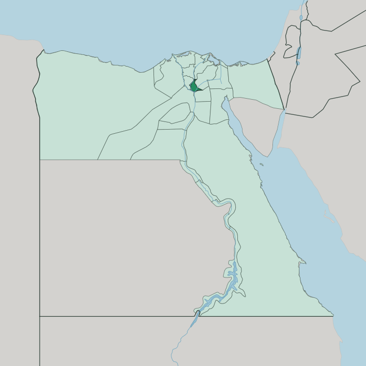
Towns & cities in Muḩāfaz̧at al Qalyūbīyah
Pick a town or city — each links to where to stay.
Base yourself in Cairo. Few travellers sleep inside the governorate by choice; most stay in the capital, immediately to the south, and cross the line for the day. Benha is the one practical exception, a working transport town on the east bank of the Damietta branch where the Delta rail lines converge.
Shubra El Kheima, on the southern rim, is really an extension of the Cairo conurbation. For green riverside space, you want El Qanater El Khayreya at the head of the Delta, the classic day trip out. Treat Muḩāfaz̧at al Qalyūbīyah as a cluster of stops within easy reach of the capital.
About Muḩāfaz̧at al Qalyūbīyah
This is where the Delta begins.
What is Muḩāfaz̧at al Qalyūbīyah known for?
At El Qanater El Khayreya, the Nile forks into its Damietta and Rosetta branches, held back by the nineteenth-century Delta Barrage whose surrounding gardens draw picnickers up from Cairo. Benha, the capital, is the rail knot that ties the whole Delta to the capital to the south. To the north of Benha lie the ruins of Athribis, capital of an ancient Lower Egyptian nome.
The southern edge blurs into Shubra El Kheima, one of the largest cities in Egypt and now the heart of the country's electronics industry.
Where is Muḩāfaz̧at al Qalyūbīyah?
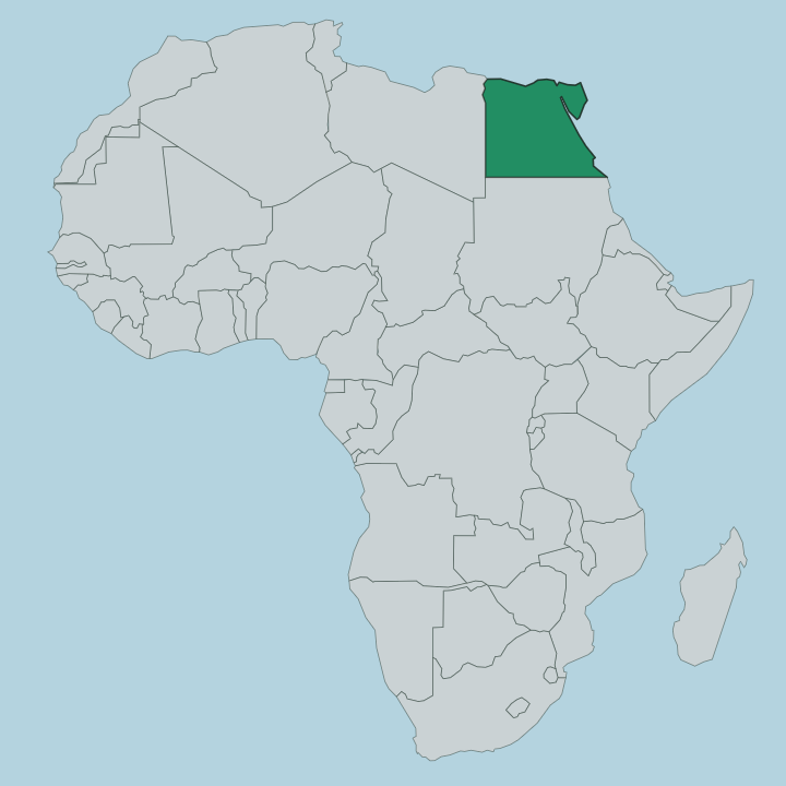
Muḩāfaz̧at al Qalyūbīyah occupies the very head of the Nile Delta, the wedge of land where the single river of Upper Egypt fans out toward the Mediterranean. Its territory is compact. Cairo and Giza press against its southern edge, so close that the city of Shubra El Kheima has effectively merged into Greater Cairo.
To the north lie Ad Daqahlīyah and Al Gharbīyah, deeper into the Delta farmland; Ash Sharqīyah frames the east and Al Minūfīyah the west. The defining line through it all is water. At El Qanater El Khayreya the Nile divides into the Damietta branch, which runs down the eastern side of the governorate past Benha, and the Rosetta branch, which peels off to the west.
Between and around those channels stretches some of the richest irrigated farmland in Egypt, a flat green plain threaded with canals fed from the Delta Barrage. The capital, Benha, stands on the east bank of the Damietta branch, roughly halfway between Cairo and Tanta. Nowhere here is far from a canal or a field.
That head-of-the-Delta position, straddling the split of the Nile, is what has made the governorate matter for irrigation, for transport, and for the ancient towns that grew up along the water.
What is Muḩāfaz̧at al Qalyūbīyah like?
Life here is Delta life, shaped by the river and the fields it feeds. The governorate is farmland first: maize and cotton, wheat, and orchards heavy with oranges, apricots, and bananas, and it leads the country in poultry and eggs. The name itself carries an odd echo of antiquity.
Qalyūb, the town it comes from, is thought to arabise the Greek Kalliópē, the muse of epic poetry. Older still is Athribis, just north of Benha, once the seat of a Lower Egyptian nome and layered with Ptolemaic, Roman, and Byzantine remains. Alongside that deep past runs a hard modern edge.
Shubra El Kheima, on the Cairo fringe, grew into a dense industrial city and became the centre of Egypt's electronics manufacturing. The everyday language is Egyptian Arabic, spoken across the whole governorate as it is across the country. Two worlds sit side by side here.
One is the slow green world of canal-fed fields and riverside gardens; the other is the crowded factory belt where the Delta meets the capital. Both are Qalyūbīyah.
What is the history of Muḩāfaz̧at al Qalyūbīyah?
The land is older than the name. Athribis, on the hill of Kom Sidi Yusuf just north of Benha, was a city of the tenth Lower Egyptian nome and remained lived-in through Ptolemaic, Roman, and Byzantine times. The modern shape of the region owes most to the nineteenth century.
Under Muhammad Ali Pasha, engineers began the Delta Barrage at El Qanater El Khayreya to master the Nile's flood and feed the canals; the works were completed in 1862, the first modern irrigation structure to span the river. Benha rose in the same century as a Delta railway junction. Water made all of it.
What is the climate of Muḩāfaz̧at al Qalyūbīyah?
The climate is hot and dry, a desert regime softened only a little by the Delta's canals and fields. Summers on the plain are long and fierce. Rain is almost unheard of from spring through autumn, and the little that falls comes in the mild, short winter, blown in off the Mediterranean to the north.
The comfortable window for the Delta Barrage gardens or the streets of Benha runs through the cooler months, roughly October to April. Skip high summer.
How do you get to Muḩāfaz̧at al Qalyūbīyah?
Almost everyone comes through Cairo. The capital's international airport sits just to the south, and the governorate begins where Greater Cairo ends around Shubra El Kheima. From there Benha is the key.
It is one of the busiest rail junctions in the Delta, and the main lines running north out of Cairo toward Tanta, Alexandria, and the Damietta side all thread through it. Trains and the riverside roads following the Damietta branch tie the towns together. Reaching Qalyūbīyah, in practice, means simply heading north out of Cairo.
Updated July 2026