India
State of Bihar, India — Towns & Travel Guide


Bihar is a state on the Gangetic plain of eastern India, split by the Ganges and heir to the ancient realm of Magadha.
Find your area →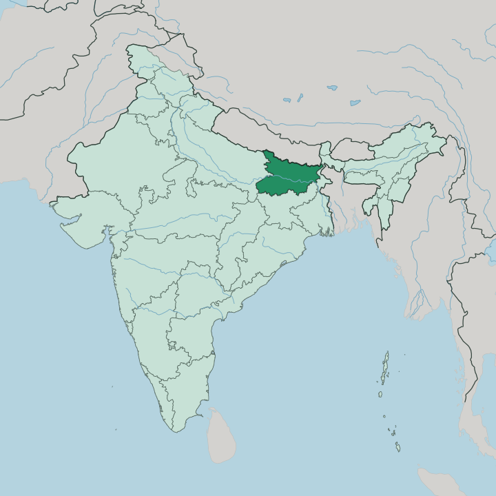
Towns & cities in State of Bihar
Pick a town or city — each links to where to stay.
 India
India
Patna
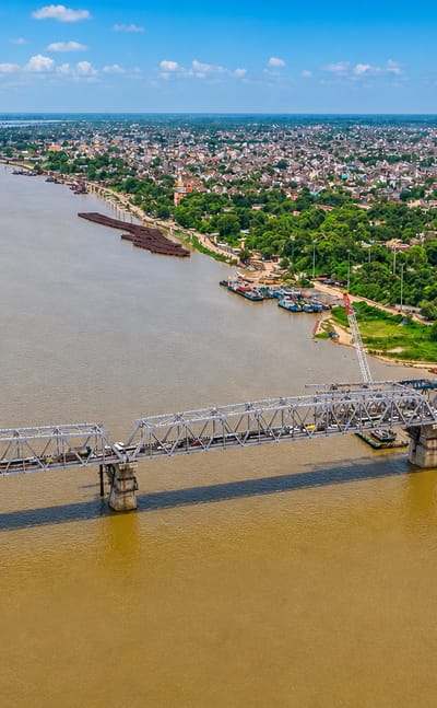
Patna is the capital city of Bihar, India, a long-settled centre of the state marked by its museums and old quarters.Where to stay →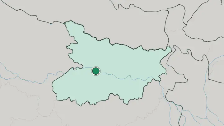
About State of Bihar
This is where the Buddha reached enlightenment.
What is State of Bihar known for?
He did so at Bodh Gaya, under a descendant of the original Bodhi tree, and the Mahabodhi temple that marks the exact spot still draws pilgrims from across the whole Buddhist world. Nearby stand the ruins of Nalanda, a great monastic university that taught for seven centuries. The hill town of Rajgir was the first capital of Magadha, the kingdom that later rose to rule much of the subcontinent from Pataliputra, the ancient city that grew into Patna.
Farming carries on above the ruins. Rice, wheat, and sugarcane cover the flat Ganges plain that surrounds every one of these sites.
Where is State of Bihar?
Bihar lies in eastern India, landlocked on the Indo-Gangetic plain that runs east from the heart of the subcontinent. The Ganges cuts straight across it from west to east and cleaves the state in two. North of the river spreads the North Bihar plain, flat alluvial country that tilts down from the foothills of Nepal along the northern border.
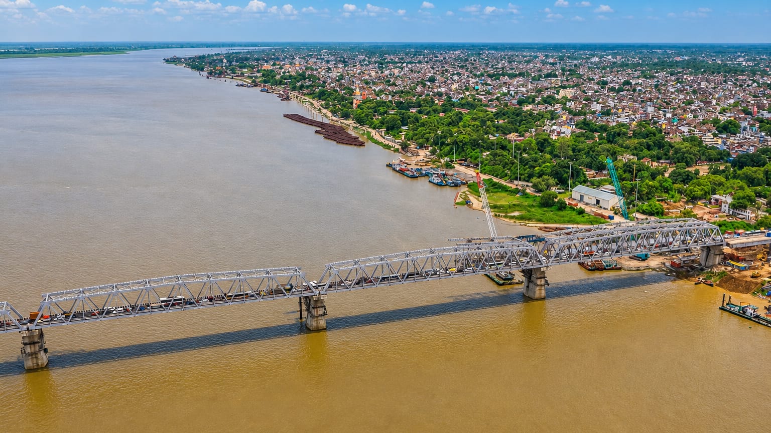
South of the river the land rises gently toward the older rock of Jharkhand, the state carved out of southern Bihar in the year 2000. Uttar Pradesh adjoins Bihar to the west, and West Bengal closes it off to the east. Water defines the map here. Patna sits at the meeting of three rivers, where the Gandak coming down from Nepal and the Sone rising in the southern hills both pour into the Ganges.
The Kosi, the Burhi Gandak, and the Ghaghara thread the northern plain as well, and their yearly flooding both feeds the soil and menaces the villages along the banks. No mountains break the interior. The whole of Bihar is river-built farmland, silt laid down over ages of monsoon flood, and the flatness carries the eye a long way toward the horizon on every side.
What is State of Bihar like?
Bihar speaks in several tongues at once. Hindi is the language of government and schooling, but the mother tongues of everyday life are Bhojpuri in the west, Magahi around Patna and Gaya, and Maithili in the north-east, the one of the three written into the Indian constitution's schedule of recognised languages. Each carries its own folk songs and theatre.
The state's temper is rural and devout, tied to the farming calendar and the rivers that water it. The defining festival is Chhath. Over four days after Diwali, families gather on the ghats of the Ganges and its tributaries to honour the sun, and women keep a fast of some thirty-six hours without food or water while offerings are made at dawn and dusk to the rising and setting sun.
It is Bihar's own festival above all others. The old religions run deep in the same soil: this is the land where the Buddha taught and where Mahavira, the last of the Jain tirthankaras, was born at Vaishali, so pilgrims of both faiths still trace their founders' footsteps across the plain. Madhubani painting, the bright line-drawn folk art of the Mithila region, carries that layered inheritance onto paper and mud walls alike.
What is the history of State of Bihar?
Early Indian history begins here. The kingdom of Magadha rose on this plain in the first millennium BCE and grew into the seat of the Maurya and Gupta empires, ruled from Pataliputra, the ancient city that lies beneath modern Patna. That city was a centre of power and learning when much of the world was still village-scale.
The name Bihar itself comes from vihara, the Sanskrit word for a Buddhist monastery, of which the region once held many. The modern state was drawn up in the year 1912, when Bihar and Orissa were split away from the province of Bengal.
What is the climate of State of Bihar?
Bihar runs on the rhythm of the monsoon. Summers on the open plain turn fierce from March into June, when the dry loo wind blows off the land and afternoon heat can climb past 40 degrees. Then the rains break.
The south-west monsoon soaks the state from June to September and drops the great bulk of the year's water in those months, refilling the Ganges and its tributaries and flooding the northern districts. Winters are short, dry, and often wrapped in morning fog as the cool air settles over the flat land.
How do you get to State of Bihar?
Most travellers land at Patna. Jay Prakash Narayan International Airport is the state's main gateway, linked to the big Indian cities and to the trunk railway lines that fan out across the plain. Pilgrims heading for the Buddhist circuit often fly instead into Gaya, the airport close to Bodh Gaya.
Bihar is landlocked, so the approach is by air, rail, or road, and the dense rail network makes the train the usual way to move between Patna and the sites to its south.
Common questions
What is the best area to stay in State of Bihar?
Patna: arriving and basing a wider trip.
Good for
Updated July 2026