Kenya
Baringo, Kenya — Towns & Travel Guide


Baringo is a Kenyan county in the Rift Valley, its floor holding freshwater Lake Baringo and the flamingos and hot springs of Lake Bogoria.
About Baringo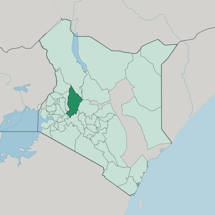


Towns & cities in Baringo
Pick a town or city — each links to where to stay.
Kampi ya Samaki is the one real village on Lake Baringo, and its lakeside camps sit closest to the birds, the hippos, and the boats out to Ol Kokwe Island. Sleep on the water itself at the island's tented camp. Down south at Lake Bogoria, the reserve gate at Loboi sits within reach of the geysers and the flamingo flats, though beds there are thin and many people day-trip in from Baringo.
Kabarnet is the county town. It rides a ridge of the Tugen Hills high above the Kerio Valley, holding the largest cluster of hotels and the small Kabarnet Museum. Pick the lakeshore for wildlife, the ridge town for a cooler base.
About Baringo
Two Rift Valley lakes give Baringo its name and its draw.
What is Baringo known for?
Lake Baringo is freshwater and full of birds, while Lake Bogoria to the south simmers with hot springs and geysers and pulls in vast flocks of lesser flamingos along its alkaline shore. Fossil hunters know the county for the Tugen Hills, where the six-million-year-old Orrorin tugenensis, nicknamed Millennium Man, was dug from the ground. Kabarnet is the hub.
The two lakes and the hills above them anchor almost every visit.
Where is Baringo?
Baringo sits in the middle of Kenya's Rift Valley, north-west of Nairobi and north of the city of Nakuru, with the equator cutting across its southern edge. The land drops from cool highlands into a hot rift floor. That floor carries a chain of lakes.
Lake Baringo, freshwater and roughly 130 square kilometres, spreads across the north, flanked by the Tugen Hills on the west and the Laikipia Escarpment on the east, and fed by the Molo, Perkerra, and Ol Arabel rivers running off the surrounding highlands. It is the second-most northerly of the Rift Valley lakes, after Lake Turkana far up toward the Ethiopian border. South of it lies Lake Bogoria, a narrow alkaline lake in a half-graben basin, lined with hot springs and geysers and separated from Lake Baringo only by the flat Loboi Plain.
A third lake, Lake Kamnarok, sits west in the Kerio Valley. The Tugen Hills run the length of the county from north to south, a long fault block dividing the two great troughs. West of them the ground falls away again into the Kerio Valley, a deep rift arm between the Tugen Hills and the Elgeyo Escarpment.
It is broken, tilted country throughout.
What is Baringo like?
Three peoples share Baringo, and the land sorts them. The Tugen, a branch of the Kalenjin, hold the central Tugen Hills and the Kerio Valley, herding on the tops and farming the slopes. Their old age-set system, the ibinda, cycled through seven sets and once framed the passage into adulthood and the sharing of authority.
Pokot pastoralists range across the drier north. Down on the shore of Lake Baringo live the Ilchamus, often called the Njemps, a Maa-speaking people related to the Maasai who took up fishing and pole their catch home in ambatch reed boats found nowhere else in the country. Kalenjin, in its Tugen dialect, is the everyday language, with Swahili and English carrying wider affairs.
The county's best-known son is Daniel arap Moi, a Tugen from Sacho who became Kenya's second and longest-serving president. Kabarnet, high in the hills, gathers the county's offices and its larger markets. Music and spoken word run through Tugen life.
Songs mark birth, initiation, and marriage, and the six-stringed lyre keeps the old stories moving from one generation to the next. It is a culture built on cattle, oral memory, and the rhythm of a hard, dry country.
What is the history of Baringo?
Few places reach as far back. The Tugen Hills hold rock layers spanning the age when the first human ancestors appeared, and in 2000 a French team led by Brigitte Senut and Martin Pickford lifted Orrorin tugenensis, a roughly six-million-year-old hominin nicknamed Millennium Man, out of those beds. Much later the same country became a colonial district administered from Kabarnet.
Baringo itself was drawn in 2013, when Kenya's new constitution turned the old district into one of forty-seven counties. Kabarnet stayed the seat.
What is the climate of Baringo?
Altitude splits the weather. Down on the rift floor around Lake Baringo and Lake Bogoria the air stays hot and dry, semi-arid country where the Perkerra River is dammed to irrigate crops that the rains alone could never keep alive. Up in the Tugen Hills it turns cooler and greener, and Kabarnet catches more rain than the lakeshore far below.
Two wet spells break the year, the long rains around March to May and shorter rains late in the year. Drought is a familiar hardship.
How do you get to Baringo?
Nearly everyone comes by road. The usual run heads north-west from Nairobi through Nakuru and on north along the B4 across the floor of the Rift Valley, then turns off onto a C-class road that climbs the Tugen Hills escarpment into Kabarnet, a drive of a few hours. For the lake, the tarmac carries on to Kampi ya Samaki, where boats cross to Ol Kokwe Island and the camps out on the water.
Light aircraft can put down at the Kabarnet airstrip. There is no railway and no scheduled big-jet service.
Good for
Updated July 2026