Kenya
Bomet, Kenya — Towns & Travel Guide


Bomet is a tea-and-dairy county in Kenya's South Rift, where the Nyangores River leaves the Mau Forest for the Mara.
About Bomet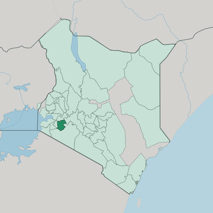


Towns & cities in Bomet
Pick a town or city — each links to where to stay.
Bomet town is the natural base, set on the Nyangores River where the roads from Kericho, Sotik and Narok converge. It is a working town. Beds run to guesthouses and small hotels that serve traders, tea buyers and visitors to the mission hospital at Tenwek rather than tourists.
Sotik, west toward the Nyamira border, does the same in the heart of the tea belt. For safari-goers the county is really a staging post: the Maasai Mara lies south across the Narok line, and its lodges, not Bomet, are the wildlife destination.
About Bomet
What is Bomet known for?
Bomet is Kipsigis country, the heartland of the largest Kalenjin sub-tribe. Tea defines it. Estates and smallholder plots climb the cool hills toward the Mau Forest, and dairy herds graze the wetter ground between them.
The Nyangores River rises in that forest and runs past Tenwek, where a mission hospital has stood since 1937 and a small hydro plant taps the falls. Bomet town anchors the trade in tea, milk and maize.
Where is Bomet?
Bomet lies in the South Rift, the highland country south-west of Nairobi and west of the Rift Valley floor. It is a county of rolling hills. The land rises eastward from around the Sotik plains toward the Mau Forest, the great water tower that caps the county's north-eastern shoulder.
Fertile volcanic soils cover most of it, which is why tea and pyrethrum thrive on the cool upper slopes. Four counties ring it: Kericho to the north, Nyamira to the west, Narok to the south, and Nakuru off to the north-east. Rivers shape the rest.
The Nyangores rises among the springs and swamps of the southern Mau and runs down through Bomet town, dropping over the falls at Tenwek on its way south. Below the escarpment it meets the Amala, and the two join to form the Mara River, the same river that later waters the Maasai Mara and the Serengeti far downstream. So a county few outsiders can place feeds one of Africa's most famous wildlife rivers.
Bomet town sits near the centre of it all, at the meeting of the roads to Kericho, Sotik and Narok.
What is Bomet like?
Life here is Kipsigis life, ordered by land, cattle and church. The Kipsigis are the largest of the Kalenjin peoples, and Bomet is one of their strongholds. Once herders, they were pushed by pressure on land into farming, so a single household may keep a few dairy cows behind the house and a plot of tea or maize out front.
The old age-set system still frames how the generations relate, and initiation remains a passage into adulthood. Sunday matters here. Missions such as the one at Tenwek put down deep roots, and church life carries through the week.
The rhythm is rural and unhurried. Market days pull traders into Bomet town and Sotik with milk cans, produce and livestock, and the talk turns to rain, cattle and grazing. This is Kalenjin highland country, the same cool, high ground that has sent a remarkable line of distance runners onto the world's tracks.
Tea shapes the working year more than any festival does, its plucking season steady month after month. Food is plain and filling: ugali, mursik, greens, and roasted meat at a celebration. It is a landscape people work, not one they merely look at.
What is the history of Bomet?
The Kipsigis reached these hills generations before the county existed, moving south with other Kalenjin groups out of the north and settling the western Rift Valley highlands. British rule reordered the land, laying out the tea estates whose descendants still cloak the slopes. The modern map came late.
Bomet was carved out of Kericho District as its own district in 1992, and only in 2013, when Kenya's new constitution devolved power to forty-seven counties, did it become Bomet County with Bomet town as its seat.
What is the climate of Bomet?
Altitude, not the equator, sets the weather. Bomet sits high on the Mau slopes, so the days stay mild and the nights turn genuinely cold, even though it lies almost on the equator. Rain falls through most of the year, heaviest around April and May, with only a short drier spell in January and February to interrupt it.
The tea never stops flushing. Frosts are rare, yet mornings can bite, and the calendar runs green rather than splitting into hard wet and dry halves.
How do you get to Bomet?
There is no airport at Bomet. Almost everyone arrives overland. From Nairobi the drive runs south-west for the better part of a day, climbing over the Rift Valley and down through the tea towns around Kericho, or swinging in from Narok on the road up from the Maasai Mara.
That road is the B3, the highway from Mai Mahiu to Kisii, and it threads straight through Bomet town. Matatus and buses work it constantly, linking the county to Kericho, Kisii and the capital. Bomet is a stop on the way to the Mara, not a destination in itself.
Updated July 2026