Kenya
Homa Bay, Kenya — Towns & Travel Guide


Homa Bay County lines the Winam Gulf of Lake Victoria in western Kenya, Luo fishing shore of islands, beaches, and the Homa Hills.
About Homa Bay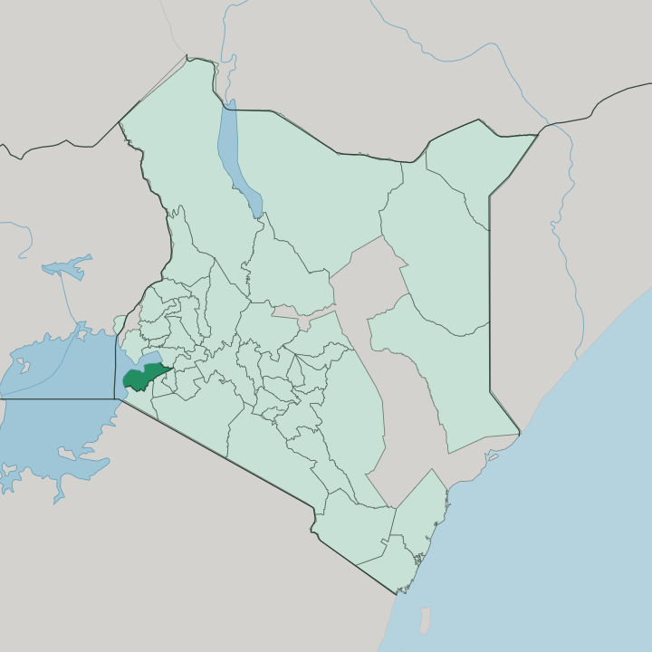


Towns & cities in Homa Bay
Pick a town or city — each links to where to stay.
The water sets the choice. Most trips start in Homa Bay town, the county seat and lake port, a short walk from the market, the jetty, and the onward matatu stage. For the islands, cross the Mbita causeway to Rusinga, where beach lodges sit near the Tom Mboya mausoleum and some of the lake's best birding.
Mfangano lies further out, boat-only and quiet. Kendu Bay anchors the eastern shore beside the green crater lake of Simbi Nyaima. Choose the town for ease; take to an island when you want water on every side.
About Homa Bay
In Homa Bay, water shapes everything.
What is Homa Bay known for?
Homa Bay lines Lake Victoria, the inland sea the Luo call Nam Lolwe, and its economy floats on tilapia, Nile perch, and the silver omena landed along the Winam Gulf. Inland, Ruma National Park shelters Kenya's only wild roan antelope in the Lambwe Valley. The islands pull hardest.
Rusinga Island and Mfangano Island hold white-sand coves, heavy birdlife, and Twa rock paintings older than any village on the shore. Rusinga also guards the tomb of Tom Mboya, the Luo statesman lost in Kenya's independence years.
Where is Homa Bay?
Homa Bay County lies in western Kenya, along the south shore of the Winam Gulf, the north-eastern arm of Lake Victoria that older maps label the Kavirondo Gulf. Water wraps most of its edges. The lakeshore bends close to 130 km from Kendu Bay in the east round to Nyandiwa in the far west, so almost no part of the county sits far from the gulf.
Inland to the south and east rise the neighbouring counties of Kisii, Nyamira, and Migori, while Kisumu faces Homa Bay across the water to the north-east. Two landscapes divide the county. A narrow belt of lakeshore lowland skirts the water, and behind it an upland plateau climbs, broken by residual hills, Gwasi and Gembe in the west, Wire near Kasipul, and the Homa Hills on the peninsula that splits the bay.
Those hills are volcanic. The Homa Hills stand on the Kendu Fault, a carbonatite mass whose steep, boulder-strewn slopes drop almost sheer to the gulf. Offshore lie sixteen islands.
Rusinga and Mfangano are the largest, with smaller Takawiri among the group near the gulf's mouth, while the flat floor of the Lambwe Valley opens south toward Ruma National Park.
What is Homa Bay like?
This is Luo country first of all. Homa Bay lies at the heart of the Luo homeland, where fishing, cattle, and an oral tradition of proverbs and praise-song shape daily life along the gulf. Music carries much of it.
The eight-string nyatiti lyre and the drum-driven ohangla still play at funerals and weddings, and the guitar-led benga sound that spread across Kenya was born among Luo musicians on this shore. Meals lean on the lake: fried tilapia or a whole Nile perch with ugali and sukuma wiki, eaten with the hands. The islands hold a second people.
The Abasuba, Bantu-speakers who crossed from the Uganda side generations ago, settled Mfangano and Rusinga and slowly took up the Luo tongue, though their own language survives in songs and place-names. Each December the Rusinga Cultural Festival revives that Suba heritage with dance, food, and storytelling. The lake keeps its own myths.
The green crater lake of Simbi Nyaima, the Luo say, drowned a village that turned away a stranger, and its story is still told at Kendu Bay. Tom Mboya, born on Rusinga, remains the county's proudest son.
What is the history of Homa Bay?
Luo clans reached this shore over several centuries, moving down the Nile and in from the Uganda side to settle the gulf and its fishing grounds, while Abasuba refugees from the collapse of Buganda took the islands. The colonial administration planted a lake port on the bay and, in 1925, named it Homa Bay after the hills above it. For decades the district answered to Nyanza Province from Kisumu.
Devolution changed that. Homa Bay became one of Kenya's counties in 2013, its own seat of government at last.
What is the climate of Homa Bay?
Homa Bay keeps an equatorial warmth softened by Lake Victoria. Days run hot on the lakeshore lowland and a little cooler up on the plateau, but frost is unknown and the water steadies the swing between seasons. Rain comes in two spells: the long rains from March to May, then shorter storms from September into November, with the drier months around the turn of the year.
Lake breezes and afternoon thunderheads build over the Winam Gulf through much of the year. It stays green.
How do you get to Homa Bay?
Most travellers come overland from Kisumu, a drive of about two and a half hours south-west on the tarmac A1, or by matatu from the Kisumu bus stand. Homa Bay town has its own paved strip at Kabunde for light aircraft, but scheduled flights land at Kisumu, the nearest full airport, across the gulf to the north-east. The lake does the rest.
Ferries and small boats cross the Winam Gulf to Mbita, and the Mbita causeway carries the road on to Rusinga; from there, launches reach Mfangano and the smaller islands.
Good for
Updated July 2026