Kenya
Kitui, Kenya — Towns & Travel Guide


Kitui is a large, semi-arid county in eastern Kenya, the Kamba heartland crossed by the Yatta Plateau, the longest lava flow on Earth.
About Kitui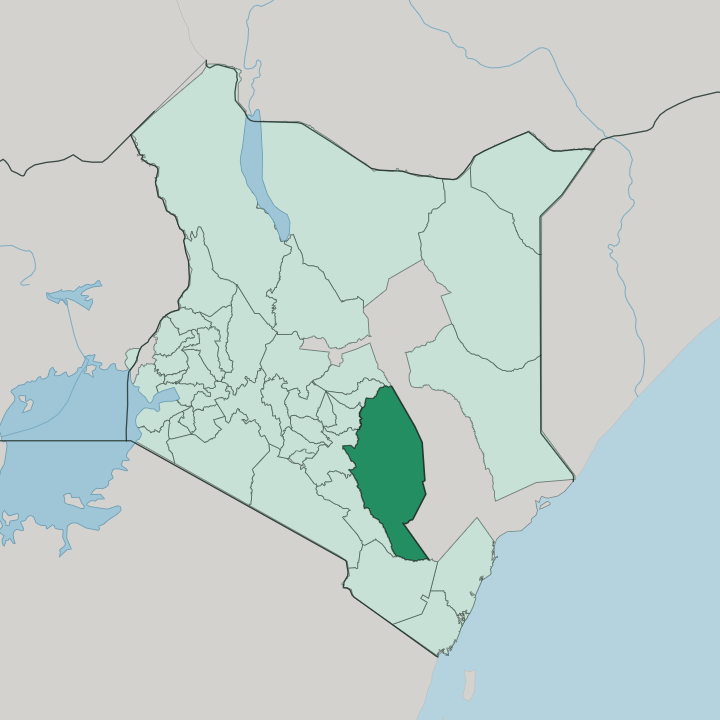


Towns & cities in Kitui
Pick a town or city — each links to where to stay.
Kitui town is the natural base, the county seat and its biggest market, an overland stop reached from Nairobi by way of Machakos. Mwingi sits north on the Garissa road, the handiest town for Mwingi National Reserve and the Tiva crossings. Mutomo lies south, a small market town below its succulent plant sanctuary.
The dry bush holds little else. Start in Kitui town for a first stay, then move on to Mwingi or Mutomo when the plateau country and the game reserves are what you came for.
About Kitui
Iron gave Kitui its name.
What is Kitui known for?
The word means a place where iron goods are forged, from the Kikamba spoken by the Kamba people who make up most of the county. The Yatta Plateau, a lava ridge reckoned the longest of its kind on Earth, runs down the western edge between the Athi and Tiva rivers. Wood carvers and sisal-basket weavers keep the old Kamba crafts going.
Wildlife draws the rest, with Tsavo East National Park reaching into the south and Mwingi National Reserve spread across the north.
Where is Kitui?
Kitui fills a broad stretch of eastern Kenya, east of Nairobi and beyond the town of Machakos. The land lies low and dry. The ground is mostly a plain that tilts down toward the east and northeast, dropping to the hot lowlands along the Tana River.
Central Kitui rises into hilly ridges above the plains, with wide, thinly grassed valleys between them. Seven counties ring it: Machakos and Makueni to the west, Embu, Tharaka-Nithi and Meru to the north, Taita-Taveta to the south, and Tana River county wrapping the east and southeast. The Yatta Plateau is the county's signature landform.
This narrow lava ridge, formed by an ancient flow from the Ol Donyo Sabuk highland, runs unbroken from the north to the south along the western side of Kitui, between the Athi River and the Tiva. Geologists rate it the longest lava flow on Earth. The Athi marks the western boundary and later joins the Galana on its way to the Indian Ocean, while the Tana traces the far eastern edge.
Rain-fed seasonal rivers such as the Tiva cut the plains and run only after the rains. In the far south, Tsavo East National Park climbs to the plateau's rim, and Mwingi National Reserve holds the drier bushland of the north. Nzambani Rock, a granite dome near Kitui town, stands over the surrounding country.
What is Kitui like?
Kitui is Kamba country through and through, and daily life still turns on the land. Most families farm the dry plains, planting drought crops like green grams, millet and cowpeas that can stand the short rains. Goats and cattle graze the ridges.
Meals lean on what the dry land gives, muthokoi of dehusked maize and beans, stiff ugali, and pigeon peas from the field edges. Beekeeping runs deep in the bush here, and Kitui's log-hive honey travels far beyond the county. The common tongue is Kikamba, the Bantu language the Kamba have spoken across these hills for generations.
Craft carries the Kamba name furthest. Woodcarvers turn out figures and bowls sold in markets across Kenya, and women weave the sisal kiondo baskets by hand. The Kamba were long-distance traders before the colonial era, carrying ivory and craftwork down to the coast and returning with cloth, beads and iron.
Music matters too. Kamba drumming and acrobatic dancing mark weddings and harvests, the dancers leaping and tumbling to a hard drum line. Sacred groves and old ancestral sites still dot the ridges, tended by families who trace long lines back into Kituiland.
What is the history of Kitui?
Long before the railways, Kitui was a Kamba trading hub. The name is older, from the ironworkers. Caravans set out from here for the coast with ivory, hides and iron, following the Athi and Sabaki rivers down to the Indian Ocean.
The trader Kivoi wa Mwendwa led such caravans, and in 1849 guided the missionary Ludwig Krapf into the interior, the journey on which Krapf became the first European to see Mount Kenya. British rule later met Kamba resistance in the hills around Kitui. The county took its present shape in 2010, under Kenya's new constitution.
What is the climate of Kitui?
Heat and thirst define Kitui, a county set in Kenya's arid and semi-arid belt where two brief rainy spells bracket long baking months. It sits in Kenya's arid and semi-arid belt, and rain comes in two short spells rather than one long season. The long rains fall around March and April, the short rains from October into December, and the months between bake under a high sun.
The eastern lowlands toward the Tana are the hottest and driest, while the central ridges around Kitui town catch a little more rain and stay cooler. Failed rains and drought are an old worry across these plains. Heat rules the year here.
How do you get to Kitui?
Kitui is a road destination. Travellers reach it overland from Nairobi, driving east through Machakos and on to the county town, with matatus and long-distance buses covering the same tarmac. There is no passenger railway and no airline serving Kitui town, so the nearest big airport stays back in Nairobi.
Mwingi, in the north, sits right on the A3 highway that runs from Nairobi on toward Garissa. Small airstrips near Kitui and the reserves handle light aircraft only.
Updated July 2026