Kenya
Laikipia, Kenya — Towns & Travel Guide


Laikipia is a high plateau north of Mount Kenya, a mosaic of wildlife conservancies and cattle ranches on the Kenyan equator.
About Laikipia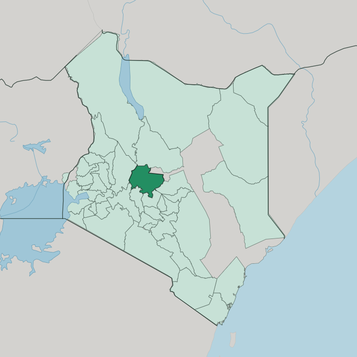


Towns & cities in Laikipia
Pick a town or city — each links to where to stay.
Most beds in Laikipia sit inside the conservancies themselves, tented camps and ranch houses that come with guided game drives across private land. Ol Pejeta runs the largest cluster, from Sweetwaters Tented Camp to bush camps near the rhino sanctuary. Loisaba and Solio spread lodges over the northern and southern reaches, each on its own wildlife.
Nanyuki is the practical base off the plateau, a working town of dukas and airstrips where you sort out flights, fuel, and supplies before heading up to the ranches. Book the camp, not the town.
About Laikipia
What is Laikipia known for?
Laikipia is known for its wildlife conservancies, private ranches turned over to lions, elephants, and both black and white rhino across the plateau north of Mount Kenya. Ol Pejeta Conservancy holds the last two northern white rhinos on Earth, Najin and Fatu, under armed guard. Wildlife here roams cattle country rather than a fenced park, since almost none of Laikipia carries formal reserve status.
The Ewaso Ng'iro River draws game to its banks. Big cats are the draw.
Where is Laikipia?
Laikipia is a broad plateau in central Kenya, spread across the equator north of Nairobi and rising to the northwest of Mount Kenya. The Aberdare Range walls it in along the southwest, and the escarpment of the Great Rift Valley drops away to the west. Its name means treeless plain in the Maa language, and much of the county is open grassland and acacia savanna broken by rocky outcrops of ancient gneiss and old lava sheets.
The land sits high. Cool air holds despite the equator running straight through it. The Ewaso Ng'iro River is the county's spine, gathering meltwater and streams off the glaciers of Mount Kenya before it swings northeast toward the deserts beyond.
Game funnels to its banks in the dry months. Laikipia forms a threshold between the green central highlands and the arid country stretching north into Samburu and Isiolo. Nyahururu sits on the southwestern edge, grown up around Thomson's Falls, while the county government works from Rumuruti out on the plains.
Elephants move between Mount Kenya and the northern rangelands across this ground, one of the last corridors left to them.
What is Laikipia like?
Life in Laikipia turns on cattle. The Mukogodo Maasai, Samburu, and Kikuyu farmers share the plateau, herders and cultivators whose fortunes rise and fall with grass and rain. Swahili and English carry across the county as Kenya's national languages, but the older tongues of the range are Maa and its close cousin Samburu, spoken among the pastoralist families who move stock between grazing.
Beadwork, cattle, and the age-set traditions of young morans still shape daily life away from the lodges. Wildlife and people work the same ground here, and that arrangement is the county's real signature. Group ranches and community conservancies such as Il Ngwesi and Naibunga let Maasai and Samburu owners earn from tourism and grazing on land they hold in common.
The old colonial cattle estates never fully vanished, and many became the private conservancies that run livestock alongside rhino and lion. It makes for an uneasy, negotiated landscape. Drought pushes northern herders and their animals south onto ranch grass, and the friction over pasture and water is as much a part of Laikipia as the game drives are.
What is the history of Laikipia?
Laikipia was Maasai grazing land. The 1911 Maasai Agreement forced the northern Maasai off the plateau and south toward a reserve, clearing the way for European ranchers who carved vast cattle estates out of the open range. British ex-soldiers and settlers founded Nanyuki in the 1920s, at the foot of Mount Kenya.
Many of those colonial estates later turned to wildlife and became the plateau's conservancies. The county took its modern form in 2013, under Kenya's devolution.
What is the climate of Laikipia?
Laikipia straddles the equator, but its height keeps the climate cool and dry rather than tropical. Rain comes in two seasons, the long rains around April and May, then shorter rains late in the year. Between them the plateau bakes.
In the dry stretches from January and again through the middle of the year, game crowds the Ewaso Ng'iro and the scattered waterholes. Days warm into the mid-twenties and nights turn cold on the open grassland.
How do you get to Laikipia?
Nairobi is the starting point for almost every trip to Laikipia. The tarmac A2 highway runs north from the capital past Mount Kenya to Nanyuki in a few hours' drive, and that road is the overland spine into the county. Light aircraft do the rest of the work.
Charter and scheduled flights out of Nairobi land at Nanyuki's airstrip and at bush strips on the bigger conservancies, where lodges send vehicles to meet arriving guests. Nanyuki is also the old railhead.
Good for
Updated July 2026