Kenya
Nyamira, Kenya — Towns & Travel Guide


Nyamira is a county in the Gusii highlands of western Kenya, a fold of tea-green ridges east of Lake Victoria around Nyamira town.
About Nyamira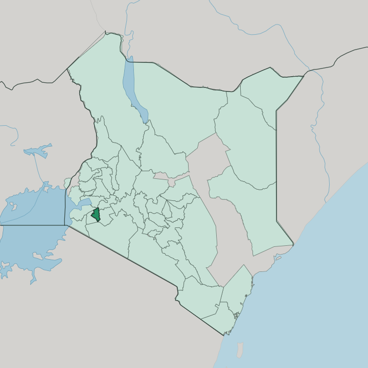


Towns & cities in Nyamira
Pick a town or city — each links to where to stay.
Rooms cluster along the main roads. Nyamira town, the county seat on the Kisii-Nyamira road, holds the steadiest run of guesthouses and the busy market that pulls the whole district in for trade. Keroka, the junction town on the Sotik road, carries the fullest set of hotels and the matatus that thread the surrounding hills.
Nyansiongo sits high under Kiabonyoru for a night among the tea. When rooms run short, the city of Kisii lies a short drive over the county line and holds the widest choice of hotels anywhere near Nyamira.
About Nyamira
Tea defines Nyamira.
What is Nyamira known for?
Smallholder plots quilt the hills in bright green, feeding factories at Nyansiongo, Sanganyi and Kiberigo, and the crop shares the slopes with bananas, coffee and pyrethrum on deep volcanic soil. This is the heart of Gusiiland, the highland home of the Abagusii, who speak Ekegusii and are known across the region for soapstone carving. Below the southern ridges the land breaks at the Manga escarpment, a cliff line above the plains.
Kiabonyoru, the county's highest hill, rises to the north-east.
Where is Nyamira?
Nyamira sits in the Gusii highlands of western Kenya, a compact county of hills east of Lake Victoria and just south of the equator. It is high country. The land rises and folds in a run of green ridges and narrow valleys, and Kiabonyoru, the highest hill in the county and in Gusiiland as a whole, stands to the north-east above Nyamira town.
Along its southern reach the ground drops away at the Manga escarpment, a cliff line falling toward the plains below. Kisii County wraps around to the west and south, the two once a single district that people still call North Kisii. Bomet and Kericho climb toward the Rift Valley to the east; Homa Bay lies off to the north. The streams do the rest of the shaping.
Streams rise on the ridges and run off in every direction, the Sondu, the Gucha or Kuja, the Kemera and the Mogonga among them, all draining west toward Lake Victoria. The soils they cut through are deep and dark, enriched over ages by volcanic ash from the Rift Valley, and it is this fertility, paired with steady rain, that has made the county one of the most productive corners of Kenya. Tea and bananas cover most of what the eye can reach.
Little of the land lies flat.
What is Nyamira like?
The Abagusii give Nyamira its character. This is their highland homeland, a densely settled country of family farms where Ekegusii is the language of the market, the church and the home. Land is worked in small plots and handed down through the family, and the rhythms of planting, harvest and cattle still order much of daily life.
Elders are heeded. Music runs through it, the deep drone of the obokano, a great eight-string bass lyre, sounding at weddings and funerals alongside drums and dance. Across Gusiiland the same people are known for carving soft soapstone, though the famous quarries lie just over the line at Tabaka in Kisii.
Heritage clings to the high ground. The Manga range, a fortress of rock and caves along the escarpment, sheltered Gusii fighters against colonial troops, and the shrine of Otenyo, a warrior executed by the British and buried on the ridge, still draws people to its slopes. Faith runs deep as well: the Seventh-day Adventist church, planted at Nyanchwa in 1912, shapes weeks across Gusiiland.
Markets gather and scatter by the day in Keroka, Nyansiongo and Nyamira town, thick with bananas, maize and greens off the surrounding farms. It is a working landscape, not a quiet one.
What is the history of Nyamira?
Nyamira is young; its ground is old. The Abagusii settled these highlands generations before the colonial borders were drawn, farming the ridges and defending them when British troops met stiff resistance in the Gusii rising of 1908. For most of the past century the district was simply the northern half of Kisii, and older maps still label it North Kisii.
Devolution changed that. Kenya's constitution split the old Kisii District in two in 2013, and Nyamira became a county in its own right, with Nyamira town as its seat.
What is the climate of Nyamira?
It is the elevation that governs Nyamira's climate. The county sits high in the Gusii highlands near the equator, so it stays green and mild the year round, without the heat of the lowlands or a long dry season. Through the year, rainfall never lets up for long.
It falls through much of the year in two main seasons, feeding the tea, the bananas and the streams that run off the ridges toward Lake Victoria. Mornings come up cool and often misty on the higher ground around Kiabonyoru. Bright afternoons follow.
How do you get to Nyamira?
There is no airport at Nyamira. Most travellers fly first into Nairobi, then take a short domestic hop to Kisumu International Airport near Lake Victoria, and finish the last stretch by road up into the hills. The drive climbs.
From Kisumu the road runs south-east through Kisii and on to Keroka and Nyamira town, a couple of hours of tea country and switchbacks. The long overland route from Nairobi crosses the Rift Valley and takes most of a day. No railway reaches the county, so the matatu and the shared taxi carry the rest.
Good for
Updated July 2026