Lebanon
Mohafazat Liban-Nord, Lebanon — Towns & Travel Guide


Mohafazat Liban-Nord is northern Lebanon's coast-to-summit region, running from Tripoli's Mamluk old city up to the Cedars of God.
Find your area →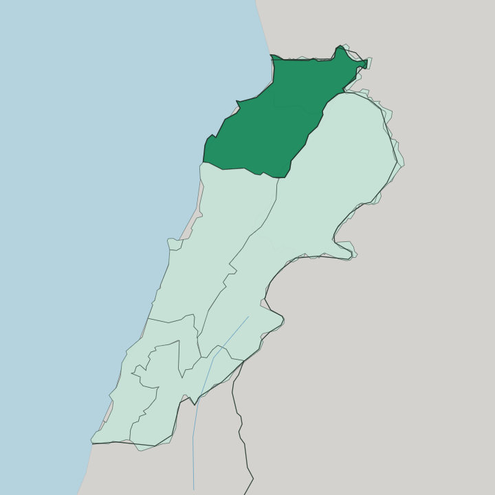
Towns & cities in Mohafazat Liban-Nord
Pick a town or city — each links to where to stay.
 Lebanon
Tripoli
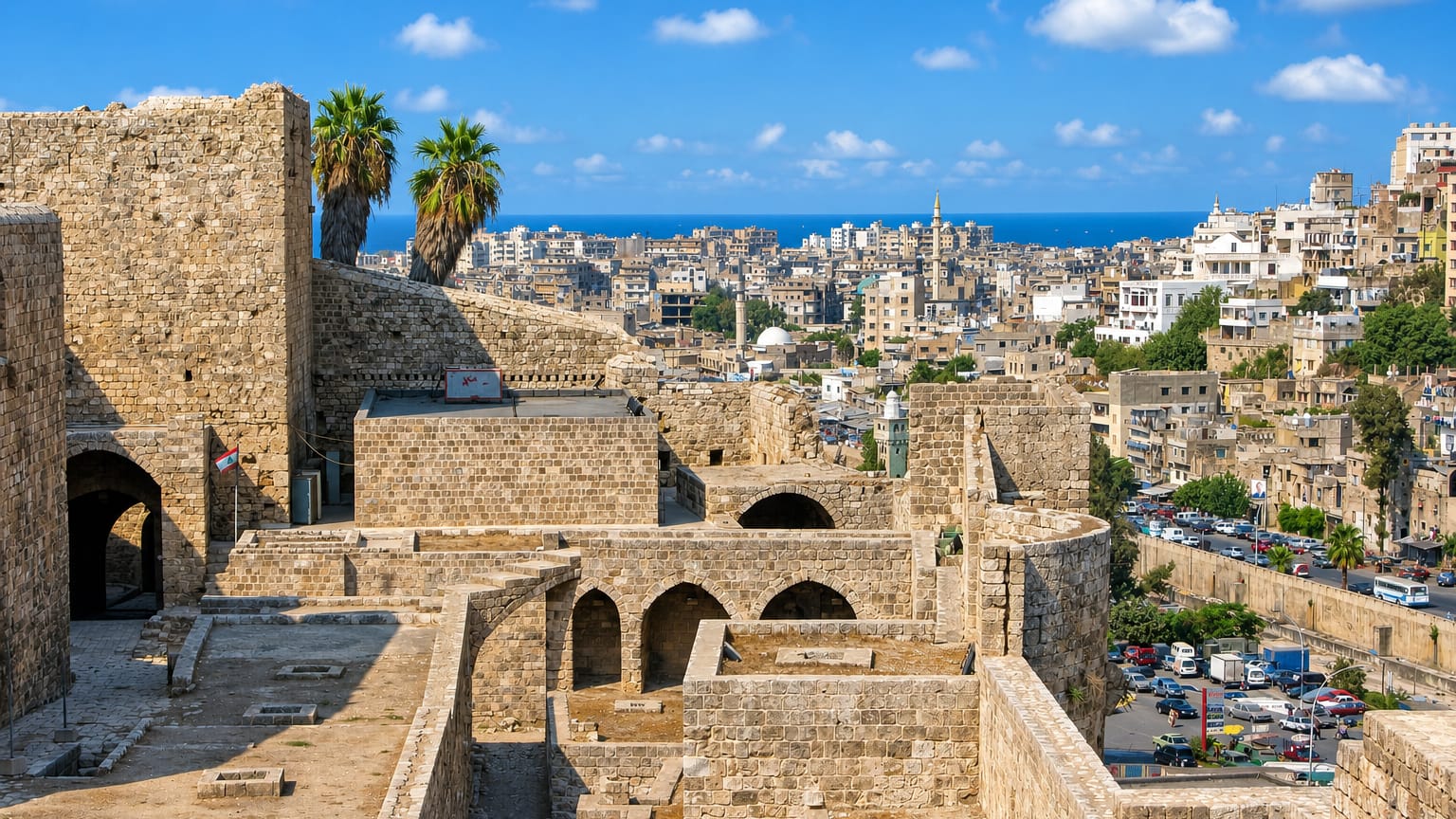
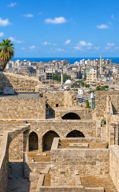
The Crusader citadel looks down on Tripoli, a Mediterranean harbour city in North Lebanon, known for Qalaat Saint Gilles and its old cathedrals.Where to stay →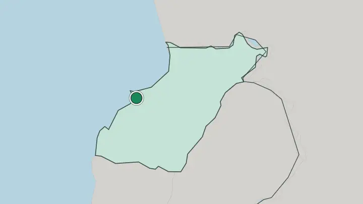
About Mohafazat Liban-Nord
What is Mohafazat Liban-Nord known for?
Two things define the North Governorate: an old Mamluk port and a holy mountain valley. Tripoli anchors the coast as Lebanon's second city, its medieval quarter packed with hammams, khans, and the Citadel of Raymond de Saint-Gilles. Inland the land climbs fast.
The Kadisha Valley cuts a deep gorge lined with cave monasteries, and above it stand the Cedars of God, the last grove of the trees that once roofed temples across the ancient world. Qurnat as Sawda, the highest peak in Lebanon, crowns the eastern skyline.
Where is Mohafazat Liban-Nord?
Mohafazat Liban-Nord occupies the northern stretch of Lebanon, its western edge on the Mediterranean and its eastern wall rising into Mount Lebanon. Tripoli sits on the coast. From there the land tilts sharply upward, so that a drive of an hour or two takes you from sea level to snowfields.
The governorate borders Akkar to the north, Baalbek-Hermel over the mountains to the east, and Keserwan-Jbeil to the south. Its whole western flank is the Mediterranean Sea. Six districts divide it: Tripoli on the coast, then Batroun, Koura, Zgharta, Bsharri, and Miniyeh-Danniyeh climbing inland.
The defining line of the region is vertical, not horizontal. Qurnat as Sawda, the highest peak in Lebanon and the wider Levant, stands on Jabal al Makmel in the Bsharri District, its slopes holding snow long into spring. Below that summit a spring feeds the Kadisha River, which carves the Holy Valley westward before joining other streams at Zgharta to become the Abu Ali.
That river runs down through Tripoli and out to the sea. The coast is narrow here. Behind it the mountains do most of the work, and the whole character of the North follows from that steep climb from shore to summit.
What is Mohafazat Liban-Nord like?
The North holds two of Lebanon's worlds side by side. Tripoli is overwhelmingly Sunni Muslim, a working port city that keeps the second-largest concentration of Mamluk architecture anywhere after Cairo. Its soap makers, coppersmiths, and sweet shops still trade in the old khans.
Then you climb. The Kadisha Valley has been a heartland of Maronite Christianity for well over a thousand years, its cliffs pocked with hermitages and monasteries such as Qannubin, where monks have withdrawn since around the sixth century. Bsharri, the town at the valley's head, gave the world Khalil Gibran, whose museum sits above the gorge that shaped him.
West of it the Koura District keeps a strong Greek Orthodox tradition among its olive villages around Amioun. Arabic is spoken throughout. Faith runs through the whole region, yet it wears very different clothes from one valley to the next, Muslim on the coast and Christian in the heights.
What holds it together is the land. The mountain, the cedars, and the holy river belong to everyone here, whatever they pray to, and the North tells its story through them.
What is the history of Mohafazat Liban-Nord?
The North's deep history belongs to Tripoli and the mountains alike. When the Mamluks took the coastal city in 1289 they razed the old seaside town and rebuilt it inland around the Frankish citadel that Raymond de Saint-Gilles had begun in 1102, and that Mamluk core still stands. The valley kept a different story.
Maronite monks had long since made the Kadisha Valley their refuge, hollowing monasteries into its cliffs. The governorate itself is young. North Lebanon was drawn together as an administrative region in 1959, and in a later reform the Akkar district was carved off into its own governorate, leaving the six districts that now ring Tripoli.
What is the climate of Mohafazat Liban-Nord?
Altitude, not season, is what decides the weather here. On the coast at Tripoli the climate is Mediterranean, with hot dry summers and mild wet winters that keep the port comfortable most of the year. Climb toward Bsharri and the story flips.
Snow settles thickly on Qurnat as Sawda and the Cedars of God through winter, feeding the mountain ski slopes and the springs that fill the Kadisha River. A single day can take you from beach heat to alpine cold. The gap between shore and summit is the whole point.
How do you get to Mohafazat Liban-Nord?
Nearly everyone reaches the North through Beirut. Lebanon's only major airport sits beside the capital, and Tripoli lies about fifty miles up the Mediterranean coast from there by the main highway. The coast road is the spine.
From Tripoli, mountain roads switchback up toward Zgharta, Bsharri, and the Cedars of God, gaining height fast as they climb the valleys. Batroun and the Koura olive country sit along the way south. Getting around the North means driving, because the terrain rises so steeply that every inland town is a climb from the sea.
Common questions
What is the best area to stay in Mohafazat Liban-Nord?
Tripoli: the Mamluk old city and Al-Mina port.
Good for
Updated July 2026