Malaysia
Pulau Pinang, Malaysia — Towns & Travel Guide


Pulau Pinang is a Malaysian state split by the Strait of Malacca into an island and its mainland, with George Town at its heart.
About Pulau Pinang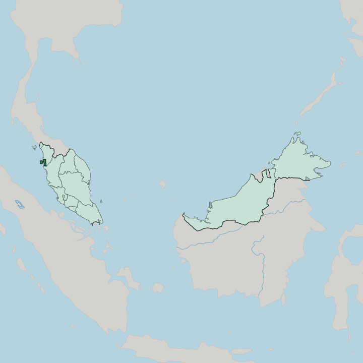
Towns & cities in Pulau Pinang
Pick a town or city — each links to where to stay.
George Town is the obvious first base, its heritage grid putting the clan jetties, hawker stalls and street murals inside a walk. The beaches lie to the north. Batu Ferringhi strings the island's resort hotels along one sandy bay northwest of the capital, and Tanjung Bungah fills the quieter stretch between it and town.
Bayan Lepas, down at the island's south-east corner, is the airport-and-factory district rather than a place to linger. Choose George Town for the heritage core, or the northern beaches when you want sand within reach of it.
About Pulau Pinang
What is Pulau Pinang known for?
Pulau Pinang is Malaysia's food capital and its most famous heritage destination. George Town carries the reputation. The old core of the capital won a UNESCO World Heritage listing in 2008, shared with Malacca, for streets of colonial shophouses and Peranakan clan mansions that survived intact.
Hawker stalls draw the crowds, plating char kway teow, asam laksa and cendol along the five-foot-ways. Behind the town, Penang Hill rises 833 m above the island and cools the whole strip below it.
Where is Pulau Pinang?
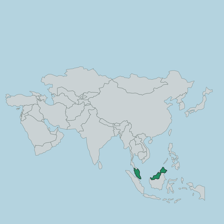
Pulau Pinang sits on the northwest coast of Peninsular Malaysia, one of the smallest states in the country by land. The Strait of Malacca cuts it in two. Penang Island holds the west of the state, a granite bulk of about 295 km² where George Town spreads across the northeast tip and Penang Hill climbs 833 m at the centre.
Seberang Perai stretches along the mainland to the east, a wider band of coastal plain and estuary reaching back toward the ranges. The water between the two narrows to roughly 3 km at the George Town channel and widens to around 13 km further south. Two spans bridge the gap.
The Penang Bridge links Gelugor on the island to Perai on the mainland, while the longer Sultan Abdul Halim Muadzam Shah Bridge, the Second Penang Bridge, runs south from Batu Maung to Batu Kawan across some 24 km of the strait. Kedah wraps the state along the north and east, and Perak borders it to the south. The open Strait of Malacca lies to the west of the island, the shipping lane that made the place. Every part of the state faces that water.
It has shaped Pulau Pinang more than any land border ever has.
What is Pulau Pinang like?
Pulau Pinang built its character on trade, and the mix of peoples the free port drew is still the state's defining trait. No single group holds a majority. Chinese, Malay and Indian communities each make up a large share of the population, and George Town threads their temples, mosques and churches within a few streets of one another.
Out of that grew the Peranakan, the Straits Chinese descended from early Chinese settlers who married into Malay society and fused the two into a distinct cuisine, dress and building style. Language runs the same way. Malay is the state language, but Penang Hokkien fills the markets, Tamil carries in the Indian quarters, and English lingers from the colonial century.
Food is the everyday expression of all of it. Char kway teow, asam laksa, nasi kandar and rojak each trace to a different community, and the hawker stall is where they meet. Festivals fill the calendar, from Chinese New Year to Thaipusam to Hari Raya.
The culture lives on the street here. It is eaten, not just displayed.
What is the history of Pulau Pinang?
Modern Pulau Pinang begins in 1786. Francis Light, acting for the British East India Company, took Penang Island from the Sultan of Kedah and opened George Town as a free port, the first British foothold in Southeast Asia. The mainland strip, then called Province Wellesley and now Seberang Perai, was added in 1800 to guard the harbour.
From 1826 the settlement was governed within the Straits Settlements alongside Malacca and Singapore, and its free-trade harbour pulled in merchants and labourers from across Asia. That colonial century laid down the plural society and the shophouse capital that still define the state.
What is the climate of Pulau Pinang?
Pulau Pinang runs hot and humid all year, a tropical rainforest climate close to the equator on the Strait of Malacca. Daytime highs sit in the low thirties Celsius and nights stay warm, with little seasonal swing. Rain is the real variable: the heaviest downpours come with the southwest monsoon between about April and October, often as short afternoon storms rather than all-day rain.
The forested slopes of Penang Hill stay cooler and wetter than the coast below. There is no cold season here.
How do you get to Pulau Pinang?
Most visitors fly straight to the island. Penang International Airport sits at Bayan Lepas in the south-east of Penang Island and links the state to hubs across Asia. Overland, trains and buses run up the peninsula to Butterworth on the Seberang Perai mainland, where a passenger ferry and the two road bridges carry you across the Strait of Malacca to George Town.
The Penang Bridge and the longer Second Penang Bridge take all the road traffic between mainland and island. From the airport it is a short drive north into the heritage core.
Good for
Updated July 2026