Netherlands
Provincie Drenthe, Netherlands — Towns & Travel Guide


Drenthe is the Netherlands' quiet northeastern province, land of prehistoric hunebed dolmens, wet heathland, and old farming villages.
About Provincie Drenthe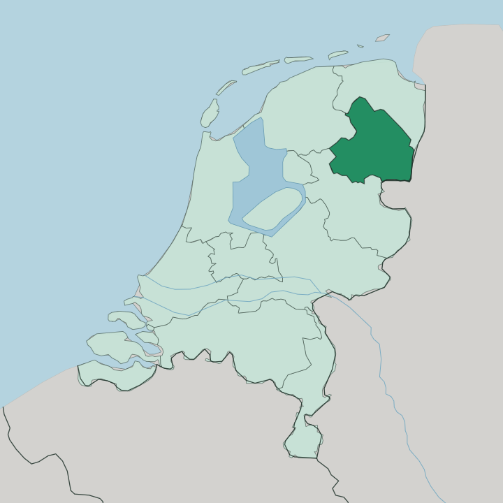
Towns & cities in Provincie Drenthe
Pick a town or city — each links to where to stay.
Assen is the natural base. A compact capital beside the TT circuit, it is a short train ride from Groningen and central to everything. Borger sits deeper in the country, next to the largest hunebed in the Netherlands and its Hunebedcentrum, and it suits anyone chasing the dolmen route by bike.
Emmen anchors the peat-colony south. For the wet heath and juniper thickets of Dwingelderveld, stay small in the esdorpen around Dwingeloo. Choose Assen for trains and the TT; choose Borger or the quiet Drentsche Aa villages when you want farmland instead.
About Provincie Drenthe
Drenthe is known for its hunebedden.
What is Provincie Drenthe known for?
These are megalithic dolmen tombs, stacked from glacial boulders by Funnelbeaker farmers five millennia ago, and 52 of them survive scattered along the Hondsrug ridge. That makes them older than Stonehenge. The province is also the least crowded in the country, a place of heath, forest, and peat, and its people are quietly proud of that emptiness.
Vincent van Gogh painted the peat barges and moorland here and wrote simply, "Here is peace." Assen, the capital, draws crowds each June for the Dutch TT motorcycle race.
Where is Provincie Drenthe?
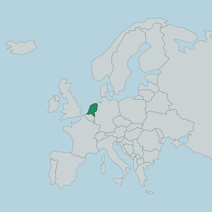
Drenthe lies in the northeastern corner of the Netherlands, sharing its whole eastern edge with Germany. Groningen borders it to the north, Friesland to the west, and Overijssel to the south. It has no coast at all. Alone among the mainland Dutch provinces, Drenthe touches no sea, and its land instead climbs onto a low glacial plateau that sets it apart from the wet polders further west.
The spine of that plateau is the Hondsrug, a sandy ridge some 70 kilometres long, bulldozed into shape by an ice sheet from the North Sea region during the Saalian glaciation. Water here does not roar. The Drentsche Aa, a slow brook that keeps its medieval meanders, gathers under many local names and drains north toward Groningen and eventually the Waddenzee.
Between the ridges lie the wet heathlands of Dwingelderveld, the largest such expanse in western Europe, and the drained peat colonies of the east. Sand, heath, brook, and bog: the whole province reads as a single glacial landscape rather than a scatter of towns. That geology, more than any border, is what shaped it.
What is Provincie Drenthe like?
Drenthe wears its age lightly. The oldest thing about it is written in stone: the hunebedden, dolmen tombs raised more than five thousand years ago by farmers of the Funnelbeaker culture, cluster along the Hondsrug and give the province its founding myth. Around them grew the esdorpen, green villages built as rings of Saxon farmhouses around a shared grass brink, at Anloo, Rolde, and Balloo among the meadows of the Drentsche Aa.
Life here has long been rural and unhurried. About half the province still speaks Drents, a Low Saxon dialect closer to the speech of neighbouring Groningen and northern Germany than to standard Dutch. The peat colonies of the east tell a harder story, of migrant diggers who cut the bog by hand and lived in sod huts, and that memory still colours the southern towns.
Van Gogh came for three months to sketch the moor and its labourers, drawn by exactly this austerity. The Hondsrug earned UNESCO Global Geopark status in 2016 for the ice-age landscape beneath all of it. Heritage here is geological as much as human.
What is the history of Provincie Drenthe?
People have lived on the Hondsrug since the Stone Age, and the hunebedden mark that first settlement. For most of recorded history it stayed poor. Drenthe was a thinly peopled reach of moor and bog, landlocked far inland and largely ignored by the wealthy western provinces.
It became a full province of the Batavian Republic in 1796, ending centuries as a neglected borderland. Its fortunes turned on peat. From the mid-nineteenth century diggers stripped the eastern bogs for fuel, planned peat colonies rose around Hoogeveen and Emmen, and the emptied land was ploughed into farmland that still defines the south.
What is the climate of Provincie Drenthe?
Drenthe's weather is mild but restless. The climate is maritime, though a touch more continental than the Dutch coast, since no sea reaches inland to soften the air over these heaths and bogs the way it does further west. Winters are cool and damp.
Summers stay moderate, and rain falls in every month rather than one season, so the heather and the brookside meadows keep their green through the year. Frost settles harder over the open heath of Dwingelderveld than in the sheltered towns. The sandy Hondsrug drains fast and warms early, one reason its villages were the first settled.
How do you get to Provincie Drenthe?
Most travellers reach Drenthe overland. The province has no airport of its own, so flights land at Amsterdam or Groningen and the last leg comes by train. Rail lines run down from Groningen through Assen and on to Hoogeveen and Meppel, and a separate branch reaches Emmen.
Once here, the bike is king. Drenthe threads together its hunebedden, heaths, and esdorpen with one of the densest cycle networks in the country, and many visitors never touch a car.
Updated July 2026