Netherlands
Provincie Limburg, Netherlands — Towns & Travel Guide


Limburg is the hilly southern tip of the Netherlands, a slim salient wedged between Belgium and Germany along the Maas.
Find your area →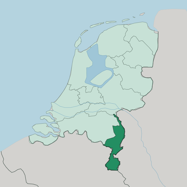
Towns & cities in Provincie Limburg
Pick a town or city — each links to where to stay.
 Netherlands
Maastricht
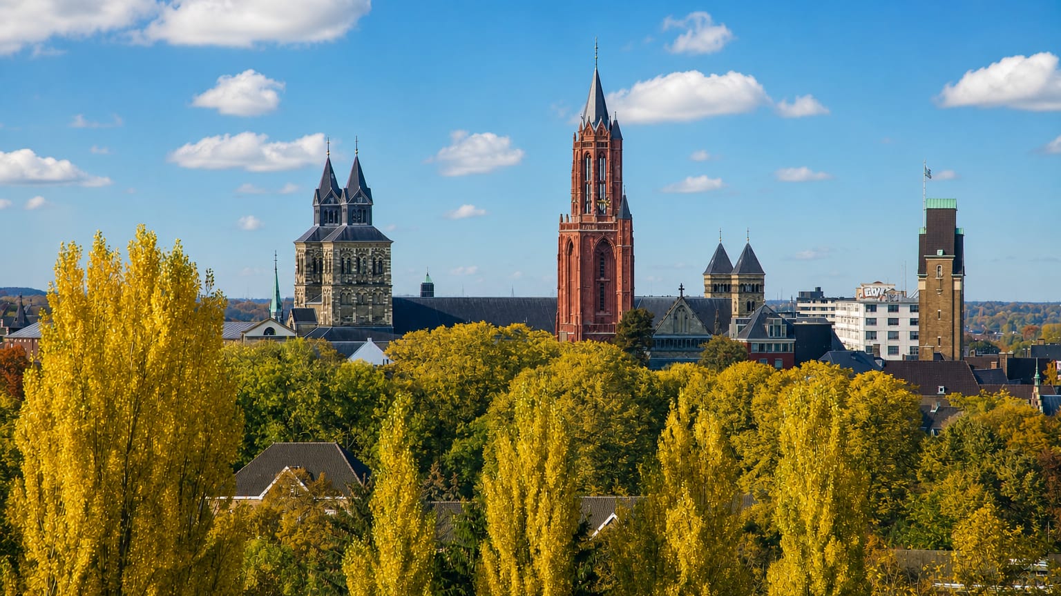
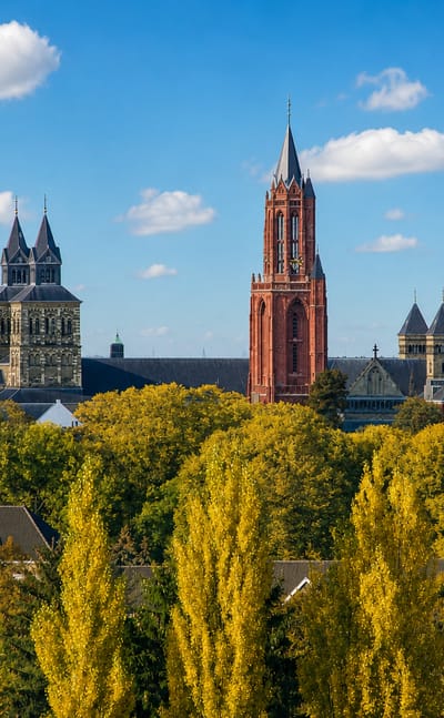
Maastricht stands on the Meuse in Limburg, a walled city of the Netherlands set around the Basilica of Saint Servatius and the Sint Servaasbrug.Where to stay →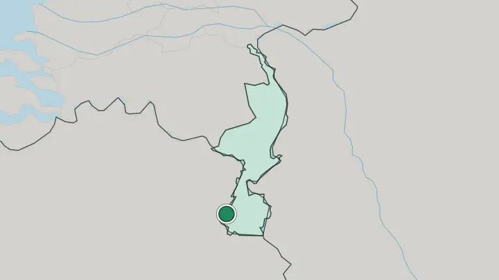
About Provincie Limburg
This is the Netherlands at its least flat.
What is Provincie Limburg known for?
Limburg tapers into a long panhandle between Belgium and Germany, with the Maas threading its whole length and hills rising in the south around Maastricht, the provincial capital. Near the village of Vaals the land climbs to the Vaalserberg, at roughly 322 metres the highest ground in the continental country and the point where three borders meet. Carnival, Catholic feast days and a table-first way of living set the mood.
It feels half Dutch, half continental. People here even speak their own tongue, Limburgish, alongside Dutch.
Where is Provincie Limburg?
Limburg is the far southeastern corner of the Netherlands, a long narrow salient that pushes down between Belgium and Germany. Its shape is unmistakable. The province stretches for roughly a hundred kilometres from the flat, sandy north near Venlo down to the pinched southern tip at Maastricht, and along much of that run it is only a short drive wide from border to border.
The Maas is the spine of it. Flowing in from Belgium, that river runs the whole length of the province, gathering the smaller Geul, Gulp and Roer as it goes, and for a stretch below Maastricht it marks the very line between the Netherlands and Belgium. Terrain is what makes Limburg unlike the rest of the country.
The north is classic Dutch lowland, sand and peat laid out flat, but South Limburg breaks into rolling hills of fertile loess cut by stream valleys. It is the one part of the Netherlands with real gradients. The land keeps climbing toward the southeast until it reaches the Vaalserberg, at about 322 metres the highest point of the mainland Netherlands, whose summit near Vaals is the Drielandenpunt where the Dutch, Belgian and German borders converge.
Germany's North Rhine-Westphalia presses on the eastern edge, Belgian Limburg and Liège on the west and south, and inside the country only Noord-Brabant and Gelderland touch it at the top.
What is Provincie Limburg like?
Limburg carries itself differently from the Protestant north of the Netherlands. It is deeply Catholic, and that shows in the calendar as much as in the churches. Carnival is the great fixture, three official days that swell into a whole week before Lent, when work stops, town squares fill and brass and wind bands take over the streets.
Those wind bands, the bloasmuzeek tradition, run through village life the year round. People call the local temperament Bourgondisch, a Burgundian appetite for the table, for long lunches and good beer and taking time over both. Language sets the province apart too.
Alongside Dutch, most people speak Limburgish, recognised as a regional language in 1997, and it fractures into countless local dialects, so a town near Venlo can sound quite unlike one near Maastricht. The land feeds the culture directly. Orchards of apple, cherry and pear cover the loess of the south, and vineyards have taken hold on the warm slopes, with wine appellations at Maasvallei, Mergelland and Vijlen.
It is a small province with a strong sense of itself. The hills, the Catholic feasts and the shared border with Belgium and Germany all pull Limburg toward its neighbours as much as toward the rest of the Dutch state.
What is the history of Provincie Limburg?
The Maas made this a corridor of empires long before it was a province. The Romans forded the river at Maastricht, calling their crossing Trajectum ad Mosam, and Bishop Servatius brought Christianity there in the fourth century. Through the Middle Ages the land was tied to the Duchy of Limburg and fought over by Brabant, Spain, Prussia, Austria and France in turn.
Ownership changed hands repeatedly. The modern border came late. The 1839 Treaty of London split the old territory in two, sending the eastern half to the Netherlands and the western half to Belgium, and only in 1867 was the Dutch province fully reincorporated into the Kingdom.
What is the climate of Provincie Limburg?
Limburg has a temperate maritime climate, mild and damp, with cool winters and warm rather than hot summers. Wet weather visits Limburg in every season. The hills of South Limburg catch a little more of it than the flatter north, and the sheltered southern valleys around Maastricht run marginally warmer, which is why vines and orchards thrive on the loess there.
Snow visits the higher ground near the Vaalserberg more often than it dusts the lowlands. Grey, changeable skies are the norm.
How do you get to Provincie Limburg?
Most travellers reach Limburg by train or road rather than by air. Its own Maastricht Aachen Airport handles a modest run of flights, but the bigger gateways sit just over the borders in Belgium and Germany. Rail is the easy way in.
Fast trains run down the Maas valley from the rest of the Netherlands to Maastricht, Roermond and Venlo, and the German hub of Aachen lies barely half an hour east of the capital. From the south you can be in Belgium or Germany within minutes of leaving Maastricht.
Common questions
What is the best area to stay in Provincie Limburg?
Maastricht: the Vrijthof and the old Maas crossings.
Updated July 2026