Netherlands
Provincie Flevoland, Netherlands — Towns & Travel Guide


Flevoland is the Netherlands' youngest province, drained from the old Zuiderzee and drawn up from scratch after 1986.
About Provincie Flevoland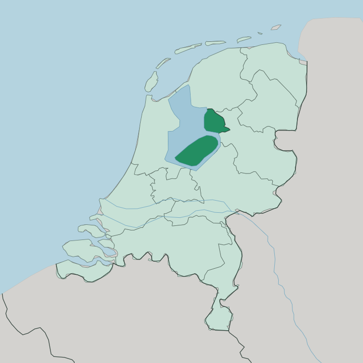
Towns & cities in Provincie Flevoland
Pick a town or city — each links to where to stay.
Almere is the obvious base, the largest city and the closest to Amsterdam across the Markermeer. Lelystad suits a different trip. The capital puts you beside the Batavia harbour and the water museums, halfway up the IJsselmeer shore.
Up in the Noordoostpolder, Emmeloord anchors the farm country, with the fishing town of Urk out on its western rim. Pick Almere for city links and Amsterdam access; pick Lelystad or Urk when the reclaimed coast and its history are what you came for.
About Provincie Flevoland
This is engineered land.
What is Provincie Flevoland known for?
Every field, road and town sits on seabed that was pumped dry in the 20th century, so Flevoland reads like a working model of Dutch water control. Lelystad, the capital, takes its name from Cornelis Lely, the engineer whose plan closed the Zuiderzee and turned it into the freshwater IJsselmeer. Almere, built from nothing after 1976, has since grown into one of the country's larger cities.
The wetlands of the Oostvaardersplassen and the former island of Schokland pull in the visitors who do come. Newness is the whole point.
Where is Provincie Flevoland?
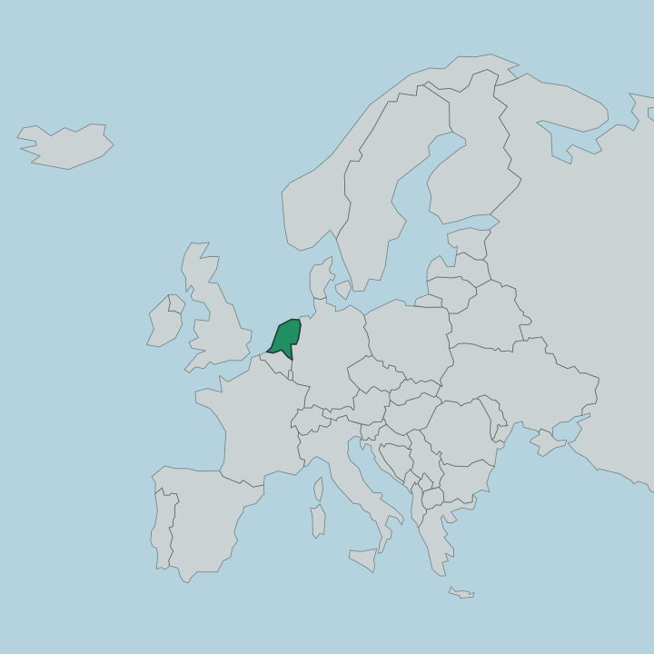
Flevoland sits in the middle of the Netherlands, on ground that was open water within living memory. It is the country's smallest province by dry land, about 1,410 km² of it. The whole surface was lifted from the bed of the former Zuiderzee, the inland sea that the Afsluitdijk sealed off in 1932 and turned into the freshwater IJsselmeer.
Three polders make up the province, drained one after another. The Noordoostpolder came first, pumped dry in 1942; Eastern Flevoland followed in 1957 and Southern Flevoland in 1968. Water still frames almost every edge of it.
The IJsselmeer and the Markermeer wrap the western and northern shores, leaving Flevoland ringed by lake rather than sea. Much of the land lies below the level of the water around it. Dikes and pumping stations hold that water back, and the fields behind them run flat and geometric, laid out on a planner's grid.
Friesland and Overijssel border the province to the north and east across narrow channels, while Gelderland, Utrecht and North Holland lie beyond its southern lakes. Two older places break the newness. Urk and Schokland were islands in the Zuiderzee before the water went, and both now stand on dry polder ground, high points in a landscape that everywhere else is younger than the roads.
What is Provincie Flevoland like?
Flevoland carries almost no old town at its heart, and that shapes how the place feels. The culture here is the culture of the polder itself: farming families who moved onto empty ground in the 1950s and 1960s, and the planners who drew their villages before the land was even dry. Emmeloord and the ring of villages around it in the Noordoostpolder were designed on paper first.
Almere took the idea further, a city sketched out in the 1970s where architects were handed a clean grid and told to experiment, and its bold modern buildings still stand out against the Dutch norm. Youth is the common thread. Urk breaks that pattern hard.
The old fishing town keeps its own dialect, its Protestant traditions and its harbour, holding to a life that predates every polder around it. Its history reaches back centuries. Nearby Schokland, once a poor island abandoned in 1859 when the sea grew too dangerous, became the first Dutch site on the UNESCO World Heritage list.
Between these poles, the young grid and the old island, Flevoland tells one long story about the Dutch and their water. The land museums at Lelystad, gathered around the Batavia harbour, put that story on display.
What is the history of Provincie Flevoland?
The province is younger than most of its own trees. For centuries this was open water. The Zuiderzee, a shallow arm of the sea, once reached deep into the heart of the Netherlands until an engineer named Cornelis Lely drew up the plan that would shut it out for good.
In 1932 the Afsluitdijk sealed the old sea into the freshwater lake now called the IJsselmeer. The polders came next. Pumped dry one by one, the Noordoostpolder emerged in 1942 and the Flevopolders followed through the 1950s and 1960s.
In 1986 those reclaimed lands were joined into a single province, the twelfth and newest in the country.
What is the climate of Provincie Flevoland?
Flevoland has a cool maritime climate, and the open water around it drives the weather. Winds off the IJsselmeer and the Markermeer sweep unbroken across the flat polders, so the province feels breezier than its inland neighbours. Winters stay mild and damp; summers are warm without turning hot, and rain falls across the whole year rather than in one wet season.
The exposed lakeshore keeps the air moving even on still days elsewhere. Grey and gusty is the usual bargain.
How do you get to Provincie Flevoland?
Most travellers reach Flevoland through Amsterdam. From there the way in is simple: Almere sits on the direct rail line running north out of the capital, only minutes away, so trains from Amsterdam reach the city almost before they have picked up speed. The same line carries on to Lelystad along the IJsselmeer shore.
By road the province links to Amsterdam over the dikes and bridges that cross the Markermeer. A small airport sits near Lelystad. It handles light traffic rather than the long-haul flights that land at Amsterdam.
Good for
Updated July 2026