Russia
Khabarovskiy Kray, Russia — Towns & Travel Guide


Khabarovsk Krai stretches along the lower Amur River in the Russian Far East, from taiga highlands down to the Sea of Okhotsk.
Find your area →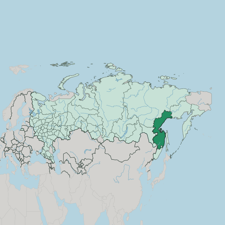
Towns & cities in Khabarovskiy Kray
Pick a town or city — each links to where to stay.
 Russia
Khabarovsk
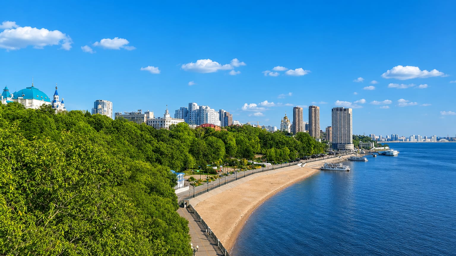
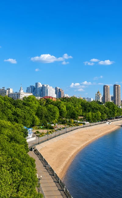
Khabarovsk is the seat of Khabarovskiy Kray in the Russian Far East, laid out along Muravyov-Amursky Street.Where to stay →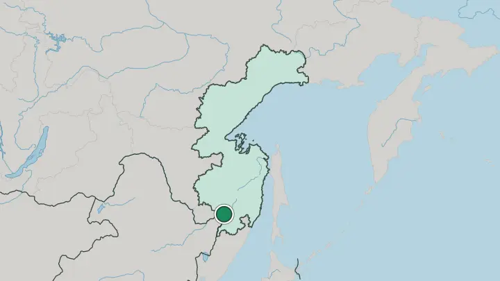
About Khabarovskiy Kray
The Amur River defines this territory.
What is Khabarovskiy Kray known for?
It is the third-largest federal subject of Russia, a vast wedge of taiga, mountain and river running north from the Chinese border to the Sea of Okhotsk. Khabarovsk, the administrative centre, sits where the Ussuri River joins the Amur, and its riverfront and rail-and-road bridge are famous enough to appear on the national banknote. Komsomolsk-on-Amur, built by young Soviet volunteers in the taiga, is the region's industrial anchor.
Beyond the two cities the land turns wild fast, into larch forest and the ranges of the Sikhote-Alin.
Where is Khabarovskiy Kray?
Khabarovsk Krai occupies a long strip of the Russian Far East, reaching from the Chinese border in the south to the sub-Arctic north. The lower Amur River is its spine. The river enters the territory near Khabarovsk, where the Ussuri River joins it from the south, then swings north and east through larch taiga before reaching the sea at Nikolaevsk-on-Amur.
There it empties into the Strait of Tartary, the channel that divides the mainland from the island of Sakhalin and opens into the Sea of Okhotsk. Mountains wall the river on both sides. The Sikhote-Alin range rises to the south-east, between the Amur valley and the Sea of Japan, while the Bureya Range and the Dzhugdzhur Mountains fronting the Okhotsk coast climb along the north.
It is the third-largest federal subject of Russia by area. Most of that land is dense swampy forest of larch, spruce and fir, thinning to bare highland in the far north. Roughly half the territory's people live in Khabarovsk alone.
The rest of the country is close to empty, a great sweep of taiga, river and coast.
What is Khabarovskiy Kray like?
Two layers of life share the Amur here. The older belongs to the Nanai and the other Tungusic peoples of the river, hunters and fishers whose villages string along the banks below Komsomolsk-on-Amur, keeping a shamanistic tradition and fish-skin craft that predate any Russian post. The newer is Russian, and it is barely more than a century and a half old.
Khabarovsk grew from a military outpost of 1858 into the administrative and cultural capital of the whole Far East, with theatres, a regional museum and the wide riverfront that draws the city out on summer evenings. Distance shapes everything. Moscow lies seven time zones west, and the territory looks as much toward the Amur and the Pacific as toward European Russia.
Chinese trade crosses the river to the south, Korean and Pacific influences arrive through the ports, and the result is a Far Eastern culture with its own accent. The Amur is the thread that ties it together. It carries the region's history, its trade and its self-image, and the fish it yields still feeds villages that were here long before the railway.
What is the history of Khabarovskiy Kray?
The name honours Yerofey Khabarov, the seventeenth-century explorer who pushed down the Amur for the Russian crown. Russian settlement came much later. Soldiers founded the military post of Khabarovka in 1858, and the arrival of the Trans-Siberian Railway at the century's end turned it into the hinge of the Far East, where the line crosses the Amur on the great bridge.
The territory itself was drawn in 1938, when the sprawling Far Eastern Krai was split and Khabarovsk Krai took its own shape. Komsomolsk-on-Amur, raised from empty taiga in the 1930s by young volunteers, added the industry.
What is the climate of Khabarovskiy Kray?
The climate is sharply continental and monsoon-touched. Winters are long and bitterly cold, with January in Khabarovsk holding well below freezing under clear dry skies. Summers flip the pattern: the East Asian monsoon drags warm, humid air off the Pacific, and July turns hot and wet along the Amur.
The contrast widens as you go north, where the Dzhugdzhur Mountains and the Sea of Okhotsk coast give short cool summers and a near sub-Arctic winter. Between Khabarovsk Krai's harsh winters and wet summers, the shoulder seasons pass quickly. Rain falls mostly in the warm months, leaving the deep-freeze winters crisp and snow-light by inland standards.
How do you get to Khabarovskiy Kray?
Most travellers arrive at Khabarovsk. The city's Novy airport is the main air gateway of the southern Far East, and the Trans-Siberian Railway reaches it overland from Moscow across seven time zones, crossing the Amur on the bridge shown on the banknote. From Khabarovsk, rail runs north to Komsomolsk-on-Amur, and in the warm months river boats work down the Amur toward Nikolaevsk-on-Amur at the mouth.
The far north stays hard to reach. Reaching the Sea of Okhotsk coast and the mountain interior means small planes or long river journeys, not roads.
Common questions
What is the best area to stay in Khabarovskiy Kray?
Khabarovsk: the Amur embankment and city base.
Good for
Updated July 2026