Thailand
Phra Nakhon Si Ayutthaya, Thailand — Towns & Travel Guide


Phra Nakhon Si Ayutthaya is the Thai province around the ruined island capital of the Ayutthaya Kingdom, north of Bangkok.
About Phra Nakhon Si Ayutthaya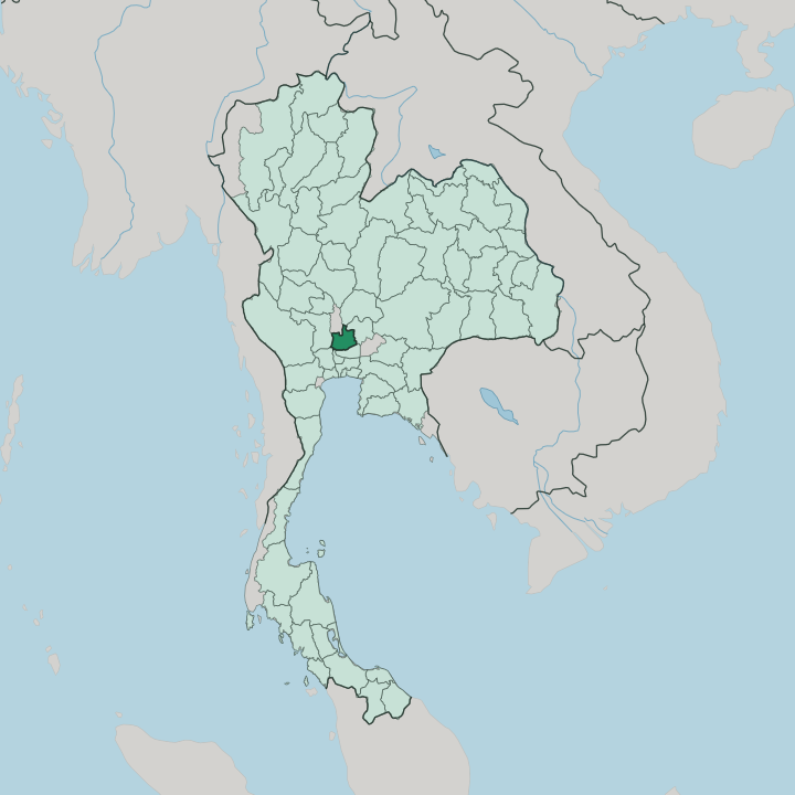


Towns & cities in Phra Nakhon Si Ayutthaya
Pick a town or city — each links to where to stay.
Most travellers sleep on the island. The old core is compact and flat, easy to cross by rented bicycle, and it puts the ruins of the Ayutthaya Historical Park within a few minutes' ride if you want the temples at your door. Along the Chao Phraya and Pa Sak riverbanks sit boutique hotels and river resorts, some facing Wat Chaiwatthanaram as it lights up after dark.
Backpackers head for the guesthouse lanes off Naresuan Road, beside the night market, where beds and bicycles come cheap. Choose the island for temples, the riverside for calm.
About Phra Nakhon Si Ayutthaya
Its fame rests on ruins.
What is Phra Nakhon Si Ayutthaya known for?
The old capital of the Ayutthaya Kingdom was sacked in 1767 and never rebuilt, and its brick temple spires and headless Buddhas stand protected as the Ayutthaya Historical Park, a UNESCO World Heritage Site. At Wat Mahathat a sandstone Buddha head sits cradled in fig-tree roots. Wat Phra Si Sanphet keeps three restored royal chedis in a row, and Wat Chaiwatthanaram rises in Khmer style above the Chao Phraya.
The Bang Pa-In Royal Palace sits downstream.
Where is Phra Nakhon Si Ayutthaya?
Phra Nakhon Si Ayutthaya lies on the flat Central Plains of Thailand, in the lower valley of the Chao Phraya, the largest river in the country. Bangkok sits downstream to the south. The land is low and wet, alluvial mud laid down over centuries and worked into some of the most productive rice country in Thailand, and there is scarcely a hill in sight.
In the rainy season the rivers rise and the fields flood, the same seasonal water that has fed the rice harvests here for generations. Rivers, not ridges, shape the province. The old capital occupies an island.
Three rivers wrap it: the Chao Phraya curls along the south and west, the Lopburi River runs past the north, and the Pa Sak River closes the eastern side, so the historic core sits moated by water on every edge. Canals thread the plain beyond, and boats once mattered here more than roads. Downstream toward Bangkok stands the Bang Pa-In Royal Palace, the old summer retreat of the Siamese kings, set among gardens on the Chao Phraya.
Flat rice fields, cut by the Lopburi and Pa Sak, run to the province's edges in every direction.
What is Phra Nakhon Si Ayutthaya like?
Ayutthaya remembers itself as a Buddhist city. Its skyline is a field of prang and chedi, the tapering brick spires the Siamese built for their kings and their faith, and monks in saffron still cross the ruins each morning. Theravada Buddhism runs deep here.
Living temples stand among the dead ones: Wat Phanan Choeng holds a giant seated Buddha revered by Thai and Chinese worshippers alike, and Wat Yai Chai Mongkhon keeps a long reclining Buddha wrapped in saffron cloth. Thai is the everyday language. The old capital was a trading city as much as a holy one.
Merchants from Portugal, the Netherlands, Japan and Persia kept quarters along the rivers, and the ruins of a Portuguese settlement and a Japanese village still mark the southern bank. Rice, rivers and temples order the rhythm of provincial life beyond the old walls. Ayutthaya boat noodles simmer at stalls along the water, a dish born on these very rivers.
Each year the World Heritage ruins host a light-and-sound festival, and at Loi Krathong the rivers around the island carry drifting candles. It is a landscape lived in, not just visited.
What is the history of Phra Nakhon Si Ayutthaya?
The Ayutthaya Kingdom was founded in 1350 by the ruler remembered as U-Thong, and for more than four centuries its island capital ruled Siam. Thirty-three kings reigned here. Trade with China, Persia and Europe made the city one of the largest and wealthiest in the world of its day, until a Burmese army stormed and burned it in 1767 and the kingdom fell.
In time the court withdrew downriver and settled at Bangkok. The gutted temples were left standing, and in 1991 the ruins entered the list of UNESCO World Heritage Sites as the Ayutthaya Historical Park.
What is the climate of Phra Nakhon Si Ayutthaya?
Three seasons divide the year. The hot months from March to May are the fiercest, when the plains bake and April is the hottest of all. Then the southwest monsoon arrives, and from May into October heavy rain swells the Chao Phraya and its tributaries, sometimes spilling over the low banks to flood the rice fields and the ruins alike.
A cooler, drier spell follows from November to February, the kindest time to walk the Ayutthaya Historical Park. It is tropical throughout, hot and humid far more often than not.
How do you get to Phra Nakhon Si Ayutthaya?
Most travellers come up from Bangkok. Trains on the northern line run up from the capital to Ayutthaya's riverside station in about two hours, the cheapest and easiest way in. Minivans and buses cover the same ground by road, while some travellers prefer to arrive slowly by cruise boat gliding down the Chao Phraya from the capital.
The nearest airports are Bangkok's, an hour or so to the south. A short ferry crosses the river onto the island, where bicycles and tuk-tuks handle the rest.
Good for
Updated July 2026