Thailand
Changwat Buri Ram, Thailand — Towns & Travel Guide


Buriram is a province of lower Isan in northeastern Thailand, Khmer temple country where Phanom Rung crowns a spent volcano near Cambodia.
About Changwat Buri Ram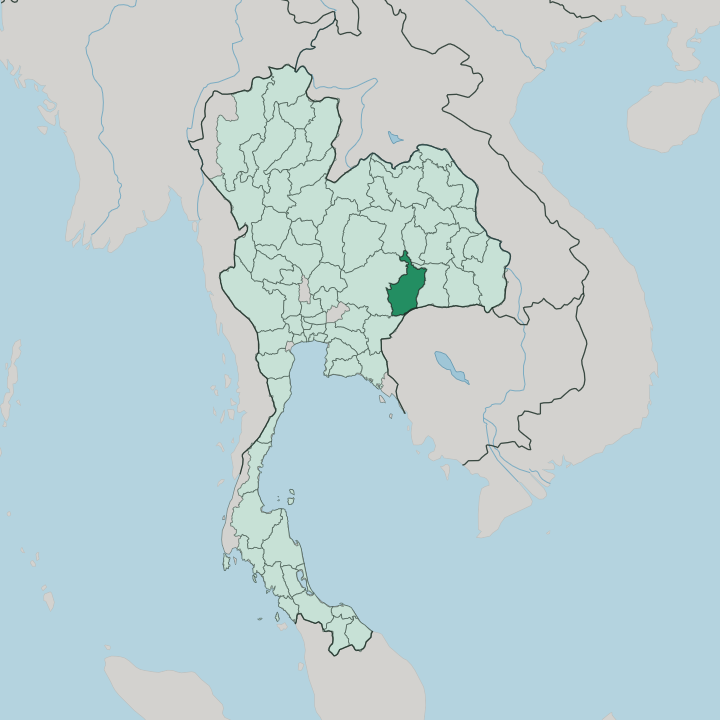


Towns & cities in Changwat Buri Ram
Pick a town or city — each links to where to stay.
Buriram town is the obvious base, and the only one with an airport, a mainline railway, and a full spread of hotels. It sits close to the Chang Arena and the racing circuit on the town's southern edge. For the temples, head west.
Nang Rong is the market town nearest Phanom Rung, an easy hop below the volcano, while Prakhon Chai sits beside the moated ruin of Prasat Muang Tam. Choose the town for sport and transport; choose Nang Rong or the southern districts when Khmer stone is what you came for.
About Changwat Buri Ram
What is Changwat Buri Ram known for?
Two things put Buriram on the map, and they sit centuries apart. Phanom Rung is the first, a thousand-year-old Khmer sanctuary of pink sandstone raised on a spent volcano, the grandest Angkor-era temple in Thailand. The second is sport.
Buriram United play football before packed stands at the Chang Arena, and the German-designed Chang International Circuit brought MotoGP racing to Isan. Between the two lie flooded rice plains, silk-weaving villages, and a scatter of lesser Khmer ruins that most travellers pass by on the road south to the Cambodian frontier.
Where is Changwat Buri Ram?
Buriram lies in lower Isan, the southern reach of the Khorat Plateau in northeastern Thailand, roughly 410 kilometres from Bangkok. Surin borders it to the east and Nakhon Ratchasima to the west, the two great provinces of the lower plateau. Maha Sarakham and Khon Kaen lie north across the Mun River. Sa Kaeo closes the south-western corner, where the plateau breaks toward the Cambodian lowlands.
The southern edge is different. There the land climbs to the Dângrêk Mountains, the forested wall that carries the frontier with Cambodia along its crest. Most of the province is flat.
Rice plains and cassava fields spread across the plateau at a few hundred metres above the sea, broken here and there by low hills that were once volcanoes. A scatter of old cones breaks the flatness. Phanom Rung sits on one of them, an extinct cone rising from the plain south of Buriram town.
Khao Kradong is another, a forest-topped crater on the town's own doorstep. The plateau tilts gently, shedding its water north and east into the Mun and on toward the Mekong. It is farming country above all, and the volcanoes are its landmarks.
What is Changwat Buri Ram like?
Buriram is Isan with a Khmer accent. Along the southern districts many families speak Northern Khmer at home, a legacy of the centuries when this plateau belonged to Angkor rather than to Bangkok. That inheritance shows in the food, the temple fairs, and the looms.
Silk-weaving villages around Na Pho, Phutthaisong, and Ban Kruat turn out the tight mudmee patterns that Isan is known for. The table is pure northeast: sticky rice eaten by hand, green-papaya som tam pounded fierce with chilli, grilled chicken and fermented fish. The other Buriram is loud and modern.
On match days the town turns blue for Buriram United, and the roads south fill again each time the circuit hosts a race. The two Buriram sit side by side without much friction. Once a year they almost touch, when the sunrise light of the Phanom Rung festival pours straight through the fifteen sandstone doorways of the old sanctuary and thousands climb the volcano to watch.
Farming still sets the rhythm the rest of the year. Rice, silk, and the slow Isan calendar of merit-making and rocket festivals shape ordinary life far more than the grandstands do.
What is the history of Changwat Buri Ram?
History here is written in stone. When the Khmer Empire ruled the plateau, between the tenth and thirteenth centuries, its builders raised Phanom Rung and a chain of lesser sanctuaries along the royal road that ran from Angkor to Phimai. The empire receded; the temples were left to the forest.
Centuries later a Thai frontier town called Muang Pae took its place, renamed Buriram, the city of happiness, in the early nineteenth century. The province took its modern shape in the administrative reforms that reorganised Siam late in the nineteenth century.
What is the climate of Changwat Buri Ram?
Buriram runs on three seasons, like the rest of Isan. The hot months from March to May are punishing, when the plateau bakes and the rice paddies crack dry. Then the southwest monsoon breaks.
Rain falls from May into October, heaviest in September, greening the fields and filling the reservoirs that carry the province through the dry spell. The cool season from November to February is the traveller's window, dry, clear, and comfortable, the best time to climb Phanom Rung. Winters here are warm by any northern measure.
How do you get to Changwat Buri Ram?
Most visitors come up from Bangkok, roughly 410 kilometres to the south-west. The quickest way is the short flight into Buriram's small airport, its schedule shaped in part by the football and the racing. Trains are the classic route.
The northeastern line out of Bangkok stops at Buriram station on its long run toward Ubon Ratchathani, and the night sleeper is a journey in itself. Drivers come up the highways through Nakhon Ratchasima, the junction where every road into lower Isan seems to meet. Phanom Rung itself is the harder prize, reached only by a hired car, a guided tour, or a songthaew running up from Nang Rong.
Updated July 2026