Thailand
Changwat Songkhla, Thailand — Towns & Travel Guide


Songkhla is a southern Thai province on the Gulf of Thailand, wrapped around the country's largest lake, with Hat Yai as its trading hub.
About Changwat Songkhla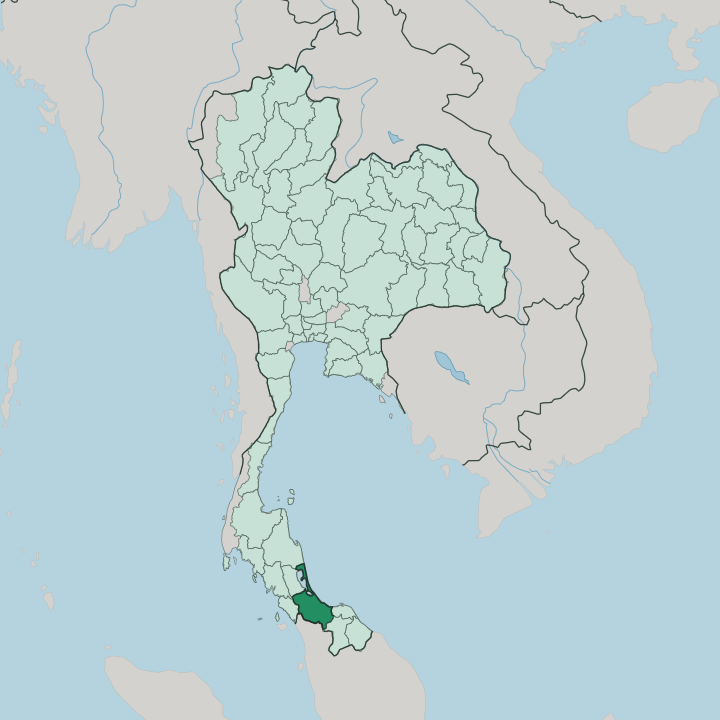


Towns & cities in Changwat Songkhla
Pick a town or city — each links to where to stay.
Two towns cover most needs. Most visitors base themselves in Hat Yai, the largest city, where the airport, the buses, and the southern railway all converge before the run to Malaysia. Songkhla town is the gentler alternative, an old seafront capital of shophouse streets closer to the beaches.
Ko Yo sits out in the lake. Stay in Hat Yai if you want transport and markets; choose Songkhla town for the Old Town and the sand at Samila and Chalatat.
About Changwat Songkhla
What is Changwat Songkhla known for?
Two cities define the province, and neither overshadows the other. Songkhla is the quiet capital, a spit of Old Town shophouses between the Gulf of Thailand and the lake, with the Golden Mermaid looking out over Samila Beach. Hat Yai is the opposite: the largest city, a trading and shopping centre that pulls in weekend crowds from Malaysia down the road.
Between them sits Songkhla Lake, the largest natural lake in Thailand. The province trades hard. Rubber, seafood, and border commerce run through it, and travellers mostly pass through Hat Yai before turning to the coast.
Where is Changwat Songkhla?
Songkhla lies far down the Malay Peninsula, in the south of Thailand, on the Gulf of Thailand coast. It faces east toward the gulf. Behind that coast spreads Songkhla Lake, the largest natural lake in the country, a shallow lagoon that runs some 78 kilometres north to south and opens to the sea near Songkhla town.
Rare Irrawaddy dolphins still cling on in its fresher upper reaches. The province wraps the lake's eastern and southern shores, while Phatthalung holds the far side. The capital sits on a spit at its mouth, water on both sides.
South of the lake the land rises into forested hills along a rugged border with Malaysia, the states of Kedah and Perlis lying just across it at the busy Sadao crossing. Inland the ground climbs to Khao Mai Kaeo, the province's highest point at 821 metres. The interior is rubber country.
Hat Yai grew up in this southern basin as a railway town, and it remains the largest city and the junction of the far south, while the capital keeps to the coast an hour to the northeast. Pattani and the deeper Malay-Muslim provinces begin just beyond the southern line.
What is Changwat Songkhla like?
Three communities have shared this coast for centuries. Thai Buddhists form the majority, their temples marking the towns and the lakeshore, while a large Muslim minority gives the province its southern edge. Many of those Muslims are Sam-Sam, a Thai-speaking group whose roots blur the old line between Thai and Malay.
Chinese settlers came by sea to trade. Their Hokkien descendants built the shophouse rows of Songkhla's Old Town, and the vegetarian festival each autumn still fills the streets with their rites. Mosque, temple, and Chinese shrine stand within the same few blocks.
The dialect is Southern Thai, quick and clipped, hard even for other Thais to follow. Its folk arts run deep. Manora dance, with its bird-like costumes and long silver nails, and the nang talung shadow-puppet plays both belong to this stretch of the south.
The food is fierce. Southern curries lean hot and dry, salted fish and turmeric flavour the everyday table, and Hat Yai's fried chicken and dim sum draw eaters from across the border. Along Nang Ngam Road, murals now colour the old walls, and cafés fill shophouses that once held rice merchants and gold traders.
What is the history of Changwat Songkhla?
The province carries a Malay past. In early centuries this coast lay at the northern edge of Langkasuka, a Malay kingdom shaped by Srivijaya, and the name Songkhla is a Thai bending of the Malay Singgora, the city of lions, for a lion-shaped hill above the harbour. A fortified port grew here.
The Sultanate of Singora was founded in the early seventeenth century by Dato Mogol, a Persian trader, and thrived under his son Sulaiman before Siamese armies broke it. Bangkok later drew the whole south firmly under its crown.
What is the climate of Changwat Songkhla?
The climate is tropical and wet, hot and humid the year round. The northeast monsoon sets the rhythm. From about October into December it drives heavy rain onto the Gulf of Thailand coast, and November can turn torrential, flooding the lowlands around Songkhla Lake and swamping Hat Yai's streets.
The drier, calmer months run from late January into April. This is the opposite pattern to the Andaman Sea side of the peninsula, which takes its rain earlier in the year.
How do you get to Changwat Songkhla?
Almost everyone comes through Hat Yai. Its airport is the busiest in the far south, with flights up to Bangkok and across to Kuala Lumpur and Singapore, and Hat Yai Junction is the main railway hub of southern Thailand, where the line down from Bangkok splits toward Malaysia and the deep south. Songkhla town has no airport of its own.
From Hat Yai it is a short run northeast by bus or minibus, well under an hour up the road. Overland travellers cross from Malaysia at the Sadao and Danok checkpoints.
Good for
Updated July 2026