Thailand
Changwat Udon Thani, Thailand — Towns & Travel Guide


Udon Thani anchors upper northeastern Thailand, where Bronze Age Ban Chiang and the pink Red Lotus Sea spread across the Khorat Plateau.
About Changwat Udon Thani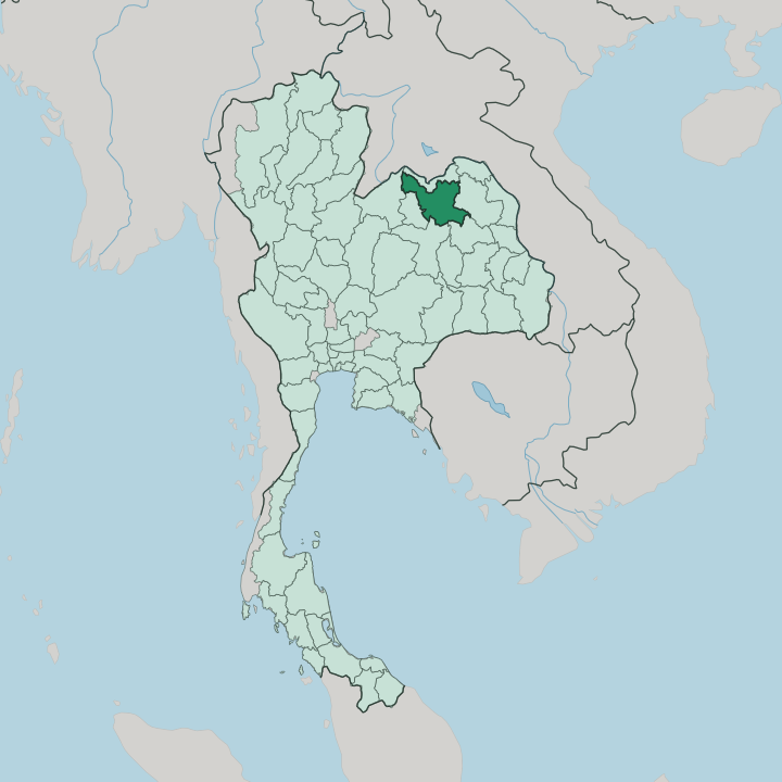


Towns & cities in Changwat Udon Thani
Pick a town or city — each links to where to stay.
Most trips start in the capital. It gathers the airport, the railway station and the night markets around Nong Prajak Park, so most itineraries begin in the city of Udon Thani before fanning out. Kumphawapi lies to the south, the launch point for the dawn boats that carry visitors onto the Red Lotus Sea.
Ban Chiang sits east in Nong Han district, the base for anyone whose whole reason for coming is the Bronze Age museum and its excavation pits. Farther north, Ban Dung holds the Kham Chanot grove, a naga pilgrimage site ringed by salt flats. The city itself is the pick for food and transit, the trading centre of upper Isan.
About Changwat Udon Thani
Two names carry the province.
What is Changwat Udon Thani known for?
Ban Chiang, a low mound of Bronze Age graves in Nong Han district, earned UNESCO listing as one of Southeast Asia's earliest metalworking sites, and its swirl-painted pottery became a Thai emblem. The other draw is the Red Lotus Sea on the Nong Han Kumphawapi wetland, where tropical water lilies open pink across the water each cool season. Udon Thani, the provincial capital, trades as the commercial market of the surrounding rice country.
An American air base in the Vietnam War left the city with Western restaurants and English-speaking habits that outlasted the airmen. This is the hub of upper Isan.
Where is Changwat Udon Thani?
Udon Thani spreads across the upper Khorat Plateau, the broad sandstone tableland that fills northeastern Thailand. This is Isan. The province sits on undulating plains and low hills a little way back from the Mekong, which runs along the far side of Nong Khai to the north and marks the border with Laos.
Six provinces surround Udon Thani, Nong Khai to the north and Loei with Nong Bua Lamphu off to the west. Nong Khai lies north, Sakon Nakhon east across the Phu Phan hills, Kalasin to the southeast, Khon Kaen south, and Loei with Nong Bua Lamphu to the west. That western province was itself carved out of Udon Thani in 1993, five districts split away to form a unit of its own.
Water drains north and east off the plateau toward the Mekong. The Songkhram River gathers much of that flow along the province's northern edge, while shallow wetlands pool on the flats inland. Largest of them is Nong Han Kumphawapi, the lake that reddens with water lilies each cool season.
Rice paddies cover most of the cleared ground, broken by stands of dry dipterocarp forest and the reservoirs that carry farms through the dry months. Beneath the fields lie some of Southeast Asia's largest potash beds, a buried legacy of the ancient sea that once covered the plateau.
What is Changwat Udon Thani like?
The province is Lao at heart. Its people speak Isan, a tongue closer to the Lao of Vientiane than to the Thai of Bangkok, and the old kingdom of Lan Xang shaped the region long before the modern border ran down the Mekong. Village life turns on wet-rice farming and the Theravada Buddhist temples that anchor each community.
Food is unmistakable. Green papaya som tam pounded with chilli and fermented fish, grilled chicken and baskets of sticky rice make up the everyday table, and the night markets of Udon Thani sell it late. Mor lam sets the sound of Isan, a rapid sung poetry driven by the khaen mouth organ, and it fills the province's festivals and long-distance buses alike.
Craft runs deep here too. The swirling painted pottery of Ban Chiang, among the oldest in Southeast Asia, still shapes the local sense of heritage, and Chinese-Thai merchants gave the capital its Pu-Ya shrine and its dragon festival. A final layer is American.
Bars, Western kitchens and English signage from the air-base decade never fully faded, and they still colour the streets around the city.
What is the history of Changwat Udon Thani?
Human settlement here is very old. The graves of Ban Chiang hold bronze and painted pottery worked more than three millennia ago, long before any Thai state reached the plateau. Udon Thani itself is young.
Prince Prajak Sillapakhom laid it out in 1893 for King Chulalongkorn, pulling Siam's regional garrison back from the Mekong as France pressed its claims along the river and Nong Khai fell inside a demilitarised strip. The next turning point came with war. American forces built a great air base outside the city in the Vietnam War, and the money and habits of that decade reshaped Udon Thani for good.
What is the climate of Changwat Udon Thani?
Udon Thani runs on three seasons. The heat peaks before the rains, when the plateau bakes dry and hazy from March into May. Then the southwest monsoon breaks.
Storms roll up from the south and soak the province from May to October, swelling the Songkhram and flooding the paddies green. The cool, dry months from November to February are the kindest, with clear skies over the Khorat Plateau and the water lilies opening on Nong Han Kumphawapi. Real cold never comes.
How do you get to Changwat Udon Thani?
Most arrivals come by air. Udon Thani International Airport sits just outside the city and links it to Bangkok many times a day, the busiest run in the northeast. Trains serve Udon Thani as well.
The Northeastern Line climbs up from Bangkok through Khon Kaen, and the overnight sleepers reach Udon Thani by morning. The province also sits on the road north to the Mekong, an hour from the Nong Khai bridge that crosses to Vientiane and the rest of Laos. From there the whole of upper Isan is within easy reach.
Good for
Updated July 2026