Thailand
Changwat Si Sa Ket, Thailand — Towns & Travel Guide


Si Sa Ket is a province of lower northeastern Thailand, its rice plains climbing south to the Dângrêk mountains along the Cambodian border.
About Changwat Si Sa Ket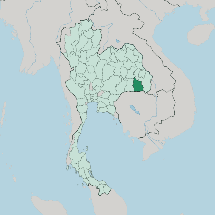


Towns & cities in Changwat Si Sa Ket
Pick a town or city — each links to where to stay.
Most beds cluster in Si Sa Ket town, the provincial capital on the northeastern railway. Si Sa Ket town is modest. The town works as a base for day trips south to the Khmer ruins and the Dângrêk cliffs, and Kantharalak is the closer jumping-off point for Khao Phra Wihan National Park itself.
For the cool-season mist over the Phanom Dong Rak range, travellers head up to Phu Sing. Those wanting more hotels, and the nearest airport, often sleep an hour east in Ubon Ratchathani instead.
About Changwat Si Sa Ket
Khmer stone defines the province.
What is Changwat Si Sa Ket known for?
Along the Dângrêk escarpment in the south sits Khao Phra Wihan National Park, and just over the ridge in Cambodia stands Preah Vihear, the cliff-top temple both countries claimed for decades. Older Khmer ruins dot the plain, among them Prasat Hin Ban Samo in Prang Ku. The soil feeds it too.
Farmers grow jasmine rice, pungent garlic and shallots, and the volcanic-soil durian grown around Kantharalak and Khun Han. The Kuy, elephant-keepers of Isan, have herded and farmed these districts for generations.
Where is Changwat Si Sa Ket?
Si Sa Ket sits in the far south of Isan, on the Khorat Plateau of northeastern Thailand. The land is mostly flat. Its northern and central districts belong to the broad valley of the Mun River, a tributary of the Mekong that drains the plateau eastward toward Ubon Ratchathani.
Rice paddies and low rises fill this lowland, threaded by the Huai Samran and other small tributaries running down off the hills. Surin lies to the west, Roi Et and Yasothon to the north, and Ubon Ratchathani to the east. The south is different country. There the ground climbs to the Dângrêk mountains, the sandstone escarpment the Thai call Phanom Dong Rak, which walls the province off from Cambodia.
This ridge is the border. Along it run the provinces of Preah Vihear and Oddar Meanchey on the Cambodian side, and the cliff-top temple that gives Khao Phra Wihan National Park its name stands just beyond the line. The frontier here stretches for kilometres of forest and cliff.
From viewpoints on the scarp the plateau falls away northward, and the plain of the Mun spreads out below toward the distant Mekong.
What is Changwat Si Sa Ket like?
Four peoples share Si Sa Ket, and it shows in the markets. Lao speech, the everyday tongue of Isan, mixes with Northern Khmer along the southern border, where villages have looked toward the old Khmer world for a thousand years. The Kui, or Kuy, keep a language of their own.
Their name here is bound to elephants. Kuy men were the mahouts of Isan, the trackers and tamers who once caught and trained the working elephants of the northeast. Their villages tracked wild herds through the Dângrêk forests and supplied tamed elephants to markets across the region.
The Yer round out the mix. Faith and farming shape the calendar. Old Khmer sanctuaries still anchor local worship, and the six-petalled lamduan flower on the provincial emblem stands for the six founding districts of Khukhan, Kantharalak and their neighbours.
Kitchens lean on the local harvest. Si Sa Ket garlic and shallots, prized enough to carry their own geographical-indication mark, season the jasmine rice grown across the plain, and the volcanic-soil durian of Kantharalak and Khun Han crowns the hot months. It is a rural province at heart.
What is the history of Changwat Si Sa Ket?
The Khmer came first. Long before Thailand reached this far, the builders of Angkor raised sandstone temples across the plain, among them Prasat Hin Ban Samo near Prang Ku, still standing after a thousand years. The Thai town came late.
Si Sa Ket was founded in 1786 as a settlement under Khukhan, was itself renamed Khukhan in 1904, and had its old name restored only in 1938. The Dângrêk gave the province its sharpest modern chapter, when the temple of Preah Vihear became the object of a long border quarrel with Cambodia.
What is the climate of Changwat Si Sa Ket?
Heat and monsoon rule the year here. Three seasons turn over the plain: a hot, dry stretch from March into May, the southwest monsoon soaking the fields from May to October, and cooler, drier air over the winter months. Most rain falls in the wet half of the year, heaviest around August, feeding the paddies of the Mun valley.
The hot months bite hardest before the rains break. Come the cool months, dawn mist settles over the Phanom Dong Rak range in the south, and the days turn clear and dry.
How do you get to Changwat Si Sa Ket?
The train brings in most who come to Si Sa Ket. Si Sa Ket sits on the northeastern line that runs from Bangkok out to the Mun valley, and overnight sleepers reach the town in a long night's ride, drawing up at a station in the middle of the centre. Buses run the same route from Bangkok.
Si Sa Ket has no airport of its own. The nearest runways lie an hour east at Ubon Ratchathani, whose flights link the northeast to Bangkok, and short local trains close the last gap into Si Sa Ket.
Good for
Updated July 2026