Turkey
Ağrı, Turkey — Towns & Travel Guide


Ağrı is a province of eastern Turkey on the Iranian border, its plains rising to Mount Ararat, the highest peak in the country.
About Ağrı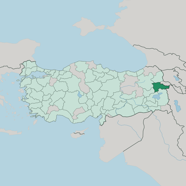


Towns & cities in Ağrı
Pick a town or city — each links to where to stay.
Ağrı, the provincial seat once called Karaköse, sits on the open plains and works as the administrative hub. Most travellers base themselves in Doğubayazıt instead. The frontier town lies within reach of Mount Ararat and the Ishak Pasha Palace, and it is where expeditions to the summit form up.
Diyadin, further west, draws visitors for its hot springs along the Murat River. Choose the city for transport links; choose Doğubayazıt for the mountain.
About Ağrı
One mountain defines Ağrı.
What is Ağrı known for?
Mount Ararat, a dormant stratovolcano and the highest peak in Turkey, rises from the province's eastern plains and lends the whole province its Turkish name. Below it sits Doğubayazıt, the frontier town where climbers gather before the ascent and where the Ishak Pasha Palace looks out over the plain. The people are largely Kurdish, part of Eastern Anatolia's high, cold interior.
Grain fields and grazing land fill the valleys the Murat River waters.
Where is Ağrı?
Ağrı lies in the far east of Turkey, within the Eastern Anatolia Region, pressed against the border with Iran. No coast reaches it. Kars sits to the north and Iğdır to the north-east, Erzurum to the north-west, and Van to the south, while Muş and Bitlis close off the south-west. The terrain runs high and rough.
Nearly half the province is mountain, the balance a patchwork of plain, plateau, and upland meadow, and volcanic ash has left the valley floors unusually fertile for grain and grazing. Ağrı province covers a broad upland basin, wide enough that its weather and its farming both answer to elevation more than to any coast. Mount Ararat commands the whole province.
The dormant stratovolcano is the highest peak in Turkey, and its snow-capped cone stands over Doğubayazıt near the Iranian frontier. Water drains off these highlands into the Murat River, whose tributaries rise in the Diyadin district and run west toward the Euphrates. Lava fields mark the ground, too.
Lake Balık sits in one such bed of old lava near Taşlıçay, dammed long ago by flows off the volcanic highlands. Passes thread between the ranges, tying the plains around the city of Ağrı to the frontier beyond Doğubayazıt.
What is Ağrı like?
Ağrı is predominantly Kurdish, one of the most heavily Kurdish-speaking provinces in Turkey. Turkish is the official language, but Kurdish is what most people speak at home. Bread, cheese, and honey anchor the local table.
Life here has long turned on livestock. Herders move flocks between the plains and the high summer meadows, and the province's grain and dairy come off that same volcanic soil. It is a pastoral culture, shaped by hard winters and short growing seasons, and its rhythms follow the animals more than any clock.
The landscape carries the region's stories. Mount Ararat is the mountain many traditions tie to Noah's Ark, and its outline shows up on everything from tea glasses to town emblems. Near Doğubayazıt, the Ishak Pasha Palace blends Ottoman, Persian, and Armenian styles into one honey-coloured complex above the plain.
Weekly markets pull villagers into the towns with livestock and wool. At Diyadin, hot springs steam out of the ground beside the Murat River, used for bathing since long before anyone wrote the custom down. This is a border culture, and it wears its many layers plainly.
What is the history of Ağrı?
The plateau was Urartian country in the first millennium BC, later drawn into the Kingdom of Armenia. An early fortress still marks Doğubayazıt. Selim I brought the region into the Ottoman Empire after the Battle of Chaldiran in 1514, and it was ruled for centuries from Erzurum.
The town went by Karakilise and then Karaköse before taking the name Ağrı, after the Turkish name for Mount Ararat. In 1930 its slopes rose in the Ararat rebellion. The old town of Bayazıt was razed, and Doğubayazıt was built on the plain below.
What is the climate of Ağrı?
Ağrı has a harsh continental climate, driven by altitude rather than any sea. Winters are long and brutally cold. Deep snow lies across the plateau and the surrounding ranges for months, and blizzards can close the passes into and out of the province.
Summers turn short and warm, with hot afternoons breaking into cold nights up on the high ground. Meltwater from that snow feeds the Murat River each spring. Cold is the long season here.
How do you get to Ağrı?
Ağrı sits on Turkey's eastern frontier, far from any sea. Most people arrive overland or by a short flight into the airport beside the provincial capital, with a second airfield over at Iğdır. From there, roads climb east across the plateau to Doğubayazıt and the foot of Mount Ararat.
The main land crossing into Iran lies just past that town. Buses link the province north-west to Erzurum and south to Van, the nearest large cities of Eastern Anatolia. The rest is road.
Good for
Updated July 2026