Turkey
Bolu, Turkey — Towns & Travel Guide


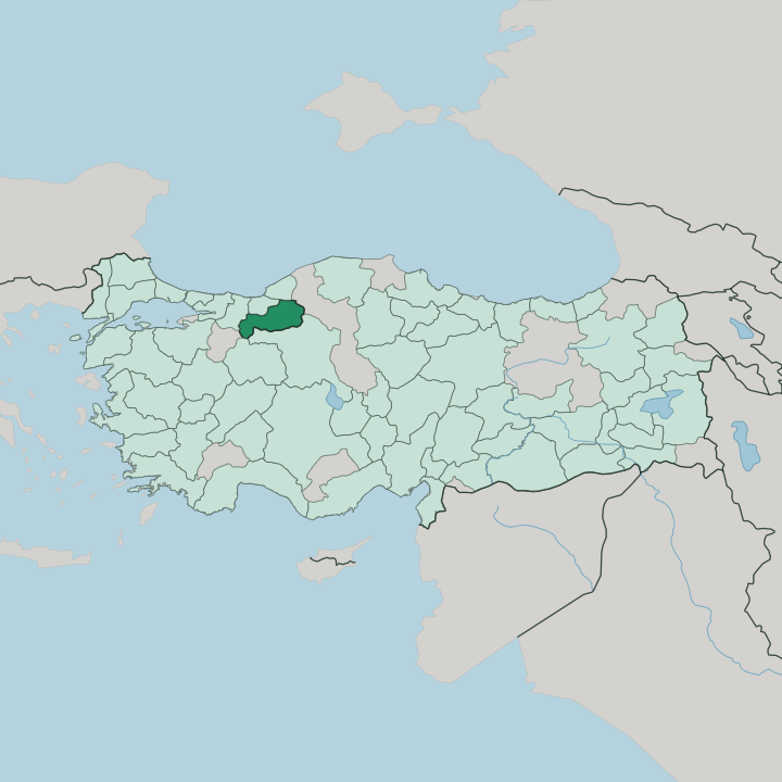


Towns & cities in Bolu
Pick a town or city — each links to where to stay.
Four very different bases split the province. Bolu itself, the capital on the Istanbul-Ankara highway, works as a plain overnight stop with hot springs on its edge. For nature, the hotels around Lake Abant sit in fir woods a short drive southwest, close to the shore path.
Skiers head higher, to Kartalkaya on the Köroğlu Mountains. Mudurnu is different again. Its conservation streets of timber Ottoman houses suit travellers who would rather wake to a working bazaar than a ski lift or a lakeshore.
About Bolu
Bolu trades on its landscape.
What is Bolu known for?
Lake Abant sits in a wooded basin southwest of the provincial capital, a crater-like lake ringed by fir and beech that draws walkers and picnic crowds through the year. Further north, the Yedigöller National Park strings seven small lakes through the forest, at its best when the leaves turn. The ski runs at Kartalkaya climb the Köroğlu Mountains to the south.
And the district of Mengen has sent cooks to Turkish kitchens for generations.
Where is Bolu?
Bolu lies inland in the Western Black Sea region, roughly halfway along the road from Istanbul to Ankara. Bolu reaches no sea. The province is folded into hills and mountains, and forest covers well over half of it, beech, oak, fir, and pine.
The Köroğlu Mountains rise along its southern edge, their bare summits holding snow into spring, while the provincial capital sits in a sheltered basin below them. Düzce lies to the west beyond Bolu Dağı, whose pass guards the approach from Istanbul, with the Black Sea coast to the north and Ankara to the south. Water does the rest of the shaping, from Lake Abant in its fir-forest hollow to the stepped tarns of Yedigöller.
Lake Abant fills a landslide-dammed hollow in the fir forest southwest of the city, and the small lakes of the Yedigöller National Park step down a wooded valley further north. Streams drain north toward the Black Sea and south into the Sakarya. Elevations climb from green river valleys to alpine meadow within a few kilometres, which is why one province can carry trout lakes, ski runs, and upland pasture at once.
Fog settles often in the basins. The North Anatolian Fault runs straight beneath the province, and the earthquake of 1944 tore along it here.
What is Bolu like?
Bolu's strongest tradition is cooking. Through the empire's final century the kitchens of the Ottoman palace were staffed by men from the district of Mengen, and the town still runs a cookery school and an annual chefs' festival that keep the craft alive. The provincial table leans on what the highlands give, sheep's-milk cheese, yoghurt, trout, and dishes such as Mengen pilaf and palace halva.
Strabo praised the pastures and cheese of ancient Bithynium. The folk hero Köroğlu belongs here too, the outlaw-poet of a Turkish epic whose name the southern mountains carry. Old towns keep their Ottoman fabric intact.
Mudurnu, a guild town of timber houses gathered round a fourteenth-century mosque, still keeps its old Ahi craftsmen's traditions, and it holds a place on the Cittaslow list of slow towns. Göynük, further west, keeps whole streets of tall Ottoman houses, old fountains, and the tomb of Akşemseddin, the scholar who taught Mehmed the Conqueror. Hot springs draw a different crowd.
Bathers have soaked in the thermal water around the capital since Roman days, and the mountain villages above still farm and graze much as they always have.
What is the history of Bolu?
Under the old capital lies an ancient one. The Greek town of Bithynium rose here as a Hellenistic foundation of the kings of Bithynia and grew rich on the pastures and cheese around it; under Rome it took the name Claudiopolis. It sat on the road that linked Nicomedia on the coast to Ankara inland.
The Ottomans took Bolu in 1325, and the surrounding towns of Mudurnu and Göynük became early seats of their rule. The palace drew its cooks.
What is the climate of Bolu?
Bolu's weather answers to altitude. Winters are cold and snowy, and the high country around Kartalkaya holds a reliable snowpack that feeds the ski season from late December into March. Summers turn warm by day and cool sharply at night in the mountains, gentler than the Turkish coast.
Spring is the wettest stretch, which is what keeps the forests so dense. Fog pools in the Bolu basin. Gerede and the eastern uplands run colder still, with long hard frosts.
How do you get to Bolu?
Almost everyone arrives by road. Bolu sits on the motorway between Istanbul and Ankara, and the twin bores of the Mount Bolu Tunnel carry that traffic under the pass that once choked with snow. Frequent intercity buses stop in the city on the run between the two.
The province has no airport of its own, so most fly into Istanbul or Ankara and drive the rest. From the capital it is a short climb up to Lake Abant or Kartalkaya.
Good for
Updated July 2026