Turkey
Çorum, Turkey — Towns & Travel Guide


Çorum is an inland province of northern Anatolia, holding Hattusa, the UNESCO-listed capital of the Bronze Age Hittite Empire.
About Çorum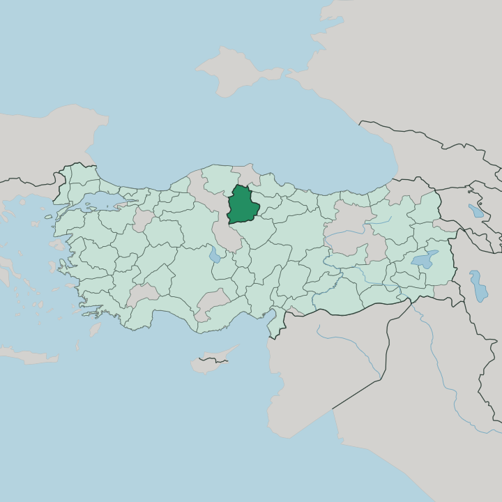


Towns & cities in Çorum
Pick a town or city — each links to where to stay.
Most visitors sleep in Çorum, the provincial capital, where the hotels sit close to the museum and the leblebi shops. Çorum town makes the simplest base. The Hittite sites lie to the south-west, so Sungurlu makes the natural overnight stop for Hattusa, Yazılıkaya and Boğazkale, an easy morning's drive from the ruins. Osmancık strings along the Kızılırmak on the Samsun road, and İskilip keeps its old town up in the hills.
Pick the capital for comfort; pick Sungurlu if the Hittite capital is why you came.
About Çorum
Çorum is Hittite country.
What is Çorum known for?
The province holds Hattusa, the Bronze Age capital that the Hittites raised on the Anatolian plateau, together with the rock-cut sanctuary of Yazılıkaya and the older mound of Alacahöyük. Archaeologists come for the cuneiform archives found here. Away from the ruins, the name means one thing to most Turks: leblebi, the roasted chickpeas that the town of Çorum has sold for generations.
Where is Çorum?
Çorum lies inland in north-central Turkey. It belongs officially to the Black Sea Region, yet it wears the dry, open face of Central Anatolia, all high plateau and tilled basin rather than green coast. The province is landlocked.
It shares borders with Çankırı to the west, Amasya to the east, and Yozgat to the south, while the Black Sea provinces of Samsun and Sinop close it off to the north. Ankara sits off to the south-west; Samsun is the closest window on the sea. Two rivers order the land. The Kızılırmak, the longest river to run its whole course inside Turkey, curves across the north of the province and through Osmancık, where the Koyunbaba bridge steps over it on pointed stone arches.
Eastern streams drain the other way, toward the Yeşilırmak. Ridges of bare limestone run between the valleys, and the Çal and Ada mountains rise above the Kızılırmak near Osmancık. The provincial capital itself stands about 800 metres up, high enough that winters bite.
Between the ridges spread wide farming basins, the Budaközü plain among them, planted with the wheat and chickpeas the region lives on. Its far north, around Kargı, breaks into pine-forested mountains that lean toward the Sinop coast, the one corner where the province feels truly of the Black Sea.
What is Çorum like?
Deep time sets the tone here. More than any living tradition, it is the Bronze Age that gives Çorum its sense of itself, and the province leans on the Hittites the way other places lean on a saint or a king. Their gods, carved in file along the rock of Yazılıkaya, have become the emblem of the region.
Two museums hold the finds. The Çorum Museum gathers tablets and reliefs in the capital, while the Boğazköy Museum sits out by the walls of Hattusa itself. The other Çorum is edible.
For roughly three centuries the town has roasted chickpeas into leblebi, drying and toasting them in slow stages until the pulses turn pale and crisp, a craft now guarded by its own geographical indication. Leblebi is sold plain, salted, or coated white with sugar. İskilip answers with a dish of its own: onions, rice and lamb sealed in a cauldron and buried over a tandır fire, cooked so slowly that a single pot can take most of a day. Turkish is the language of the tea houses and the markets.
Life runs at a provincial Anatolian pace, devout and unhurried, closer to the country town than the coast.
What is the history of Çorum?
Çorum's great age came early. Around the middle of the second millennium BC the Hittites made Hattusa their capital, ruling much of Anatolia and the northern Near East from behind its ring of stone walls. Clay tablets in cuneiform, baked hard when the city burned, preserve its treaties and prayers.
The empire fell around 1200 BC. Phrygians, then Romans and Byzantines held the land, and the Turkish village beside the ruins took the name Boğazkale.
What is the climate of Çorum?
Winters here are long and cold. Sitting high on the plateau and cut off from the sea, the province runs to a continental pattern: snow lies over Çorum for weeks, and hard frosts settle into the basins. By summer the Çorum basin bakes hot and dry.
The Kızılırmak valley around Osmancık, dropping toward the Black Sea, feels milder than the capital, a softer transitional belt between Anatolia and the coast. Spring and autumn come brief but green.
How do you get to Çorum?
Çorum is a road town. The province has no airport of its own, so most arrivals drive in, and the main line of travel is the Ankara-Samsun highway that cuts clean across the middle of it. Buses stop at Sungurlu for soup and leblebi on that run.
From Ankara it is a few hours east; from the Black Sea, the port of Samsun lies a similar reach to the north. The nearest airport sits over the border at Merzifon, in Amasya.
Good for
Updated July 2026