Turkey
Kırklareli, Turkey — Towns & Travel Guide


Kırklareli is a province in Turkey's far north-west, held between the forested Yıldız Mountains, Bulgaria and the Black Sea.
About Kırklareli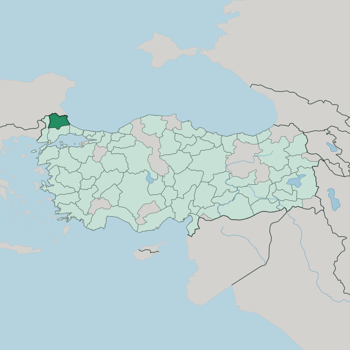


Towns & cities in Kırklareli
Pick a town or city — each links to where to stay.
Most trips run on two bases. Kırklareli town, the provincial capital, sits up in the Yıldız foothills and makes a calm base for the inland vineyards, the show caves and the forested country along the Bulgarian border. Lüleburgaz, the biggest town, straddles the old road between İstanbul and Edirne, built around Mimar Sinan's Sokullu Mehmet Paşa mosque.
For the coast, İğneada puts you beside the floodplain forests and a wide, undeveloped Black Sea strand. Vize points travellers up to Dupnisa Cave and the old Thracian ruins.
About Kırklareli
Two landscapes define the province.
What is Kırklareli known for?
In the north, the Yıldız Mountains carry dense oak and beech forest down to a short, wild stretch of Black Sea coast, while the south opens into the grain fields and vineyards of the Thracian plain. Kırklareli is one of Turkey's serious wine districts, and its cellars pull grapes off the limestone slopes around Vize and Lüleburgaz. The İğneada floodplain forests, the Dupnisa Cave and the fermented-grape drink hardaliye are the things people come for.
Where is Kırklareli?
Kırklareli fills the northern edge of East Thrace, the slice of Turkey that lies on the European mainland. Bulgaria runs along its whole northern side, a land border of roughly 180 km. The Black Sea closes the province off to the east, where a short coast of about 60 km meets the water at İğneada and Kıyıköy.
Edirne lies to the west and Tekirdağ to the south, both fellow Thracian provinces. This is Turkey's far north-western corner. The land tilts down from the forested hills in the north to the open plain in the south.
The Yıldız Mountains give the province its backbone. Also called the Istranca range, they form the Turkish end of the Strandzha massif, a forested upland shared with Bulgaria that rises southward to Mahya Dağı, the highest ground anywhere in Thrace. Oak and beech cover the slopes.
Below Demirköy the Dupnisa Cave winds underground, and streams off the hills feed the İğneada floodplain forests before they reach the sea. South of the range the land flattens. The Ergene lowlands then carry the vineyards and grain fields that make up most of the province's farmland.
What is Kırklareli like?
Kırklareli carries a deep Thracian and Ottoman layering. Its old name was Kırk Kilise, meaning forty churches, and the town kept that name until 1924. The province sits on the Balkan side of Turkey, and the mix shows in its festivals.
Every spring the Roma communities hold Kakava, a fire-and-dance celebration driven by the davul drum and the zurna pipe. In the Babaeski village of Büyükmandıra, the midwinter Koleda tradition sends masked processions through the streets to drive off the cold. These are Balkan customs, kept alive on Turkish soil.
Wine runs through the local table. The limestone hills around Vize and Lüleburgaz feed a winemaking tradition that reaches back to Thracian times, and the cellars turn out both native grapes and imported vines. Alongside the wine sits hardaliye, a non-alcoholic drink pressed from red grapes with mustard seed and cherry leaves.
The kitchens are known for sheep's-milk cheeses and for halva studded with walnuts. Ottoman stonework anchors the towns. Mimar Sinan built the Sokullu Mehmet Paşa mosque at Lüleburgaz, while Vize keeps a sixth-century Little Hagia Sophia, and Turkish is the everyday language throughout.
What is the history of Kırklareli?
The past here runs deep. People have farmed this corner of Thrace since Thracian times, and Vize began as Bizye, the seat of the Astae tribe that Rome later folded into its province of Thrace. Murad I took the region for the Ottomans in 1363.
The main town was called Kırk Kilise, the forty churches, until it was renamed Kırklareli in 1924. Balkan and world wars crossed the plain more than once before the border finally settled.
What is the climate of Kırklareli?
The province straddles two weather worlds. Along the Black Sea shore at İğneada, the water keeps the air mild and damp through the year, while the interior around Kırklareli town turns sharply continental. Summers run hot, winters cold and cloudy, with most rain falling in the colder months.
The Yıldız Mountains throw a rain shadow over the plain, so the inland towns stay drier than the coast. Snow settles on the hills between December and March.
How do you get to Kırklareli?
Most visitors arrive overland from İstanbul. The city has no airport of its own, so the usual route runs west from İstanbul along the motorway toward Edirne, passing through Lüleburgaz and Babaeski on the Thracian plain. A rail line follows the same corridor toward the Bulgarian frontier.
North of Kırklareli, the Dereköy crossing carries road traffic over the border into Bulgaria. For the coast, drivers head through Demirköy to reach İğneada and Kıyıköy.
Good for
Updated July 2026