Turkey
Şırnak, Turkey — Towns & Travel Guide




Towns & cities in Şırnak
Pick a town or city — each links to where to stay.
Beds are thin across Şırnak, and most cluster in three towns. Cizre is the obvious base. It holds the province's deepest history along the Tigris, from the Red Medrese to the shrine locals keep as the tomb of Noah, and it makes the natural jumping-off point for Mount Cudi.
The provincial capital, Şırnak itself, sits far higher in the mountains and stays cold when the valley bakes, useful mainly for reaching the western districts. Silopi lies south toward the Habur crossing, a working border town for freight rather than sightseeing. Choose Cizre if you want old streets and the river; take Silopi only when your route runs into Iraq.
About Şırnak
What is Şırnak known for?
Şırnak's name travels with Mount Cudi. In Islamic tradition, and by the reckoning of the Qur'an, this is the summit where Noah's Ark came to rest, which makes the mountain above Cizre a place of pilgrimage rather than mere scenery. The Tigris runs past below.
Cizre itself is old beyond easy counting, once the seat of the Kurdish Principality of Bohtan and the birthplace of the engineer al-Jazari, remembered for his water clocks and automata. Borders press in on every side. Iraq lies to the south and Syria to the west, and the province sits at the very corner where the three countries touch.
Where is Şırnak?
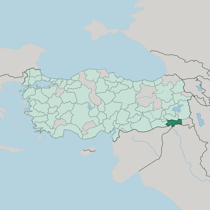
Şırnak occupies the far south-eastern tip of Turkey, the last stretch of land before the frontier bends around Iraq and Syria. The Tigris draws its southern edge. The river comes down out of the mountains, curls past Cizre, and runs on toward the plains of Iraq, and for much of that course it doubles as the international border.
Two of its tributaries, the Hezil and the Kızılsu, drain the province from the north. The province was drawn late. Only in 1990 did Turkey carve it out of neighbouring Siirt, Hakkâri and Mardin, giving the Southeastern Anatolia Region its youngest province.
The land tilts hard from north to south. Mountains wall the west and the south, chief among them Mount Cudi, whose four peaks rise straight above the Tigris near Cizre, with Mount Gabar off to the north-west. Between the ranges the ground opens into plateaus cut by deep river valleys, and only in the north and the far south does it flatten into true plain.
Seven districts split the province. Cizre, Silopi and İdil hold the low, hot country near the borders; Şırnak town, Beytüşşebap and Uludere climb into the cold highlands; Güçlükonak sits between. It is a small province with a lot of vertical range.
What is Şırnak like?
Şırnak is a Kurdish province, and Kurmanji is the first language of its towns and villages. Turkish runs alongside it in schools and offices. The mountains keep old ways close.
Newroz, the spring festival at the equinox, lights bonfires across the province and pulls crowds into the streets of Cizre and the highland towns, a marker of Kurdish identity as much as a change of season. Music, oral poetry and the long memory of the Bohtan princes still colour how the region tells its own story. Faith and legend sit heavily on the land here.
Mount Cudi is held, in Islamic tradition, as the resting place of Noah's Ark, and Cizre keeps a shrine revered as the tomb of Noah, so pilgrimage is woven into ordinary life. The town has a scholarly past to match. The engineer al-Jazari was born here before he built his automata and water clocks for the Artuqid court, and the Red Medrese made Cizre a seat of learning under the emirs of Bohtan.
Even the Kurdish romance Mem û Zîn sets its lovers among those princes on the Tigris. History is not a museum piece in Şırnak. It is argued over, sung, and lived.
What is the history of Şırnak?
For most of its past Şırnak was not a province at all, but the mountainous edge of older lands around Cizre. Cizre carried the weight of that history. On an island-like bend of the Tigris, it grew into the seat of the Kurdish Principality of Bohtan, ruled by the Azizan line, and it passed into the Ottoman Empire under Selim I in 1515.
The modern province is a newcomer by comparison. Turkey assembled it in 1990 from districts taken off Siirt, Hakkâri and Mardin, and the old town of Cizre finally became part of a unit named for the highland town of Şırnak.
What is the climate of Şırnak?
Şırnak carries two climates stacked on top of each other. Down on the Tigris at Cizre the summers are ferocious, dry and blazing, while the winters stay mild and short. Climb into the mountains and everything inverts.
Around Şırnak town, Beytüşşebap and Uludere the winters turn long and heavily snowbound, with cold northern air holding the drifts for months. Rain and snow arrive mostly outside the fierce summer. It is a hard land to cross in February and a furnace to cross in July.
How do you get to Şırnak?
Şırnak lies a long way from the rest of Turkey, tucked into the country's far south-eastern corner. Flying shortens it. Şırnak Şerafettin Elçi Airport, out between Cizre and İdil, links the province to Istanbul and Ankara, and for most visitors that is the sane way in. By road the approach is the D400, the old trunk route that threads down through Cizre toward the border.
The same highway runs on to the Habur gate below Silopi, Turkey's busiest crossing into Iraq. Overland from the west is a very long haul.
Good for
Updated July 2026