Vietnam
Hai Phong, Vietnam — Towns & Travel Guide


Hai Phong is northern Vietnam's largest seaport, set at the mouth of the Cấm River on the Gulf of Tonkin, the mainland base for Cat Ba Island.
About Hai Phong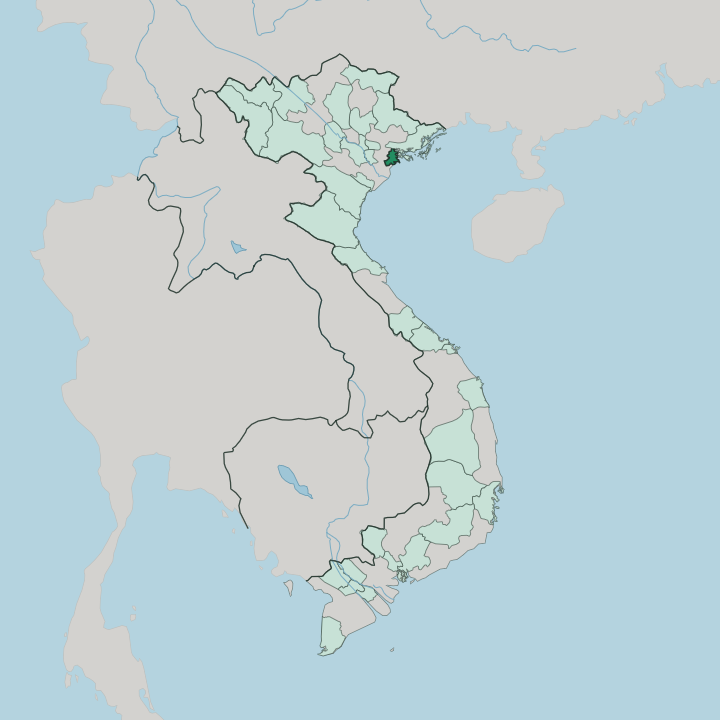


Towns & cities in Hai Phong
Pick a town or city — each links to where to stay.
Most travellers split their time between the mainland city and the islands offshore. Downtown Hai Phong, around the century-old Opera House and Tam Bạc Lake, keeps travellers among French-colonial streets and the best bánh đa cua stalls, a short walk from the train to Hanoi. For limestone scenery, cross to Cat Ba Town, the launch point for Lan Ha Bay and Cat Ba National Park.
Do Son, a slim peninsula southeast of the centre, trades the harbour for beaches and pine-shaded lanes. The decision comes down to one thing. Pick the city for food and the train; pick the islands for the water.
About Hai Phong
Two things define Hai Phong: the harbour and the flowers.
What is Hai Phong known for?
It is the largest seaport in the north of Vietnam, a working city of container cranes and shipyards rather than a resort. Come early summer, royal poinciana trees line the boulevards in blazing red, which is why locals call it the City of the Red Flamboyant. Its kitchens are famous too.
Bánh đa cua, a crab-and-noodle soup made with wide brown rice noodles, was born here. Offshore, the limestone towers of Cat Ba Island and Lan Ha Bay pull travellers out onto the water.
Where is Hai Phong?
Hai Phong sits on the northeastern edge of the Red River Delta, on the coast of the Gulf of Tonkin. The city proper stands about 120 kilometres east of Hanoi, at the mouth of the Cấm River, one of the many channels that carry the delta's water to the sea. The land here is flat and low, threaded by distributaries of the Thái Bình and Red river systems, laced with dykes and shipping canals.
Rice paddy gives way to mudflats, and mudflats to the open gulf. Offshore, the terrain changes completely. The limestone towers of Cat Ba Island, the largest of hundreds in the local archipelago, rise straight from the water, and Lan Ha Bay carries the same karst seascape south from Ha Long Bay across the provincial line.
Nearer the mainland, the Đồ Sơn peninsula juts into the gulf as a spur of low hills and pine. Further out lie the fishing island of Cát Hải and, far into the Gulf of Tonkin, the lonely outpost of Bạch Long Vĩ. Water shapes all of it.
Every part of Hai Phong drains toward the same coast.
What is Hai Phong like?
Hai Phong wears its nickname openly: the City of the Red Flamboyant. When the royal poinciana trees flower in early summer, whole avenues turn scarlet overhead, and the bloom has become the city's emblem. Each spring the Red Flamboyant Flower Festival fills the streets with parades and music, timed to the city's own Liberation Day.
This is a port town first, though, and the temperament shows. Generations of dockworkers, sailors and shipyard hands gave Hai Phong a blunt, hard-working reputation that locals wear with some pride. Food is the other point of local pride.
The kitchens lean on what the boats bring in, and the signature dish, bánh đa cua, layers crab broth over wide reddish-brown rice noodles topped with betel-leaf sausage and greens. Square seafood spring rolls, nem cua bể, are just as closely tied to the city. Vietnamese is the everyday language, spoken with a distinct northern-coastal accent.
Markets, seafood stalls and pavement cafés carry the daily rhythm. The result is energetic and unpolished.
What is the history of Hai Phong?
Hai Phong's story begins on the water. On the nearby Bạch Đằng River, Ngô Quyền destroyed a Southern Han fleet in 938, and in 1288 Trần Hưng Đạo sank the Mongol navy there by planting iron-tipped stakes in the riverbed and springing them at the falling tide. The modern city is younger.
The French built the seaport in 1887 and grew it into the Big Port of Tonkin, the industrial outlet for the whole northern colony. That port turned violent in 1946, when French warships shelled the town and lit the fuse of the First Indochina War.
What is the climate of Hai Phong?
Hai Phong runs on a humid subtropical rhythm with four clear seasons. Summers are hot and soaking wet, as the southwest monsoon drives heavy rain from May into September and pushes humidity past the point of comfort. Winters flip the mood: cool, grey and often drizzly, with a raw edge blowing off the Gulf of Tonkin in January.
Spring is warm and misty, autumn crisp and dry. Typhoons are the wild card. Between July and October the coast can take a direct hit, closing the port and the island ferries for days.
How do you get to Hai Phong?
Most visitors arrive overland from Hanoi. The Hanoi-Hải Phòng Expressway covers the run east in under two hours, and a slower colonial-era railway makes the same trip to a downtown station. Cat Bi International Airport sits just southeast of the centre, linking the city to the south of Vietnam and a handful of regional routes.
From the harbour, speedboats and ferries cross to Cat Ba Island and the outer islands. A separate expressway runs north to Ha Long Bay in minutes rather than hours.
Good for
Updated July 2026