Vietnam
Lam Dong, Vietnam — Towns & Travel Guide


Lâm Đồng runs from Vietnam's cool Central Highlands down to a South China Sea coast, its highland heart the old French hill-station city of Đà Lạt.
Find your area →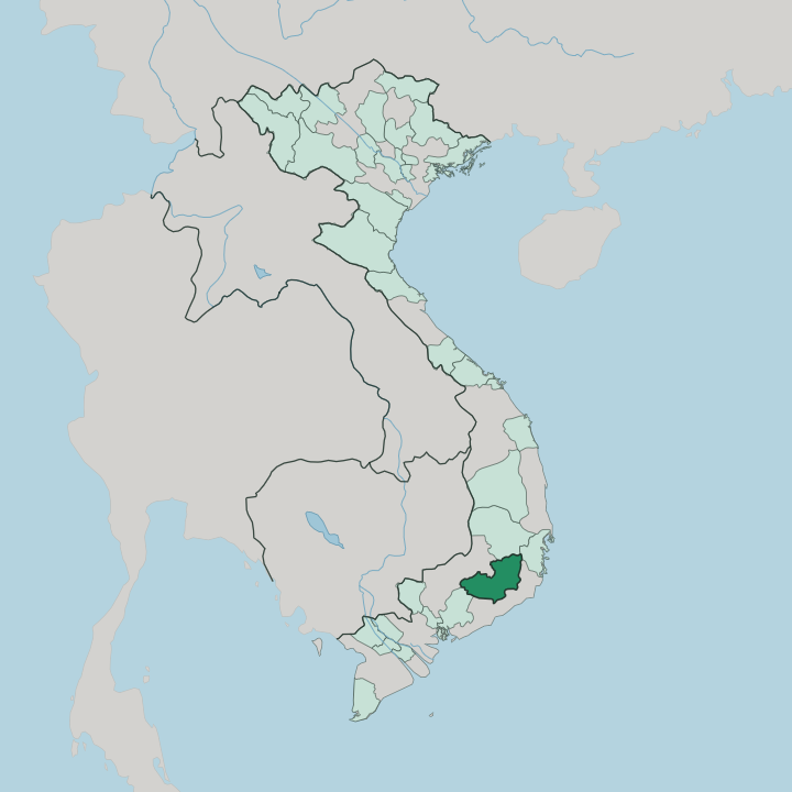


Towns & cities in Lam Dong
Pick a town or city — each links to where to stay.
 Vietnam
Ðà Lạt
Cool air off the Langbiang Plateau settles over Ðà Lạt, the largest city of Vietnam's Central Highlands, a highland town of hillside churches.Where to stay →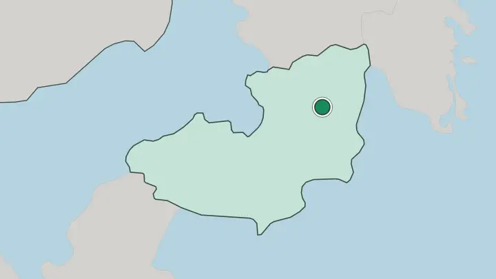
About Lam Dong
Đà Lạt is the draw.
What is Lam Dong known for?
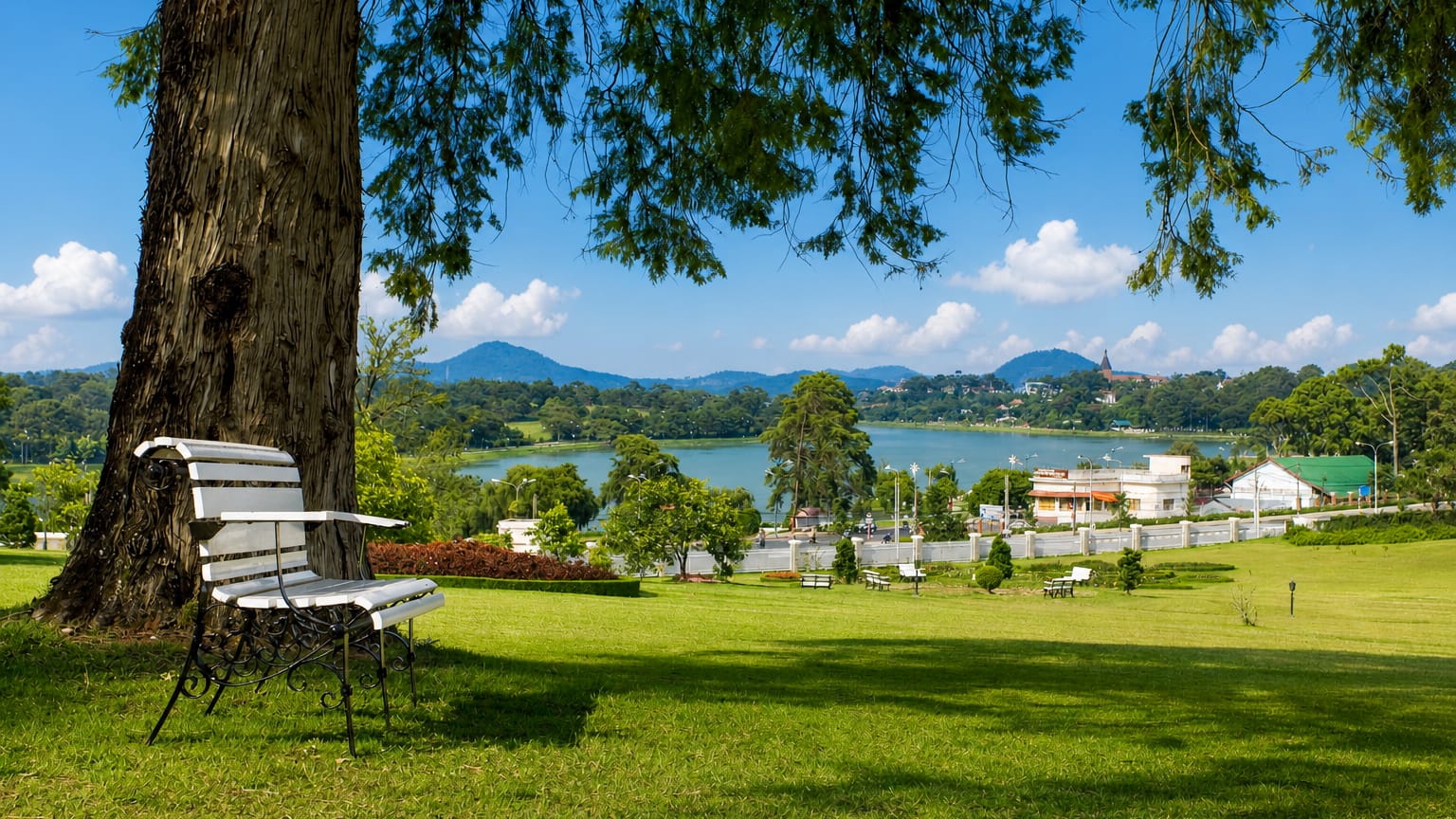
The city stands high on the Langbiang Plateau, cool and mist-wrapped where the rest of Vietnam swelters, and its French-era villas, pine woods and flower gardens have pulled in holidaymakers since colonial days. Coffee and tea blanket the surrounding highlands. The tea town of Bảo Lộc anchors the lower slopes, waterfalls drop off the plateau rim, and Xuân Hương Lake curves through the centre of Đà Lạt itself.
Where is Lam Dong?
Lâm Đồng spreads across the southern end of Vietnam's Central Highlands and reaches beyond it to the sea. The Vietnamese call this upland region Tây Nguyên. The highland core is high country, three plateaus stacking across it, the Lâm Viên, or Langbiang, in the north around Đà Lạt, then Di Linh, then the Bảo Lộc plateau stepping down toward the south.
Bidoup rises highest of all. The roof of the Lâm Viên plateau, it stands above the twin peaks of Langbiang Mountain just north of Đà Lạt, and the plateaus hold a kilometre or more above the lowlands. Pine forest covers the ridges.
The air stays cool where the rest of the south stays hot. The land tilts away from the highlands. Rivers gather here before they leave: the Đa Nhim and its neighbours feed the upper Đồng Nai River, which drains southwest toward Ho Chi Minh City some 300 km away by National Route 20.
Eastward the plateau breaks in a steep wall down to the coastal plain around Nha Trang, a drop of more than a kilometre over a few dozen kilometres of road. To the southeast the province runs down to its own South China Sea coast, the fishing town of Phan Thiết and the red-and-white dunes of Mũi Né. Northwest it reaches the border with Cambodia.
Waterfalls mark the highland edge, Datanla and Prenn near Đà Lạt, the broad terraces of Pongour further south. Lakes fill the hollows between the ridges.
What is Lam Dong like?
Đà Lạt built its whole character on being unlike the rest of the country. The French laid it out as a retreat, and the villas, the old railway station and the tree-lined lanes still give the city a European air. It became Vietnam's honeymoon town, a place of flower gardens, quiet pine walks and lakeside cafés looking over the water.
Roses, hydrangeas and golden everlastings grow here by the open field. Markets pile up the strawberries, artichokes and temperate vegetables that will not grow in the lowland heat, and coffee roasted in the surrounding hills fills the cafés along Xuân Hương Lake. An older world predates the hill station by centuries.
The K'Ho, Mạ and Churu peoples farmed these plateaus long before the French arrived, and their villages still ring Langbiang Mountain, whose name comes from a K'Ho legend of two doomed lovers. Gong music belongs to the wider Central Highlands, part of a bronze tradition UNESCO honoured across Tây Nguyên. Vietnamese is the common language.
Yet the weaving, the stilt houses and the plateau festivals of these peoples remain part of what sets Lâm Đồng apart.
What is the history of Lam Dong?
The plateaus were K'Ho and Mạ country long before any map named them. That changed in 1893. The bacteriologist Alexandre Yersin climbed onto the Langbiang Plateau and urged the French to build a hill station up in the cool air, and Đà Lạt grew from that idea.
Vietnam's last emperor, Bảo Đại, made the new resort his summer capital. The province of Lâm Đồng was drawn later around it.
What is the climate of Lam Dong?
Height, not season, sets the weather here. Because the plateaus stand a kilometre or more up, Đà Lạt and Bảo Lộc stay mild the year round while the lowlands swelter, which is how Đà Lạt earned its old name, the City of Eternal Spring. The year splits into a dry stretch from about November to April and a wet one when the southwest monsoon soaks the highlands from May into October.
Morning mist settles in the valleys and burns off by noon. Nights can turn genuinely cold on the higher ground.
How do you get to Lam Dong?
Liên Khương Airport is the way in for most travellers. It sits by Đức Trọng, some 30 km south of Đà Lạt, taking flights from Hanoi, Ho Chi Minh City and Đà Nẵng before the road climbs the Prenn Pass onto the plateau. Two roads climb up from below.
By road from Ho Chi Minh City it is roughly 300 km up National Route 20, while from the coast at Nha Trang the haul is shorter but steeper over the mountain passes. The old French cog railway to the lowlands closed long ago; only a short heritage line still runs out of Đà Lạt.
Common questions
What is the best area to stay in Lam Dong?
Đà Lạt: cool-climate flower gardens and colonial villas.
Good for
Updated July 2026