Vietnam
Ninh Binh, Vietnam — Towns & Travel Guide


Ninh Binh is a province in the southern Red River Delta of Vietnam, where karst towers and cave rivers ring the old capital of Hoa Lư.
About Ninh Binh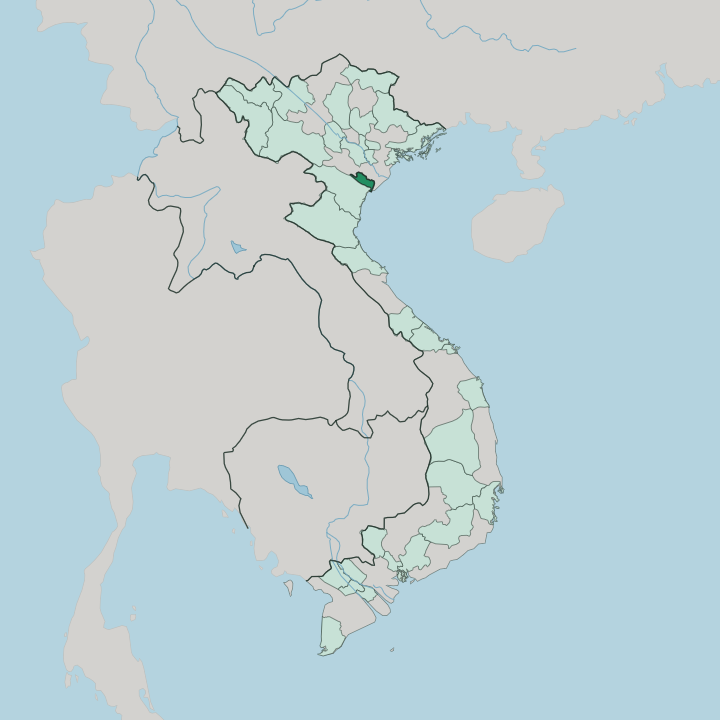


Towns & cities in Ninh Binh
Pick a town or city — each links to where to stay.
Most travellers split their nights between Tam Cốc and Tràng An. Tam Cốc is the livelier base, its lanes packed with guesthouses, sampan piers and small bars strung along the Ngô Đồng where the day-boats set off. Tràng An is quieter.
Homestays sit tucked among its UNESCO caves and paddies, a short ride from the boat station. Ninh Binh city is the plain, practical fallback beside the Đáy River, near the train and bus links. Cúc Phương National Park makes a greener base an hour west.
Pick Tam Cốc first, Tràng An for calm.
About Ninh Binh
Limestone is the whole draw.
What is Ninh Binh known for?
Ninh Binh rises from the flat Red River Delta as a maze of karst towers, and small boats thread the flooded valleys between them. The Tràng An complex is the headline here, a UNESCO World Heritage Site of caves and sheer cliffs wrapped around the tenth-century capital of Hoa Lư. Rowers punt visitors down the Ngô Đồng at Tam Cốc, gliding past rice paddies walled in by rock.
Climbers take the stone stair at Hang Múa for the view. The vast Bái Đính temple complex sprawls along the karst's western edge.
Where is Ninh Binh?
Ninh Binh sits in the southern Red River Delta, about ninety kilometres south of Hanoi. The land splits in two. Northward and east spread the flat, wet delta plains, laced with paddy fields and irrigation channels, while to the west and south the ground buckles upward into a belt of limestone karst towers, blind valleys and caves.
The Đáy River threads the eastern lowlands on its way to the sea, and the Hoàng Long winds through the hills past Hoa Lư. Smaller channels like the Ngô Đồng cut clean through the rock at Tam Cốc, so boats go where roads cannot. West of the towers, the forests of Cúc Phương National Park climb toward the Thanh Hóa border.
Ninh Binh reaches the sea as well. Its far corner at Kim Sơn opens onto the Gulf of Tonkin, a young, flat coast of reclaimed mudflats utterly unlike the crags inland. In between rise the Tràng An hills, the karst heart where cliffs, cave rivers and rice terraces lock together.
Nearly all the celebrated scenery crowds into that band, minutes from Ninh Binh city.
What is Ninh Binh like?
Ninh Binh wears its history openly. The court that ruled early Vietnam from Hoa Lư left temples to the Đinh and Lê kings among the karst, and each spring the Hoa Lư festival fills the old citadel grounds with processions. Buddhism marks the landscape most visibly.
The Bái Đính complex, one of the largest temple grounds in the country, lines a long corridor of arhat statues along the hillside, while the older Bích Động pagoda is built into a cliff face above Tam Cốc. Kim Sơn holds something rarer. Phát Diệm Cathedral, raised in stone and ironwood in 1891, carries a Roman Catholic church under the sweeping tiled roofs of a Vietnamese pagoda.
Away from the monuments, this is farming country, and daily life still turns on the rice cycle in the valleys. The local table is distinctive. Mountain goat, thịt dê, is the signature dish, the animals grazed on the scrubby limestone hills, and it comes alongside cơm cháy, rice crisped hard in the pan.
Vietnamese is the everyday language, as across the country. Village crafts persist too, from stone carving to embroidery, and the working paddies that fill every flat scrap of the karst are as much a part of the culture as the temples above them.
What is the history of Ninh Binh?
Vietnam's first independent capital stood here. In 968 the warlord Đinh Bộ Lĩnh defeated a dozen rival lords, declared himself emperor, and founded the state of Đại Cồ Việt with its seat at Hoa Lư. The karst walls made the citadel easy to defend.
Hoa Lư served the Đinh and early Lê courts until 1010, when the Lý dynasty shifted the capital north to Thăng Long, the future Hanoi. The name Ninh Binh dates to a nineteenth-century province. Its borders have merged and split more than once, and a 2025 reform enlarged the province again by folding in neighbouring Hà Nam and Nam Định.
What is the climate of Ninh Binh?
Ninh Binh has a humid subtropical climate ruled by the monsoon. Two seasons divide the year. From roughly May to October the summer monsoon brings heat, heavy humidity and the bulk of the rain, which peaks in the late-summer storms that can briefly flood the low paddies.
Winter, from November into April, turns cool and much drier, with grey, misty mornings settling over the karst around Hoa Lư. Spring and autumn are the clear, mild windows most walkers and boat-goers prefer.
How do you get to Ninh Binh?
Ninh Binh province has no airport of its own. Hanoi is the nearest hub. Almost everyone comes through it, then covers the last stretch south by road or rail.
Trains on the main North-South line stop at Ninh Binh station, a run of a couple of hours from the capital, and frequent minibuses and vans make the same trip along the expressway. Once in the province, the scattered sites reward a rented bicycle or scooter, since Tràng An, Tam Cốc and Bái Đính each sit a short ride out from Ninh Binh city.
Good for
Updated July 2026