Vietnam
Can Tho City, Vietnam — Towns & Travel Guide


Cần Thơ is the largest city of the Mekong Delta, a river port on the Hậu where floating markets crowd the canals of southern Vietnam.
About Can Tho City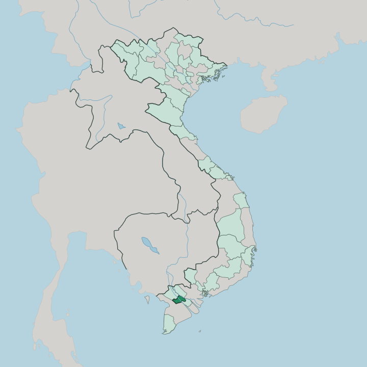


Towns & cities in Can Tho City
Pick a town or city — each links to where to stay.
Ninh Kiều is the natural base. The riverfront ward keeps the wharf, the night market and the dawn boats to Cái Răng all within a short walk of the hotels. Cái Khê runs north to the Cần Thơ Bridge, lined with the larger riverside hotels above the Hậu River.
Phong Điền trades quays for fruit gardens. Stay in Ninh Kiều first; slip out to the orchards when you want the quieter delta.
About Can Tho City
What is Can Tho City known for?
Cần Thơ is the unofficial capital of the Mekong Delta, the river city Vietnamese speakers call Tây Đô, the Western Capital. Its signature is water. Wholesale boats piled with pineapples and pomelos gather before dawn at the Cái Răng floating market, the largest of the delta's river bazaars, while the Ninh Kiều waterfront draws the evening crowd along the Hậu River.
Fruit orchards and a web of canals ring the built-up core. Rivers still do the work here.
Where is Can Tho City?
Cần Thơ sits in the heart of the Mekong Delta, the flat, water-laced plain where the Mekong River breaks into branches and empties toward the sea in southern Vietnam. The Hậu River, the Bassac arm of the Mekong, runs the length of the city and gives it its port. Smaller channels thread off it.
The Cần Thơ River, a distributary of the Hậu, carries the traffic to the Cái Răng floating market, while canals such as the Ô Môn and Thốt Nốt lace the orchards and rice fields inland. Little of the land rises far above the water. The city lies south-west of Ho Chi Minh City, a road journey of about 170 kilometres down National Highway 1A. An Giang wraps its western and northern side, Đồng Tháp its north-east, and Vĩnh Long its east across the Hậu River.
A larger Cần Thơ took shape in 2025. That year the neighbouring provinces of Hậu Giang and Sóc Trăng were folded into the city, so its territory now runs all the way from the orchard districts south-east to a stretch of the South China Sea coast. Cà Mau lies beyond its south-western edge.
The reach to salt water is new to a place long defined only by rivers.
What is Can Tho City like?
Life in Cần Thơ turns on the water and the garden. Trade still floats. Before the roads and bridges came, the delta moved its rice and fruit by boat, and that habit survives at the Cái Răng floating market, where wholesalers hang a sample of their produce from a tall pole so buyers can read the offer from across the current.
The market was listed as national intangible heritage in 2016. Orchard hamlets around Phong Điền keep the miệt vườn tradition of garden-fruit country, opening their pomelo and rambutan groves to homestays. The delta also carries its own soundtrack. Đờn ca tài tử, the amateur chamber music of southern Vietnam, drifts from courtyards and tour boats along the Hậu River.
Culture here is layered. The Khmer built the first temples on this land, and their painted pagodas still stand through the former Sóc Trăng country now inside the city, alongside the shrines of Hoa Chinese merchants and the tile-roofed Bình Thủy ancient house from the French decades. Vietnamese is the everyday language, with Khmer spoken in the delta's older villages.
Food follows the season.
What is the history of Can Tho City?
This was Khmer country first. Vietnamese settlement pushed south in the eighteenth century, and the Nguyễn lords marked a garrison called Trấn Giang here in 1739, at the meeting of the Cần Thơ River and the Hậu. France made it the seat of a province in 1876 and named it for the river, and Cần Thơ grew into the administrative capital of the south-west, the Tây Đô or Western Capital.
In 2004 it split from the surrounding province to become a city governed straight from Hanoi. The 2025 merger reunited much of that old province under the city's name.
What is the climate of Can Tho City?
Cần Thơ keeps a hot, humid tropical climate with two seasons and no real winter. Rain rules half the year. Wet monsoon downpours run from about May to November, when the Mekong swells and water backs up into the delta's canals and low streets.
The drier months from December to April bring the coolest, clearest weather, the pick of the year for boat trips. April is the hard, sticky peak of the heat before the rains return.
How do you get to Can Tho City?
Most travellers reach Cần Thơ overland from Ho Chi Minh City. The drive runs about 170 kilometres south-west down National Highway 1A, then lifts across the Hậu River on the Cần Thơ Bridge, a long cable-stayed span opened in 2010. Cần Thơ International Airport sits north-west of the centre and handles domestic flights from Hanoi, Đà Nẵng, Phú Quốc and the Côn Đảo islands.
Buses run all day. From the wharf, boats take over, carrying visitors out to the floating markets and the orchard canals the roads never reach.
Good for
Updated July 2026