Ethiopia
South Ethiopia Regional State, Ethiopia — Towns & Travel Guide


South Ethiopia Regional State is Ethiopia's newest region, carved from the old south in 2023, Rift Valley lakes, the Omo Valley and Konso terraces.
About South Ethiopia Regional State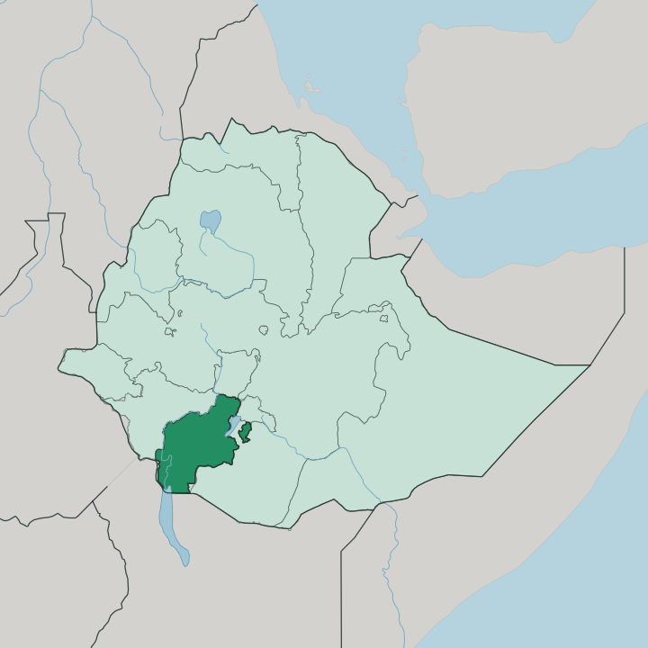
Towns & cities in South Ethiopia Regional State
Pick a town or city — each links to where to stay.
Arba Minch is the natural first base. Its ridge-top hotels look straight down onto Lake Abaya and Lake Chamo, and the town is where boat trips and Nechisar National Park drives begin. Wolaita Sodo, the regional capital, works better as a cool highland waypoint on the long road down from Addis Ababa than as a destination in itself.
Jinka lies deeper south. That small town anchors the lower Omo Valley and its weekly tribal markets. Choose Arba Minch for the lakes and an easy start; base yourself in Jinka only when the Omo peoples are the whole point of the trip.
About South Ethiopia Regional State
This is deep-south Ethiopia.
What is South Ethiopia Regional State known for?
The region split from the Southern Nations, Nationalities, and Peoples' Region in 2023, gathering a dozen zones of Wolayita, Gamo, Gofa, Gedeo, Konso and South Omo peoples under one roof. Two draws pull travellers here above all. Arba Minch sits between the reddish Lake Abaya and crocodile-thick Lake Chamo, at the mouth of the Great Rift Valley.
Further south, the lower Omo Valley holds some of Africa's most distinct pastoral cultures, and the dry-stone terraces of Konso are a UNESCO World Heritage Site.
Where is South Ethiopia Regional State?
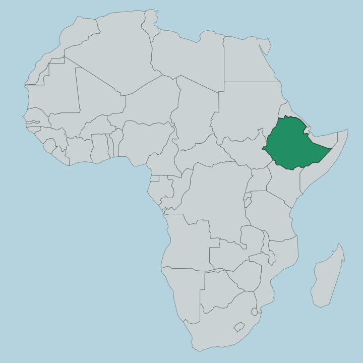
The region fills the deep south of Ethiopia, running from cool highland plateaus down into the hot floor of the Great Rift Valley. It reaches the Kenyan border. In the north and east it meets the Oromia Region and the Sidama Region; westward lies the South West Ethiopia Peoples' Region; and to the south the land drops away toward Lake Turkana and Kenya.
The terrain is the story here, layered by altitude. High ground around Wolaita Sodo, the capital, sits well above 1,600 metres, green and farmed and cut by ridges. Below it the Rift opens out.
Arba Minch stands at the valley's edge, wedged between two large lakes, reddish Lake Abaya to the north and Lake Chamo to the south, with the Nechisar plains and the Bridge of God isthmus dividing them inside Nechisar National Park. Keep going and the highlands fall toward the Omo River, the largest Ethiopian river outside the Nile basin, which drains this whole southwest before emptying into Lake Turkana on the Kenyan line. Between those poles the region packs terraced hills, acacia lowlands, rift lakes and rivers into a few hours' drive.
What is South Ethiopia Regional State like?
No single people defines this region. It was assembled from more than a dozen ethnic zones, Wolayita, Gamo, Gofa, Gedeo, Konso, the Ari and the peoples of South Omo, each with its own language, calendar and market day. That patchwork is the whole point of the place.
Around Wolaita Sodo the Wolayita speak an Omotic tongue and work some of the most intensive smallholder farms in the country, terracing enset, the false-banana staple pounded into bread across the southern highlands. East of them the Gedeo tend layered forest-gardens of coffee, enset and shade trees so distinctive that their landscape now carries its own UNESCO listing. South and west the cultures shift fast.
The Konso build fortified hilltop villages ringed by dry-stone walls and raise carved wooden waga figures over the graves of the notable dead, a living tradition running back roughly twenty-one generations. Further down the lower Omo Valley are the Mursi, Hamer and Karo, herders long known for body paint, ritual scarification and the clay lip-plates worn by their women. Weekly markets are where all of this surfaces for a traveller.
Come on the right day and a highland town square fills with colour, livestock and hard bargaining over grain and cattle.
What is the history of South Ethiopia Regional State?
As a region it is barely older than the road signs. It was created on 19 August 2023, when a dozen zones and special districts voted in a February referendum to split off from the sprawling Southern Nations, Nationalities, and Peoples' Region and govern themselves from Wolaita Sodo. The land is old.
The lower Omo Valley yielded some of the earliest known fossils of anatomically modern humans, and the walled terraces of Konso have been farmed continuously for centuries. A young state, laid over deep human ground.
What is the climate of South Ethiopia Regional State?
Altitude sets the weather here, not the calendar. The highlands around Wolaita Sodo stay temperate and green year-round, mild by day and cool at night, while the Rift floor at Arba Minch and the lower Omo lowlands run hot and dry. Rain comes in two pulses, a long wet stretch through the middle of the year and shorter spring showers, leaving the dry months from about October to March as the settled time to travel.
The heat is real below. Climb a thousand metres to the plateau and you reach for a jacket after dark.
How do you get to South Ethiopia Regional State?
Most journeys begin in Addis Ababa. Ethiopian Airlines runs domestic hops down to Arba Minch and, further south, to Jinka, which cuts a long drive into a short flight for anyone heading for the lakes or the Omo Valley. Overland, a paved highway climbs and drops through Wolaita Sodo before reaching Arba Minch, a full day's road from the capital.
Past the lakes the sealed road gives out. Reaching the lower Omo peoples means rougher tracks, a hired vehicle and time.
Good for
Updated July 2026