Ethiopia
Oromiya Region, Ethiopia — Towns & Travel Guide


Oromiya is Ethiopia's largest region, wrapping around Addis Ababa and stretching from Bale's high peaks to the Rift Valley lakes.
About Oromiya Region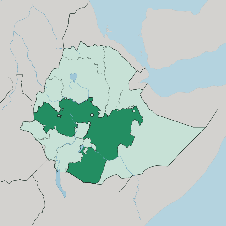
Towns & cities in Oromiya Region
Pick a town or city — each links to where to stay.
Start in Addis Ababa. Most travellers base themselves in the capital and strike out from there, since it sits as an enclave ringed on every side by Oromiya. Adama, an hour or so down the Rift Valley on the Addis-Djibouti railway, makes a warm-weather base for the northern lakes.
For the highlands, the town of Robe near Bale Mountains National Park is the staging point for treks up onto the Sanetti Plateau. Choose the capital for a first trip; choose Adama or Robe when the lakes and the mountains are the point.
About Oromiya Region
Two things define Oromiya above all.
What is Oromiya Region known for?
It is the homeland of the Oromo, Ethiopia's largest people, and it holds the highland forests where the coffee arabica plant first grew wild. The region sprawls across the centre and west of the country, wrapping fully around the capital at Addis Ababa. The Great Rift Valley slices through it, dropping from cool highland plateaus to a chain of lakes and on to warm savanna in the south.
Jimma anchors the coffee west; Bale rises in the south-east.
Where is Oromiya Region?
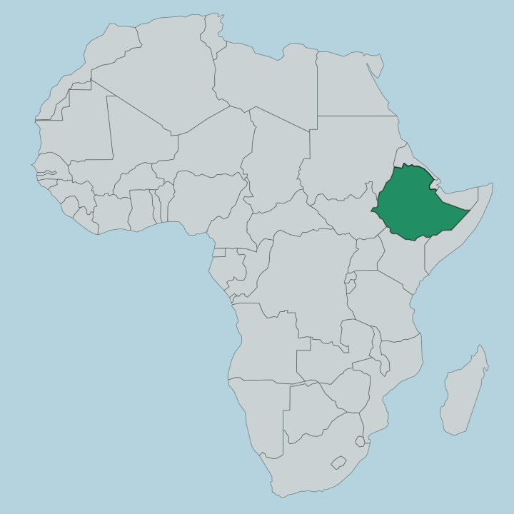
Oromiya fills the centre and west of Ethiopia, the largest of the country's regions by both land and people. It is huge. The region wraps entirely around Addis Ababa, so the capital sits as a landlocked enclave with Oromiya on every side.
The Great Rift Valley is the defining line of the land, tearing a diagonal trench across the region from the north-east down toward the south. That trench separates two very different highland blocks and studs the valley floor with lakes. The south-eastern corner rises into the Bale Mountains, a broad Afro-alpine massif crowned by Tulu Dimtu, which reaches 4,377 metres and stands as the second-highest peak in Ethiopia.
Above the treeline spreads the Sanetti Plateau, a bleak expanse of giant lobelia and moorland that shelters the endangered Ethiopian wolf. Down on the valley floor lie the Rift lakes, among them Lake Langano, whose reddish water is the one lake in the chain where swimming is safe. West of the capital the land climbs again into the wet coffee highlands around Jimma.
Borders touch nearly every neighbour Ethiopia has.
What is Oromiya Region like?
This is Oromo country. The culture of the Oromo people runs through everything, starting with the common tongue, Afaan Oromo, a Cushitic language written since 1991 in a Latin alphabet called Qubee. What sets the Oromo apart most is the Gadaa, an age-grade system of self-government that hands authority to a fresh class of leaders every eight years, with checks and rotations that reach back centuries.
Its assemblies once settled disputes, set law, and managed grazing land across the whole society. In 2016 the wider world took notice, and the Gadaa system was inscribed on the UNESCO list of intangible cultural heritage. Faith and season meet at Irreecha, the Oromo thanksgiving that marks the end of the long rains.
Crowds carry green grass and flowers to the water's edge to give thanks. Coffee belongs to daily life as much as to the economy, and the drawn-out coffee ceremony, roasting and pouring in three rounds, is the region's most ordinary act of hospitality. Music, oral poetry, and the horseback processions of festival days round out a culture that is proudly its own.
What is the history of Oromiya Region?
The Oromo governed themselves for centuries through the Gadaa, their rotating age-grade democracy, long before any central Ethiopian state reached this far south and west. Independence ended late. In the last quarter of the nineteenth century Emperor Menelik II pushed his conquests outward and folded the Oromo lands into the empire.
Oromiya as a single named region is far younger, taking its modern shape in 1992, when Ethiopia redrew itself along ethnic lines after the fall of the Derg and gathered the Oromo-majority provinces into one state around the capital.
What is the climate of Oromiya Region?
Across Oromia, elevation dictates the climate. The high plateaus around the capital and the Bale Mountains stay cool the year round, and nights on the Sanetti Plateau drop toward freezing. Down in the Rift Valley and the southern lowlands it turns hot and dry.
Rain arrives in one long wet season from roughly June to September, the kiremt rains that fill the coffee forests around Jimma and feed the Rift lakes. That single rainy stretch is what Irreecha gives thanks for when it ends.
How do you get to Oromiya Region?
Nearly everyone arrives by air at Addis Ababa, where Bole International Airport is the main point of entry to Ethiopia and the hub of its national carrier. Because the capital sits inside Oromiya, you are already at the region's doorstep the moment you land. From there the ground network fans out.
The Addis-Djibouti railway and the main highway run east through Adama, while roads climb west to Jimma and south into the Rift Valley toward the Bale Mountains. Bale itself is a long drive, so travellers reaching Tulu Dimtu and the Sanetti Plateau usually plan a multi-day loop.
Good for
Updated July 2026