Ethiopia
South West Ethiopia Peoples' Region, Ethiopia — Towns & Travel Guide


The forested southwest corner of Ethiopia, cradle of wild Arabica coffee, split from the old south in 2021.
About South West Ethiopia Peoples' Region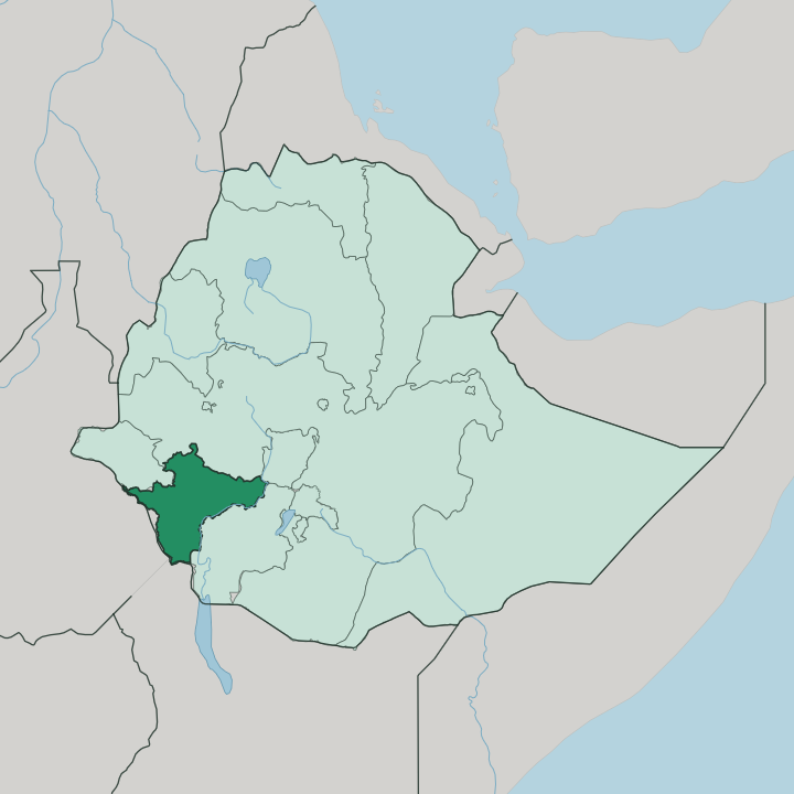
Towns & cities in South West Ethiopia Peoples' Region
Pick a town or city — each links to where to stay.
Bonga is the natural base. It is the capital of the region and the door to the wild-coffee forests of the Kafa Biosphere Reserve, and it holds the best of the region's thin supply of beds. Mizan Aman, the largest town of the Bench Sheko zone, sits farther west and works as the road junction toward the Omo lowlands.
Tepi lies lower still in the Sheka zone, a coffee and spice town at the forest edge. Push west only for a reason. Stay in Bonga for the highlands; go on to Mizan Aman or Tepi when your route runs toward the river.
About South West Ethiopia Peoples' Region
Coffee began here.
What is South West Ethiopia Peoples' Region known for?
The Kafficho people of the Keffa highlands gave the crop and the region their name, and wild Coffea arabica still grows untended under the montane forest canopy. The Kafa Biosphere Reserve protects those cloud forests, home to thousands of wild coffee varieties found almost nowhere else on Earth. Bonga sits at the heart of it, once the seat of the Kingdom of Kaffa.
Farther west the land drops toward the Omo River, where the Suri and other peoples keep older ways of living.
Where is South West Ethiopia Peoples' Region?
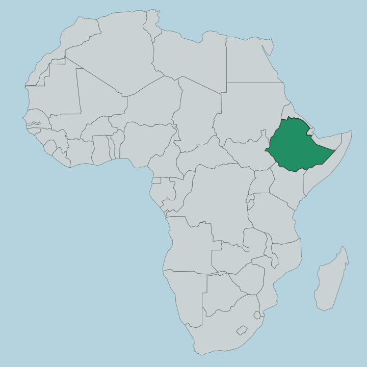
The region fills the far south-western corner of Ethiopia, wedged between the Oromia highlands to the north and the Gambela lowlands to the west. It is a land of two halves. In the east and north rise the wet, forested highlands of Keffa and Sheka, ridges climbing well above the coffee line and often lost in cloud.
Bonga stands there, on a hill in the upper reaches of the Keffa country. To the west and south the ground falls away toward the Omo River, and the climate turns hot and the forest gives way to bush and grassland. The Gojeb River drains the northern edge, running west to join the Gibe, and the two together become the Omo that marks much of the region's western boundary.
Six administrative zones make up the whole. Keffa around Bonga and Sheka around Tepi hold the coffee highlands; Bench Sheko centres on Mizan Aman; Dawro, Konta and West Omo reach south and west toward the river. Addis Ababa, the national capital, lies far to the north-east, roughly a full day's drive from Bonga over the highlands. The distances are real.
Poor roads and steep terrain keep the western zones remote, and the Omo lowlands feel a world away from the cool forests of Keffa.
What is South West Ethiopia Peoples' Region like?
This is one of the most varied human landscapes in Ethiopia, and that variety is the point. The Kafficho of Keffa are the largest people, farmers of the forest highlands whose language and heritage carry the memory of the Kingdom of Kaffa. Coffee is woven through their daily life.
The ceremony of roasting, grinding and brewing the beans over charcoal is a rite of hospitality, not a quick drink. Around them live the Bench, the Sheko, the Dawro of the southern hills and, far to the west, the Suri and their neighbours of the Omo lowlands. The contrasts are sharp.
A highland Kafficho coffee farmer and a Suri herder of the western bush share a region but little else in language or way of life. Amharic serves as the working language that ties the zones together, though each people keeps its own tongue at home. Markets are where the difference shows.
On a Bonga market day traders come in from the forest woredas with honey, spices and sacks of green coffee, and the talk runs in a mix of languages. The Suri of the west are known beyond Ethiopia for their body painting, lip plates and ceremonial stick-fighting, traditions that draw photographers to the Omo. Faith runs Orthodox Christian in the highlands and older and more local toward the river.
It is a region that rewards slowness.
What is the history of South West Ethiopia Peoples' Region?
The Kingdom of Kaffa ruled these highlands for five centuries from its capital at Bonga, a forested state guarded by deep ditches and the Gojeb River along its northern frontier. It fell in 1897, when the armies of Menelik II conquered Kaffa and carried its last king into exile. The territory was absorbed into the Ethiopian empire and, much later, folded into the sprawling Southern Nations region.
That arrangement did not hold. After a referendum, the six southwestern zones broke away to form their own regional state in 2021.
What is the climate of South West Ethiopia Peoples' Region?
Rain rules here. The forested highlands of Keffa and Sheka are among the wettest country in Ethiopia, soaked by a long rainy season that keeps the cloud forest alive and the coffee growing wild. Mornings often open in mist that burns off by midday, and the highland air stays mild the year round despite the tropical setting.
Down toward the Omo River the pattern flips to hot lowland heat with a shorter, sharper wet season. The heavy rains generally run from spring through early autumn, and the drier months around the turn of the year make the easier time to travel the forest tracks.
How do you get to South West Ethiopia Peoples' Region?
Most travellers come overland from Addis Ababa. The drive south-west to Bonga crosses the highlands and takes the better part of a long day on winding mountain roads. Mizan Teferi has a small airport with occasional domestic flights, which shortens the journey to the western zones considerably.
Beyond the main towns the going gets slow. Reaching the Omo lowlands and the Suri country in the west means rough tracks, a sturdy vehicle and time, and the rains can cut them off for weeks.
Updated July 2026