Ethiopia
Central Ethiopia Regional State, Ethiopia — Towns & Travel Guide


Central Ethiopia Regional State is a highland region southwest of Addis Ababa, home to the Gurage and Hadiya peoples.
About Central Ethiopia Regional State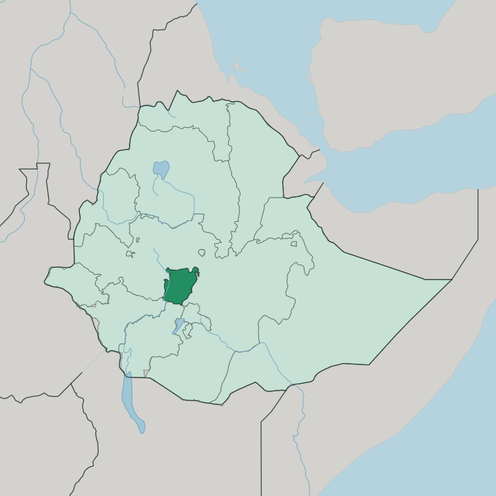
Towns & cities in Central Ethiopia Regional State
Pick a town or city — each links to where to stay.
Most visitors base in Hosaena. The town is the regional seat, perched above Lake Boyo, and it holds the widest spread of beds anywhere in the highland. Welkite, the parliament town to the west, opens the Gurage highlands along the old road through Endibir.
Butajira suits a stop on the eastern side, a market town between Addis Ababa and the Rift Valley lakes. Choose Durame for the Kambaata terraces. Beds there are few and plain.
About Central Ethiopia Regional State
This is enset country.
What is Central Ethiopia Regional State known for?
Across the Gurage highlands and the hills around Hosaena, families raise the false-banana plant that feeds the region, and the crop shapes the villages down to the pattern of their footpaths. The Gurage mountain chain divides the land east to west, rising toward 3,600 metres. Lake Boyo spreads its shallow wetland below Hosaena, drawing common cranes and hippopotamus to the reeds.
Terraced fields, market towns like Butajira and Durame, and a dense weave of Cushitic and Semitic peoples give the region its character.
Where is Central Ethiopia Regional State?
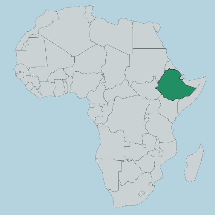
Central Ethiopia Regional State lies in the highlands southwest of Addis Ababa, on the western shoulder of the Great Rift Valley. It is a small region by Ethiopian measure, covering roughly 15,000 square kilometres of hills, plateaus and terraced farmland. The Gurage mountain chain runs through the north, dividing the land east to west and rising toward 3,600 metres at its ridgeline.
The Awash River drains the northern edge of Gurage country, while the Gibe River, a tributary of the Omo River, marks the southwestern boundary of the highlands. Rivers here run seasonal and steep. Between the ranges the ground opens into fertile valleys, thick with the enset gardens that feed the region.
Hosaena stands in the central south, high on its plateau, with Lake Boyo spread in the shallow basin below. Butajira sits to the east, on the road that drops toward the Rift Valley lakes. Durame and the Kambaata hills lie further south.
The region borders the Oromia Region on most sides and the South Ethiopia Regional State along its lower edge, and it holds no coast and no desert, only the green, folded highland that has drawn its farmers for centuries.
What is Central Ethiopia Regional State like?
The region is a mosaic of peoples rather than one nation. The Gurage and Hadiya together make up most of it, and around them live the Siltʼe, the Kambaata, the Halaba and the Yem, each with its own tongue and its own hills. Their languages split across two families.
Gurage and Siltʼe speak Semitic tongues cousin to Amharic, while Hadiya and Kambaata speak Cushitic ones, and Amharic serves as the shared official language between them. Enset ties them all together. The false-banana plant is scraped, fermented and buried for months to make kocho, the flatbread at the centre of the highland diet, and its cultivation carries rituals and knowledge handed down for generations.
Among the Gurage the crop even shaped the land itself. Their villages string along the jefoure, straight grassy avenues that run between the homesteads and give the highland its distinctive open plan, a settlement pattern held for more than 400 years. Markets pull the whole weave together.
On market day the towns fill with weavers, traders and farmers who have carried their kocho and coffee down from the terraces. Faith runs deep and mixed here, with Muslim, Orthodox Christian and Protestant communities sharing the same market squares.
What is the history of Central Ethiopia Regional State?
The region is new, but its peoples are old. Central Ethiopia Regional State was proclaimed on 19 August 2023, carved from the northern zones of the former Southern Nations, Nationalities, and Peoples' Region as that vast region broke apart. The land itself carries far older names.
The Hadiya trace their identity to the medieval Hadiya Sultanate, a Muslim principality that once reached across much of this highland before the wars and migrations of later centuries scattered it. Roads came slowly. In 1963 the Gurage Road Association built the first all-weather link from Hosaena to Addis Ababa through Welkite and Endibir, opening the highland to the capital.
What is the climate of Central Ethiopia Regional State?
In Central Ethiopia, height decides the climate. Sitting high on the western highlands, above 2,000 metres for most of its towns, the region stays mild and green through the year rather than hot, and Hosaena is cool even when the Rift Valley below bakes. Rain arrives in two seasons, the long rains of summer and a shorter spell earlier in the year, and it is those rains that keep the enset terraces lush.
Mornings run cold on the Gurage ridges. The lower ground toward the Bilate valley turns warmer and drier than the peaks.
How do you get to Central Ethiopia Regional State?
Nearly everyone arrives overland from Addis Ababa. The capital lies a few hours northeast, and the paved road runs southwest through Welkite and Endibir into the Gurage highlands, or by a second route east through Butajira toward Hosaena. There is no major airport within the region, so international travellers land at Addis Ababa and drive down.
Buses and shared minibuses connect the market towns of the highland. From Hosaena the roads fan out to Durame, Halaba Kulito and the smaller zone capitals.
Good for
Updated July 2026