Ethiopia
Gambela Region, Ethiopia — Towns & Travel Guide


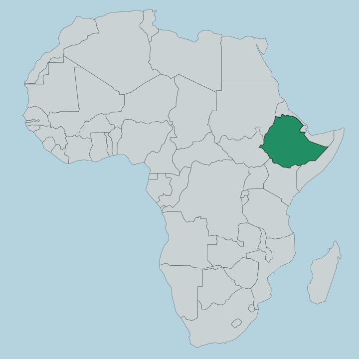
Gambela is Ethiopia's western lowland, a hot floodplain of Nilotic villages and open savanna where the Baro River runs toward South Sudan.
About Gambela Region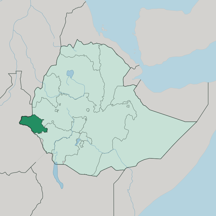
Towns & cities in Gambela Region
Pick a town or city — each links to where to stay.
Base yourself in Gambela city. The regional capital sits on the Baro River and holds the airport, the hotels and the road links out to the rest of the plains. It is the practical hub for a trip built around Gambela National Park and the river.
Beyond the town, beds thin out fast across the Nuer and Anywaa country. Abobo and Itang are the main settlements south and west of the capital, small centres out toward the park and the Gilo. Choose the capital first; venture out to Abobo, Itang or the park's edge only with your own transport and time.
About Gambela Region
What is Gambela Region known for?
Gambela is Ethiopia's far western frontier, a Nilotic lowland unlike the country's highland heart. The white-eared kob migration defines it. Every dry season, from January into April, more than a million antelope pour across the border from South Sudan into Gambela National Park, one of the largest overland mammal movements left on Earth.
Elephant and the rare Nubian giraffe range the same floodplains. The Baro River threads it all, flowing west out of the highlands toward South Sudan and the Nile system beyond.
Where is Gambela Region?
Gambela is the hot lowland floor of western Ethiopia, a broad plain sloping down from the highlands toward the border with South Sudan. Most of the region lies low, between roughly 400 and 550 metres, though the eastern edge climbs back toward two thousand metres where the highland wall begins. Rivers define almost everything here.
The Baro crosses the north, the Gilo drains the southeast, and the Akobo traces part of the southwestern boundary with South Sudan. All of them run west, gathering toward the Pibor and the wider Nile system that lies beyond the frontier. The Baro is the giant among them.
It is the only navigable river in Ethiopia, and the regional capital, Gambela, grew up on its banks where a tributary joins the main channel. Away from the water the land opens into Sudanian savanna, tall grass and scattered woodland stretching flat to the horizon. Gambela National Park spreads across this floodplain in the west, one of the largest protected areas in the country.
Wetlands and seasonal marshes fill much of it during the rains. The whole region borders South Sudan along its long western side, and that shared lowland, cut by the same rivers, ties Gambela more to the Nile plains than to the Ethiopian highlands at its back.
What is Gambela Region like?
Gambela belongs to the Nilotic peoples of the Upper Nile, not to the highland Ethiopia most travellers picture. Three peoples share the region. The Anuak, or Anywaa, are settled farmers and fishers along the rivers, living in villages strung beside the Baro, the Gilo and the Akobo.
Cattle-herding Nuer hold the open plains, a people whose lands spread across the border deep into South Sudan. In the forested eastern hills, where the lowland meets the highland wall, live the Majang. Each has its own language: Anuak and Nuer belong to the Luo and wider Nilotic family, tongues closer to the languages of South Sudan than to the Amharic of central Ethiopia.
The region is drawn along these lines, divided into ethnic zones for the Anywaa, the Nuer and the Majang. Cattle, rivers and the seasonal flood shape daily life more than any highland tradition does. Fishing camps follow the falling water.
Herds move with the grass. The result is a corner of Ethiopia that looks and sounds like the Nile lowlands it sits on, a Nilotic world under the same flag as the highland north.
What is the history of Gambela Region?
Gambela owes its shape to a river and a border. In 1902 Emperor Menelik II granted Britain a concession on the Baro at Gambela, and in 1907 a river port and customs station opened there. Steamers ran the Baro down to the Nile, carrying coffee and goods from the Ethiopian Highlands out to Sudan and Egypt.
No other Ethiopian river was navigable. The port faded through the twentieth century, but the town it created remained the anchor of the whole region. Later decades brought waves of refugees across the border from South Sudan.
What is the climate of Gambela Region?
Gambela runs hot. The lowland floor of western Ethiopia bakes under a tropical savanna climate, one of the hottest inhabited corners of the country, with daytime heat that holds through most of the year. Rain arrives on a schedule: the wet months run from May into October, when the Baro River and its tributaries swell and the plains flood.
The dry season that follows draws the white-eared kob north out of South Sudan. Little rain falls between December and February.
How do you get to Gambela Region?
Reaching Gambela means flying for all but a few. Gambela sits far from Ethiopia's highland core, and the road down from Addis Ababa is long, so the airport at Gambela city carries most visitors in. From the regional capital, tracks fan out across the plains toward the Nuer and Anywaa country and the edge of Gambela National Park.
The rainy season turns many of those roads to mud between May and October. Dry months make overland travel far easier.
Updated July 2026