Ethiopia
Benishangul-Gumuz Region, Ethiopia — Towns & Travel Guide


Benishangul-Gumuz is Ethiopia's western frontier region, where the Abay carves the plateau on its way to Sudan.
About Benishangul-Gumuz Region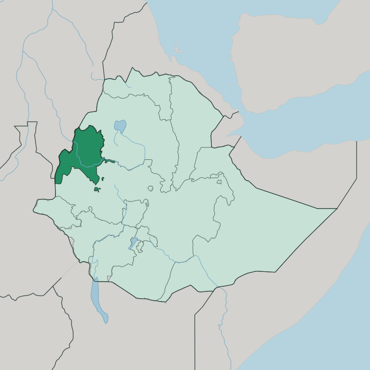
Towns & cities in Benishangul-Gumuz Region
Pick a town or city — each links to where to stay.
Assosa is the practical base. The regional capital sits on the highlands south of the Abay, holds the region's only airport, and offers the few proper hotels you will find here. It suits travellers who want a bed after the daily flight from Addis Ababa.
North across the river, the Metekel Zone town of Guba is the staging point for visits to the Grand Ethiopian Renaissance Dam, though beds there are tied to the dam project rather than to tourism. Elsewhere the towns are small market centres, and lodging thins out fast.
About Benishangul-Gumuz Region
One thing dominates.
What is Benishangul-Gumuz Region known for?
The Grand Ethiopian Renaissance Dam rises on the Blue Nile near the Sudan border, in the region's Metekel Zone, and it is the largest hydroelectric project in Africa. Away from the dam, this is Ethiopia's forested west, where bamboo and rubber cover more than half the land and the Abay cuts the plateau in two. Gold has been panned from its rivers for centuries.
The Berta and Gumuz peoples give the region its name.
Where is Benishangul-Gumuz Region?
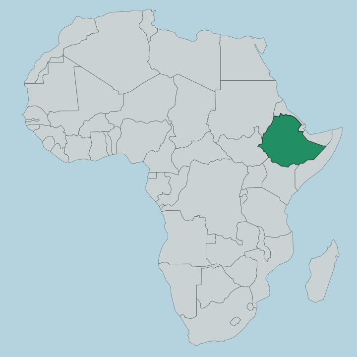
Benishangul-Gumuz occupies the western edge of Ethiopia, pressed against the long border with Sudan. The Abay, the river the rest of the world calls the Blue Nile, runs clean across it and splits the region into a northern and a southern half. That split is more than a line on a map.
The northern half was carved from the old Gojjam province and the southern half from Welega, and for years the only way between them ran the long way round through central Ethiopia. A single bridge changed that, throwing a 365-metre span across the Abay in 2012 and cutting the road between the two zones from well over a thousand kilometres to a few hundred. Forest is the other constant.
Bamboo, eucalyptus and rubber cover more than half the region, thickest on the low, hot plains that slope west toward the Sudanese lowlands. Assosa and its highlands sit higher and cooler in the south. The land falls away northward toward Guba and the Metekel Zone, where the Grand Ethiopian Renaissance Dam now holds back the Blue Nile close to the frontier.
Gambela lies to the south. Beyond the western tree line, the plains run on into Sudan.
What is Benishangul-Gumuz Region like?
The region takes its name from two peoples. Berta, who call their own country Benishangul, and Gumuz, whose homelands straddle the Abay and reach across into the Fazogli country of Sudan. Both speak Nilo-Saharan languages, closer in root to the peoples of the Sudanese border than to the Amharic and Oromo highlands to the east.
That kinship runs deep. Alongside them live Shinasha, Komo and Mao communities, the five groups the regional constitution names as indigenous to this land. Daily life here has long turned on the river and the forest.
Many Gumuz families still practise shifting hoe cultivation, clearing a patch of bush, working it, then moving on, and they fish the Abay and pan its gravels for alluvial gold as their forebears did. The Berta, longer settled and touched early by Arab traders who came upriver for gold in the nineteenth century, took to Islam and to trade. Faith divides roughly in two across the region, Christian and Muslim in near-equal measure, with older traditional beliefs surviving underneath.
It is one of Ethiopia's least urban corners. Culture here is lived in villages and along the water, not in any single city.
What is the history of Benishangul-Gumuz Region?
As a region, Benishangul-Gumuz is young. It was drawn in 1995 under Ethiopia's new federal constitution, stitched together from the part of Gojjam that lay north of the Abay and the part of Welega that lay south of it. The land itself carries a far older and harsher past.
Its gold drew Arab traders upriver in the nineteenth century, and highland empires long treated these lowlands as a hunting ground for slaves, a history that left the Berta and Gumuz on the margins of the Ethiopian state. Federation gave the region a name and a seat of its own at Assosa.
What is the climate of Benishangul-Gumuz Region?
This is tropical savanna country, hot and split hard between wet and dry. The rains come from May to October and fall heaviest over Assosa in June, July and August, when the forest greens and the Abay swells. Then the taps shut off.
From February to April the dry season turns fierce, with afternoons around the highland capital pushing toward the high thirties Celsius. The low plains sloping west to Sudan run hotter still than the highlands.
How do you get to Benishangul-Gumuz Region?
Fly to Assosa. Ethiopian Airlines runs daily flights from Addis Ababa to Assosa Airport, and the hop over the western highlands takes under an hour and a half, which is the sane way in given how far the region lies from the capital by road. Overland is possible but long, and the Metekel Zone in the north is reached separately, now that the 2012 bridge over the Abay has tied the two halves of the region together by road for the first time.
Updated July 2026