Ethiopia
Afar Region, Ethiopia — Towns & Travel Guide


Afar is Ethiopia's northeastern desert region, holding the Danakil Depression, the Erta Ale lava lake, and salt caravans crossing the flats.
About Afar Region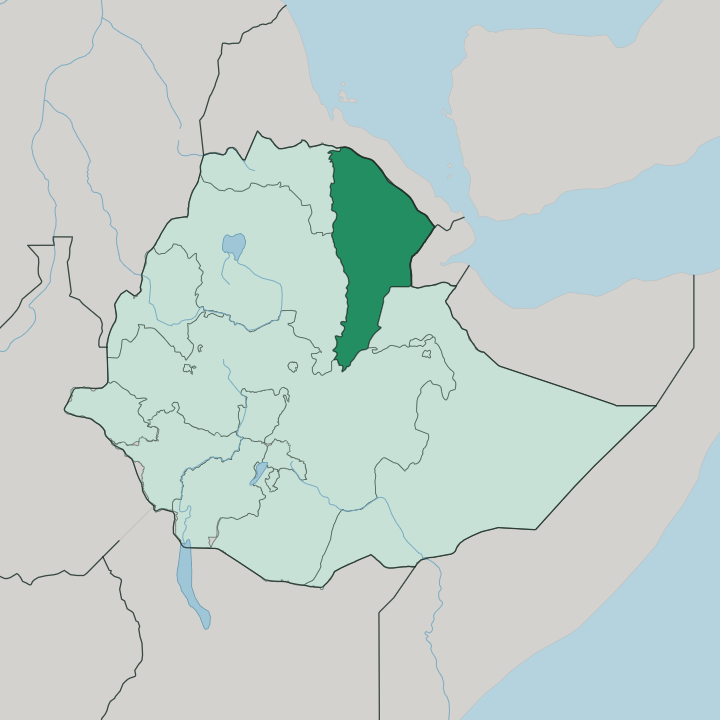
Towns & cities in Afar Region
Pick a town or city — each links to where to stay.
Semera is the practical base, a planned capital on the Awash-Assab highway with the airstrip most Danakil trips fly into. Asaita, the old capital, sits lower down the Awash River as a quieter market town toward Djibouti. Beyond them the hotels end.
Travellers heading for Erta Ale and the Dallol springs sleep on wooden cots at Afar salt villages, out under the desert stars. Choose the Awash National Park in the south instead if you want a lodge, a river, and shade rather than the raw furnace of the Danakil.
About Afar Region
What is Afar Region known for?
Afar is best known for the Danakil Depression, the sunken volcanic plain that fills the north of the region. Heat defines it. The Danakil ranks among the hottest inhabited places on earth, and its floor drops roughly 125 metres below sea level, making it one of the lowest points anywhere in Ethiopia.
Erta Ale keeps one of the planet's few permanent lava lakes glowing in that basin, while the Dallol field paints the salt in sulphur yellows and greens. Afar herders still cut blocks of salt here and load them onto camel trains bound for the highlands.
Where is Afar Region?
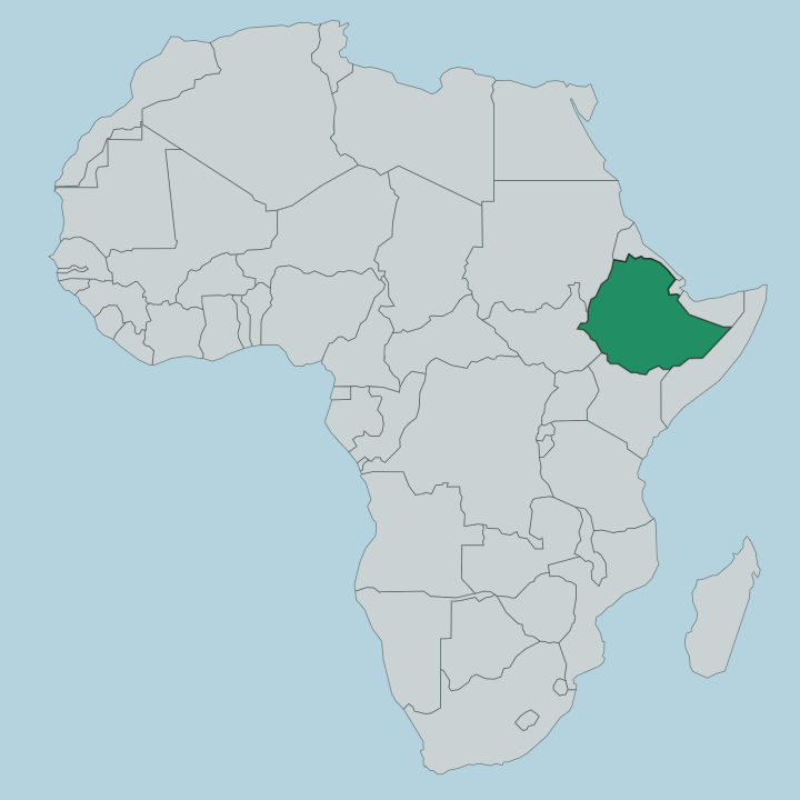
Afar spreads across the northeastern corner of Ethiopia, a wedge of desert pointing toward the Red Sea. Eritrea borders it to the north and Djibouti to the northeast. Inland it meets four other Ethiopian regions: the Tigray and Amhara highlands to the west, Oromia to the south-west, and the Somali Region to the south-east. The land itself is the story.
Most of Afar lies in the Afar Triangle, the low junction where three tectonic plates pull apart along the Great Rift Valley, and the crust here is still visibly tearing. The Danakil Depression fills the northern reach of that triangle, a plain of black basalt, salt pans, and cinder cones sunk far below the surrounding plateaus. Erta Ale smoulders in its heart.
To the west the Ethiopian Plateau rises in a wall, and to the east the Danakil Alps screen the basin from the Red Sea coast. The Awash River is the region's lifeline. It runs down from the highlands, curves through the southern lowlands past Asaita, and dies in a chain of saline lakes near the Djibouti frontier without ever reaching the sea.
Salt lakes such as Afrera lie scattered across the depression. Little rain falls, so nearly every settlement clings to that river or to a spring.
What is Afar Region like?
The region is the homeland of the Afar, a people who have grazed this desert for well over two thousand years. Herding rules daily life. Families move camels, goats, and cattle between waterholes across the plain, following pasture that the sparse rain allows, and their tall reed-mat huts can be struck and carried on a camel within an hour.
Salt is the other trade. In the Danakil, Afar men still hack slabs from the crust and drive camel caravans up to the highland markets, a journey of several days each way that has run for centuries. Almost everyone here speaks Afar, an Afro-Asiatic language that is also the working tongue of the regional government.
Islam shapes the calendar and the law of the clans. Afar society is built from patrilineal clans, proud and long wary of outsiders, and much of its history is oral rather than written. Hospitality to a guest is a strict obligation, coffee and camel's milk offered even where water is scarce.
This is one of the harshest inhabited landscapes on the continent, and the culture is shaped end to end by the discipline that surviving it demands.
What is the history of Afar Region?
Few places on earth reach deeper. In 1974 the skeleton called Lucy, a 3.2-million-year-old Australopithecus afarensis, was dug from the Hadar beds in the Danakil, and the species itself was named for the Afar. Later the region was ruled from Afar sultanates, the strongest being the Aussa Sultanate that the Mudaito dynasty founded on the lower Awash in the eighteenth century.
Modern Afar took shape in 1995, when Ethiopia redrew itself into ethnic regions and the Afar homeland became one of them. The planned town of Semera replaced Asaita as capital soon after.
What is the climate of Afar Region?
Afar is punishingly hot and bone dry. The Danakil floor is often called the hottest inhabited place on earth, with daytime highs that hover around 41 degrees through much of the year and shade almost impossible to find. Rain comes mainly between June and September, and even then it is thin, feeding the Awash River more than the desert around it.
October to February is the season travellers choose, when the depression cools just enough to walk Erta Ale and the salt flats by day. Nights on the high ground can turn surprisingly cold.
How do you get to Afar Region?
Two routes lead in. Fastest is a flight to Semera, the regional capital, whose airstrip sits on the paved Awash-Assab highway that carries most freight between Addis Ababa and the Red Sea ports. Many Danakil expeditions instead start from the Tigray highland city of Mekele, then grind down a rough road onto the basalt to reach Erta Ale and the salt flats.
There is no rail and no coast of its own here. From Semera or Asaita, everything beyond the highway means four-wheel-drive across gravel, sand, and old lava, usually with an Afar guide.
Good for
Updated July 2026