Where to stay in Enontekiö
The right area depends on your trip. Here's who each one suits — pick the place, then the hotel.
Enontekiö holds a scattered stock of beds across a municipality the size of a small country, the largest reach of Lapland in the Arctic north. The church village of Hetta is the natural base, gathered around the Enontekiön kirkko and the Enontekiön kotiseutumuseo, with small hotels, guesthouses and cabins for visitors who walk the fells and the marked trails from the centre. It is the obvious choice.
Out across the tundra the beds thin to a handful, the old fell hotel of the Kilpisjärven matkailuhotelli standing far in the north-west toward the three-country border, and cabins lying near the villages of Peltovuoma and Näkkälä for travellers who want the deep country to themselves. Stock is thin and remote. Visitors drawn to the past often stay within reach of the war museum at Järämä and the survey point of the Struven ketju, while many simply book a room at Hetta and drive out to the fells of Enontekiö by day.
Book ahead for the spring and autumn seasons, when the cabins around the fells go early.
Things to do in Enontekiö
Ranked by global recognition; descriptions from Wikidata (CC0).
Museums & Galleries
1- Järämä
Churches & Religious Sites
2- Enontekiön kirkko
- Enontekiön helluntaiseurakunta
Castles & Historic Sites
1- Markkinan kirkonpaikka Heritage
Landmarks & Notable Places
1- Ungelon torppa Heritage house
worth knowingacross 4 categories in Enontekiö
About Enontekiö
What is Enontekiö known for?
Enontekiö is known as fell country, the largest and most northern reach of Lapland, in the Arctic north where the borders of three countries meet. The church village of Hetta gathers around the Enontekiön kirkko, while the old survey point of the Struven ketju marks the great meridian arc that crossed this ground long ago. Fells fill the sky.
Reindeer herding and Sámi life shape the wide municipality, its villages of Peltovuoma and Näkkälä scattered across the tundra, and the war museum at Järämä keeps a harder chapter of the north.
What are the main landmarks in Enontekiö?
The survey point of the Struven ketju is the landmark that gives Enontekiö a place in the wider world, part of the great meridian arc once measured across this ground in the Arctic north of Lapland. The Enontekiön kirkko stands in the church village of Hetta, the parish church of the fells. Old and far-flung.
The war museum at Järämä recalls the fighting of the north, the Enontekiön kotiseutumuseo and the croft of Ungelon torppa keep the everyday past, and the high fell of Stuorrahanoaivi rises over the villages of Peltovuoma and Näkkälä in the deep country of Enontekiö.
What is the history of Enontekiö?
Enontekiö's history is the history of the Sámi and the fells. Long before any border was drawn across the Arctic north, the herding people of Lapland moved with their reindeer between winter and summer grounds, and the old market and church site of Markkinan kirkonpaikka show where the scattered families gathered to trade and to worship in the high country. Reindeer came first.
Slowly the villages of Peltovuoma and Näkkälä grew on the tundra, the Enontekiön kirkko was raised to serve the parish, and the great meridian survey of the Struven ketju ran its measuring chain across these fells in the long nineteenth century. The municipality was set on its own footing in the 19th century, in 1877. War later scarred the north, the fighting remembered at the museum of Järämä, and much of the country had to be rebuilt from the ground.
New houses rose where old ones burned. The Enontekiön kotiseutumuseo and the croft of Ungelon torppa keep that older life at Hetta, while reindeer herding and Sámi tradition still carry the long story of Enontekiö through the fells of Lapland.
Where is Enontekiö?
Enontekiö spreads over the high fell country at the far north-western corner of Lapland, in the Arctic north where Finland narrows toward the borders of Norway and Sweden. The land rises from tundra and bog to bare fells, the highest ground in the country lying out in its north-west arm. Fells crowd the horizon.
The church village of Hetta sits by the water at the heart of the municipality, the fell of Stuorrahanoaivi rises in the wild interior, and the villages of Peltovuoma and Näkkälä lie scattered far apart across the open ground of Enontekiö.
What is the climate of Enontekiö?
Enontekiö lies deep in the Arctic north, its weather among the harshest of Lapland, set by the high fells and the long polar dark. Winters are bitter and long, the snow holding over the tundra and the bare fell tops for the better part of the year while the sun stays below the horizon for weeks. The light then floods back.
The brief fell summer brings the midnight sun and a sudden green over the bogs and the birch, the season around Hetta short and intense before the early cold returns over Enontekiö. Frost can come in any month here.
How do you get to Enontekiö?
Enontekiö is remote, reached mainly by road across the fells of Lapland in the Arctic north. Highways run up to the church village of Hetta and on toward the three-country border in the far north-west, the long drive carrying most visitors in. The road is the lifeline here.
A small airfield serves the municipality in the season, and buses link Hetta to the larger towns of the south, while travellers bound for the war museum at Järämä or the survey point of the Struven ketju drive out to the scattered corners of Enontekiö from the centre.
Where Enontekiö sits
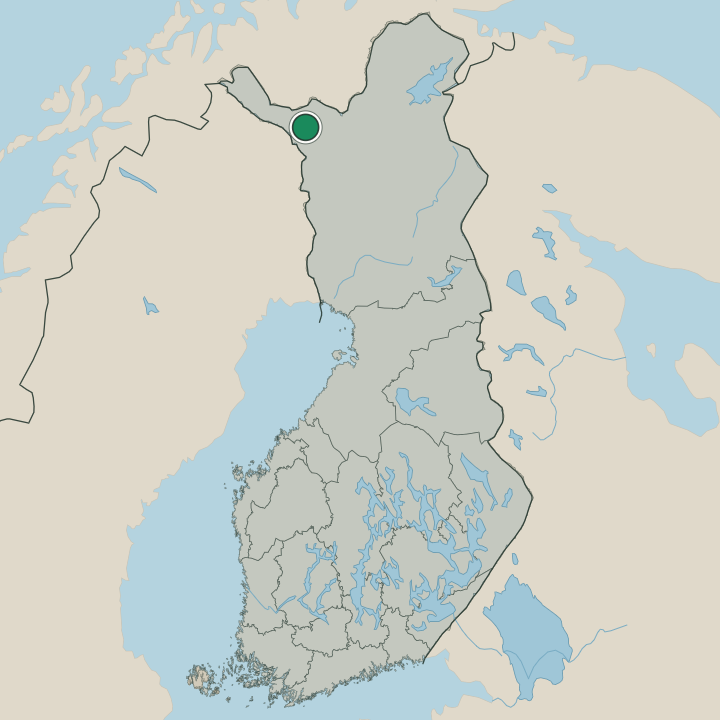
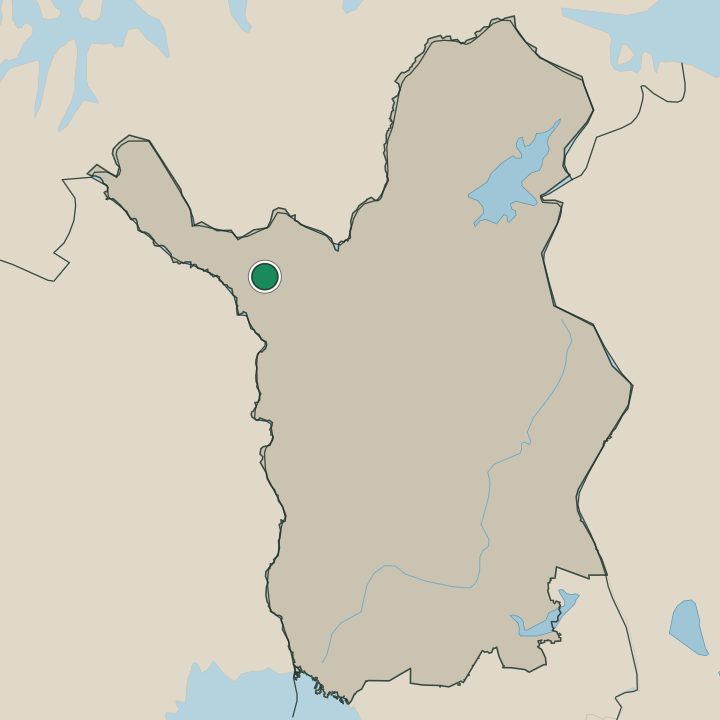
Boundaries © geoBoundaries (CC BY) & Wikidata (CC0); water & neighbours: Natural Earth.