Indonesia
Provinsi Papua, Indonesia — Towns & Travel Guide


Papua is the northeasternmost province of Indonesia, on the north coast of New Guinea, with its capital at Jayapura by the Pacific.
About Provinsi Papua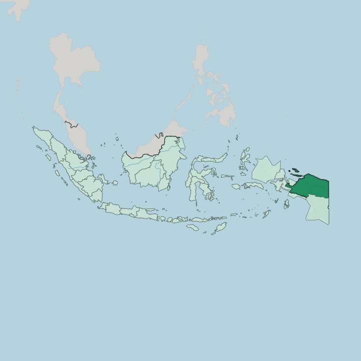
Towns & cities in Provinsi Papua
Pick a town or city — each links to where to stay.
Most visitors base themselves in Jayapura, the capital and the arrival point for the whole province. It curls around a harbour beneath the Cyclops range. West of the city, the town of Sentani spreads along the shore of Lake Sentani beside the airport, a quieter base among stilt villages and the lake's carved longhouses.
Biak lies farther out. That island in Cenderawasih Bay draws divers to its reefs and to the wreckage of fierce fighting from the Pacific War. Choose Jayapura for the border capital; pick Sentani or Biak when you want the lake or the open sea.
About Provinsi Papua
What is Provinsi Papua known for?
Papua is the northeastern corner of Indonesian New Guinea, the country's land frontier with Papua New Guinea. Jayapura is the capital. It sits on a deep bay near the border, backed by the steep Cyclops Mountains that drop toward Lake Sentani, the largest lake in the province and the setting for an annual festival of Sentani carving and dance.
The Mamberamo River, sometimes called the Amazon of Papua, drains a vast basin of rainforest and swamp to the west. Offshore lie Biak and Yapen, Melanesian islands scattered across Cenderawasih Bay.
Where is Provinsi Papua?
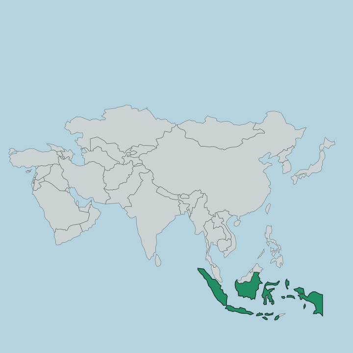
Papua fills the northeastern corner of the island of New Guinea, the western half of which belongs to Indonesia. The province lies just below the equator, at the eastern edge of Indonesia. Papua New Guinea lies along its eastern land border.
The Pacific Ocean washes the whole northern shore, while Cenderawasih Bay bites into the coast to the west. To the south rise the provinces of Central Papua and Highland Papua, carved from the same territory when the old province was divided. Jayapura stands in the far northeast, almost against the border, on a bay ringed by the Cyclops Mountains.
Inland the ground is anything but uniform. Behind the narrow coastal plain, the Cyclops range climbs steeply, and just south of it Lake Sentani fills a broad basin between the hills. Farther west the Mamberamo River gathers the runoff of the central highlands and spills across the Lakes Plains, an immense expanse of swamp, oxbows, and standing water that ranks among the least-touched wetlands on the island.
The province also reaches out to sea. Biak, Supiori, and Numfor form the Schouten Islands, and the long ridge of Yapen lies across the mouth of Cenderawasih Bay, all of them Melanesian and thick with rainforest.
What is Provinsi Papua like?
Papua is one of the most linguistically varied places on earth, splintered into hundreds of distinct languages across a few dozen peoples. The pattern is old and geographic. Along the coast and on the islands live Austronesian-speaking communities such as the Biak and the Waropen, seafarers whose ancestors arrived by canoe.
Papuan-speaking peoples hold the forested interior, and the lake-dwelling Sentani speak a Papuan tongue too, many of them descended from settlers who reached New Guinea tens of thousands of years ago. Between them they make the province a mosaic no single culture defines. Daily life still runs on sago, fish, and the garden rather than rice.
The Sentani are known for painting on beaten bark and for carving that turns house posts and canoe prows into ancestral figures, and their lake villages hold an annual festival of dance and song. On Biak, seafaring lore and the koreri myth run deep. Christianity, brought by missionaries, is the faith of most Papuans, though Jayapura and the coastal towns also hold mosques and the traders, teachers, and officials who came from Java, Sulawesi, and beyond.
Woven into all of it is the noken, the knotted string bag carried from the forehead that Papuans use for everything from garden produce to babies.
What is the history of Provinsi Papua?
New Guinea was among the first lands people ever settled, reached by sea tens of thousands of years ago. Its north coast later felt the pull of the Tidore sultanate, then of Dutch traders. The Netherlands held western New Guinea as the last shred of its East Indies, keeping it more than a decade after the rest of Indonesia turned independent.
Control passed to Indonesia in 1963. The disputed Act of Free Choice sealed that outcome in 1969. Known for decades as Irian Jaya, the land became Papua in 2002 and was split into four provinces in 2022.
What is the climate of Provinsi Papua?
Papua sits close to the equator, so it is hot and wet the year round. Rain falls in every month. Jayapura and the north coast see their heaviest downpours between November and April, with a relatively drier spell from May to October, yet even the dry months stay humid.
The Cyclops Mountains wring extra rain from the sea winds and stay cooler than the steamy coast. Seasons here mean wetter and less wet, never warm and cold.
How do you get to Provinsi Papua?
Reaching Papua means flying. The province has no flights from abroad, so travellers connect through Jakarta, Makassar, or Bali to Sentani Airport, which lies among the lake villages west of Jayapura. Biak has its own airfield and long served as a Pacific staging post for aircraft.
Pelni passenger ships also dock at Jayapura and Biak on their long loops through the archipelago. Overland, a single road crosses into Papua New Guinea at the Skouw border post near the capital, and beyond the coast rivers and small planes do most of the work.
Good for
Updated July 2026