India
Tripura, India — Towns & Travel Guide


Tripura is a small hill state in north-east India, nearly ringed by Bangladesh, with Agartala on its western plain.
About Tripura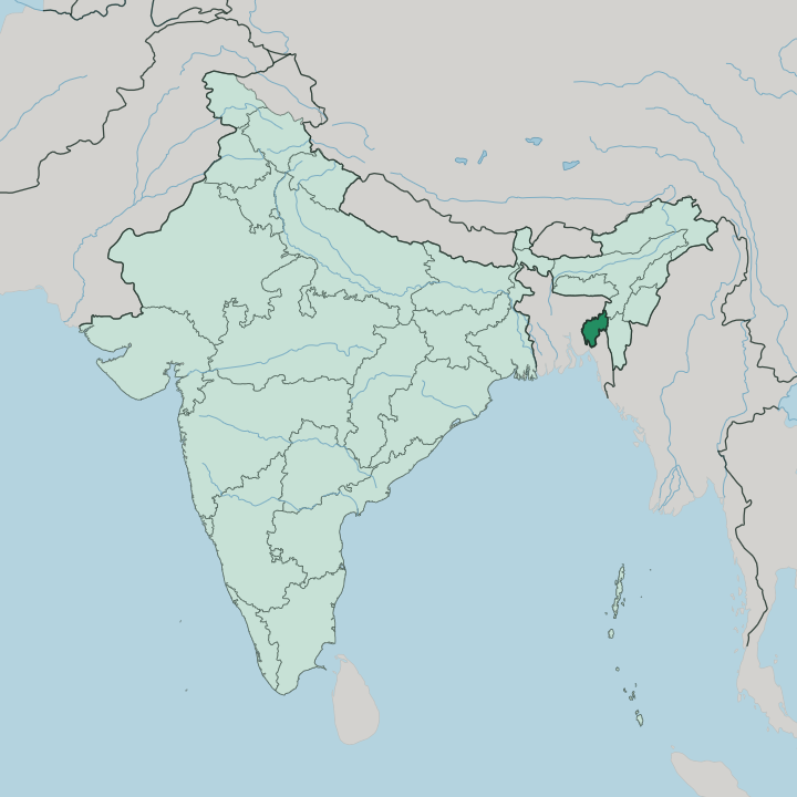
Towns & cities in Tripura
Pick a town or city — each links to where to stay.
Agartala is the sensible first base, close to Ujjayanta Palace and to the border with Bangladesh. Beds thin fast beyond it. For Neermahal you stay near Melaghar and Rudrasagar Lake, where the boats cross to the water palace.
The Jampui Hills in the north hold ridge-top villages above the orange orchards, cooler than the humid plain below. Kailasahar is the town nearest Unakoti. Base yourself in Agartala for a first visit; then move north to the hills and Kailasahar when you want the older, pre-royal Tripura the Manikya kings never built.
About Tripura
What is Tripura known for?
Tripura is known for the Manikya kings and what they left behind. Their two palaces anchor most trips. Ujjayanta Palace stands in Agartala, a domed Indo-Saracenic pile that now holds the state museum, while Neermahal sits out on the water of Rudrasagar Lake, a red-and-white summer palace reached only by boat.
Older still are the Unakoti rock carvings near Kailasahar, a hillside of Shaivite figures cut into the stone between the seventh and ninth centuries. Bamboo and cane handicraft is the everyday art. The Jampui Hills in the north are the state's orange country.
Where is Tripura?
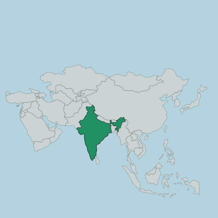
Tripura is a landlocked state in the far north-east of India, the third-smallest in the country. Bangladesh wraps around it on three sides. The border runs along the north, the west and the south, so the state is nearly an enclave, joined to the rest of India only by its eastern edge. Assam lies to the north-east and Mizoram to the east.
The land is folded into five hill ranges. Baramura, Atharamura, Longtharai, Shakhan and the Jampui Hills all rise in parallel, running roughly north to south with paddy valleys between them. Betling Shib caps the Jampui range up north, the tallest ground in the state.
Agartala sits away from all of that, out on a plain in the west against the Bangladesh line. Rivers drain the hills every way. The Gumti is the longest, gathering in the interior before crossing west into Bangladesh, and the Khowai, Manu, Haora, Muhuri and Feni carry the rest of the rainfall off the ridges.
That near-encirclement by one neighbour shapes how the state connects to everywhere else.
What is Tripura like?
Tripura runs on two cultures at once. The Tripuri and the other indigenous communities are the older layer, and a Bengali majority is the larger one, the two woven together across the state. Language marks the split plainly.
Kokborok is the tongue of the Tripuri people, a Tibeto-Burman language, and it holds official status beside Bengali. Festivals carry the older belief through the year. Kharchi Puja fills Old Agartala for seven days each summer, when fourteen ancestral deities of the Tripuri kings are washed and worshipped, and Garia Puja greets the spring around a decorated bamboo pole.
Bamboo and cane are the working material of daily life here. Artisans weave them into mats, baskets and furniture, and the craft is as much a part of the place as any temple. The Manikya court left the grand architecture.
The villages kept the dances, the deities and the looms. Both halves are Tripura, and neither tells the whole of it.
What is the history of Tripura?
The Manikya dynasty ruled the Twipra kingdom here from the early fifteenth century, one of the longest-lasting royal lines anywhere in the subcontinent. Kings for five hundred years. Their old capital stood at Udaipur, on the Gumti in the south, before the seat moved north-west to Agartala.
British influence turned the kingdom into a princely state, yet the Manikya kings kept their throne through all of it. That ended in 1949, when Tripura signed its merger with independent India. Full statehood came in 1972.
What is the climate of Tripura?
Tripura has a tropical monsoon climate. The wet season runs from roughly May to September, when the south-west monsoon soaks the hills and swells the Gumti and the other rivers. Rain is the main event of the year.
The cooler, drier stretch from October to March is the easy time to travel, with mild days on the plain and genuinely crisp air up in the Jampui Hills. Summers before the rains turn hot and heavy across the lowland around Agartala. The hills stay a few degrees kinder throughout.
How do you get to Tripura?
Most travellers fly into Agartala. Its airport, north-west of the city near the Bangladesh border, is among the busiest in the north-east and the fastest way in from the rest of India. The land route is long and narrow, because Bangladesh wraps around three sides of the state and only the eastern corner touches Assam.
A single national highway threads through that gap to carry road traffic. Trains now reach Agartala on the national network as well. From the capital, roads run out to the lake at Melaghar, the carvings at Unakoti and the ridges of the Jampui Hills.
Good for
Updated July 2026