Kenya
Busia, Kenya — Towns & Travel Guide


Busia is a county in far western Kenya, set against the Uganda border where the land drops to the shore of Lake Victoria.
About Busia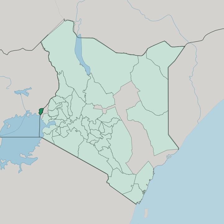


Towns & cities in Busia
Pick a town or city — each links to where to stay.
Most beds sit in Busia town, the county seat and the spot where the highway crosses into Uganda. Trade comes first here. Rooms there serve lorry drivers, cross-border traders, and the officials working the customs post, which keeps them practical and cheap rather than scenic or geared to holidaymakers.
Port Victoria is the lake alternative. It sits south-west on Lake Victoria, a small fishing landing with open water views and a far slower pace than the border strip.
About Busia
What is Busia known for?
Busia is best known as one of the busiest road crossings between Kenya and Uganda. Trade drives it. The border post at Busia town runs thick with cross-border traders and the lorries clearing customs between the two countries.
Most of the Nairobi-Kampala freight and railway cross the border just north of here at Malaba, though Busia keeps its own steady stream of trade. Along the lake, fishing towns like Port Victoria pull tilapia and Nile perch from the water. Inland, sugarcane and cotton fill the fields worked by Luhya and Teso farmers.
Where is Busia?
Busia occupies the far south-western corner of Kenya, hard against the frontier with Uganda. The boundary runs north from Sio Port on Lake Victoria, tracing the international line the whole way. Lake Victoria forms the county's south-western edge, and its waters back up inland to create wide seasonal wetlands. Siaya County lies to the south-east across the lower ground. Bungoma County and Kakamega County press in from the east, where the land begins to climb.
The county sits low, almost all of it within the Lake Victoria basin. From the lakeshore the ground rises only gently toward the Teso hills in the north, so there are no mountains here, just long open plains broken by granite outcrops and swampy river valleys. Two rivers matter most.
The Nzoia River and the Yala River both reach the lake along the county's southern edge, and their floodwaters, backed up by the lake, sustain the Yala Swamp on the northeastern shore. That wetland covers about 175 square kilometres. It is the largest freshwater swamp in Kenya, a refuge for the sitatunga antelope and a filter for the rivers draining into Lake Victoria.
What is Busia like?
Two peoples shape Busia. The Luhya hold the larger share, split into local groups the Abasamia, Abakhayo, Abamarachi, and Abanyala, each with its own dialect and territory. The Teso are the other, a community whose homeland straddles the border so that relatives live on both the Kenyan and the Ugandan sides.
Everyday speech moves between several tongues. Luhya dialects and Teso are heard alongside Luo from the lake shore and Swahili as the common language of the market and the road. Music carries much of the tradition.
Drums, horns and call-and-response songs mark weddings, funerals and harvest gatherings, and the Samia in particular keep a deep repertoire of folklore set to them. Daily life runs on farming and fishing. Families work maize, cassava, millet, and sugarcane in the fields, while along Lake Victoria the fishing communities send out canoes at dusk and bring the catch back to the landings by morning.
The border barely divides any of it. Trade, kinship and language cross freely between Busia and its Ugandan namesake, and the county feels as tied to Uganda as to the rest of Kenya.
What is the history of Busia?
Busia is young as a county but old as a borderland. The county dates only to 2013, one of the 47 units created when Kenya replaced its provinces under the constitution of 2010. Before that it was Busia District, one of two units formed in 1963 when the colonial Elgon Nyanza District was split into Busia and Bungoma, both placed in the old Western Province.
The frontier itself is older still, drawn across Teso and Samia land during the colonial partition that fixed the line between Kenya and Uganda. Trade came with the line.
What is the climate of Busia?
Busia is warm and humid the year round, tempered a little by the mass of Lake Victoria on its south-western edge. Rain falls in two seasons. The long rains come between March and May, the short rains between August and October, and the wet months leave the swamps brimming and the rivers high.
The north of the county draws noticeably more rain than the drier lakeside plains in the south. Growers here lean on the sky, since almost every field depends on rainfall rather than irrigation.
How do you get to Busia?
There is no airport within Busia County itself. The nearest is Kisumu International Airport, on Lake Victoria to the south-east, and most travellers land there before covering the last stretch by road. Matatus and buses run west from Kisumu through Bumala to Busia town in a few hours.
From the other side, the Busia post is one of the main gates between Kenya and Uganda, and long-distance coaches on the Nairobi-Kampala run pass straight through it. Trains and trucks cross nearby at Malaba.
Good for
Updated July 2026