Kenya
Kericho, Kenya — Towns & Travel Guide


Kericho is Kenya's tea county, a green highland shelf on the edge of the Mau Forest where the Kipsigis grow much of the country's tea.
About Kericho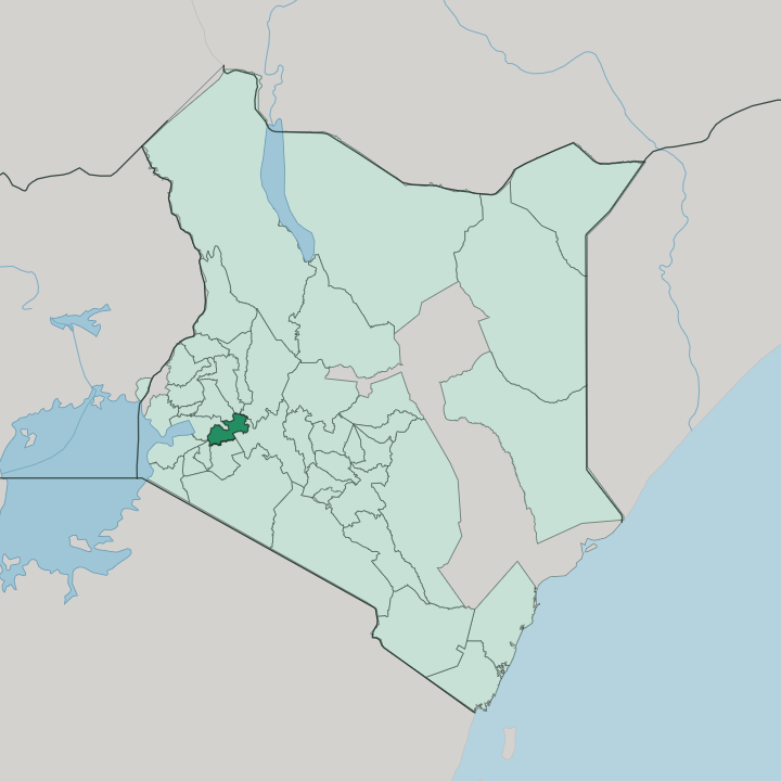


Towns & cities in Kericho
Pick a town or city — each links to where to stay.
Almost every bed sits in one town. Kericho town is where visitors base, and the old Kericho Tea Hotel, built in the 1950s beside the Unilever estate, stands a short walk from the market among the tea gardens themselves. Newer places like the Sunshine Hotel cluster near the golf course.
Out in the county, rooms thin fast, Litein, Kipkelion, and Londiani are working Kipsigis towns, not tourist stops. Choose Kericho town if you want tea walks, the Chagaik Arboretum, and the Mau Forest edge.
About Kericho
Tea is the answer.
What is Kericho known for?
Kericho grows more of it than anywhere else in Kenya, its ridges combed into waist-high green bushes that run unbroken to the treeline of the Mau Forest. The estates around Kericho town, worked since the 1920s by firms like James Finlay and Brooke Bond, turned this corner of the western highlands into the country's tea heartland. The county is Kipsigis land, part of the wider Kalenjin homeland that has sent more world-beating distance runners onto the track than any region its size.
Green hills, cool air, and tea define it.
Where is Kericho?
Kericho sits in the western highlands of Kenya, a tilted green shelf on the far side of the Great Rift Valley. The land climbs eastward into the Mau Escarpment, part of the Mau Forest complex, the largest indigenous montane forest in East Africa, and falls away westward toward the hot lake basin around Kisumu and Lake Victoria. This is the wet, high country just off the western wall of the East African Rift.
Nakuru lies over the hills to the north-east, Kisii and the Gusii highlands to the south-west. Between them, Kericho is all ridge and valley. Water and forest define the county.
Rivers rise along the Mau's wet crest and run down through the tea, feeding the Mara River that flows south into the Maasai Mara and the Serengeti plains beyond. Kericho's ridges are combed with tea because the rain is reliable and the drainage steep. Tinderet and the Londiani hills mark the northern skyline, the Kipsigis farmland spreads south toward Bomet, and everywhere the slope runs west.
Kericho County took its present shape in 2013, when Kenya's counties replaced the old districts. Kericho County covers a small stretch of ridge and valley. Most of it drains, in the end, toward Lake Victoria.
What is Kericho like?
Kericho is Kipsigis country. The Kipsigis are the largest branch of the Kalenjin, the highland people whose name has become shorthand for Kenyan distance running. Cool thin air and a culture of running from childhood have made these hills a nursery for Olympic and world champions; Wilson Kiprugut, born near Kericho, won Kenya its first Olympic medal on the track in 1964.
Kalenjin is spoken across the county in its Kipsigis form, alongside Swahili and English. Here, running is closer to a trade than a pastime. Daily life turns on the tea.
Generations of pickers, many drawn from across western Kenya, have worked the estates around Kericho town since colonial firms planted the first bushes, and the plantation has shaped the county's towns, churches, and social order as much as any chief did. Kipsigis music and oral tradition run strong, and Kericho is counted a wellspring of contemporary Kalenjin sound. Plucking is still done by hand across the estates, two leaves and a bud at a time.
Markets in Litein and Kipkelion still set the rhythm of the week. Sunday is for church. Weekdays are for tea and the track.
What is the history of Kericho?
Long before tea, these hills were Kipsigis grazing and farming land. British settlers changed that fast. Tea estates were laid out from 1924, and in 1925 the firms Brooke Bond and James Finlay bought thousands of acres of former soldier-settlement land around Kericho at auction, opening the first factory in 1927 and displacing Kipsigis families whose land claims remain contested.
The plantations made the town; the town made the county. Kericho County itself dates only to 2013, when devolution turned Kenya's old districts into counties.
What is the climate of Kericho?
Altitude makes the weather here. Kericho sits high on the Mau Forest ridge, cool and spring-like the year round, without the heat of the lake basin below or the chill of the Rift floor. Rain is the county's signature.
It falls in two seasons, the long rains from March to May, the short rains around October and November, and Kericho counts among the wettest corners of Kenya. Afternoon hailstorms are a local trademark, rattling the tea and the tin roofs. That reliable rain is exactly why the tea grows.
How do you get to Kericho?
Kericho is a road town. Most arrivals drive in from Nairobi, a climb of about four hours west over the Rift Valley and down through Nakuru, or come up the short, fast road from Kisumu on the lake. Matatus and long-distance buses link it daily with Nairobi, Nakuru, Kisumu, Eldoret, and Mombasa.
There is no scheduled airline service into town; fliers land at Kisumu International Airport to the west and finish the trip by road. The little Kericho Airport handles only light aircraft.
Good for
Updated July 2026