Kenya
Kwale, Kenya — Towns & Travel Guide


Kwale is a Kenyan county on the Indian Ocean south of Mombasa, holding Diani Beach, the Shimba Hills reserve, and Mijikenda coast villages.
About Kwale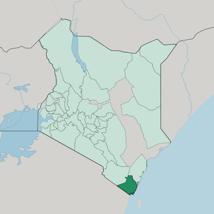


Towns & cities in Kwale
Pick a town or city — each links to where to stay.
Diani Beach is the obvious base. Its reef-fringed strip of white sand south of Mombasa carries most of Kwale's resorts, dive centres, and kitesurfing schools along the Indian Ocean shore. Ukunda, the town just behind it, holds the airport and the Mombasa road.
For wildlife, lodges cluster at the Shimba Hills reserve gate, within a morning's walk of Sheldrick Falls and the sable antelope. Choose Msambweni's quieter reef further south when you want the coast without the crowds.
About Kwale
Diani Beach is the draw.
What is Kwale known for?
This long strip of white sand and shallow reef south of Mombasa pulls kitesurfers, divers, and beach travellers to the Indian Ocean shore of Kwale. Inland, the Shimba Hills National Reserve holds Kenya's only herd of sable antelope, and Sheldrick Falls drops through its coastal rainforest. Sacred kaya forests survive on the ridges above the coast.
Base Titanium's mineral-sands operation worked the dunes near Kwale town for titanium ores from 2013 until 2024, when the deposit ran dry.
Where is Kwale?
Kwale sits on the Indian Ocean coast of Kenya, the mainland south of Mombasa. Its shoreline runs from Tiwi and Diani down past Msambweni to Vanga, a line of white sand, coral reef, and mangrove creek. Tanzania lies across the southern boundary, where the Umba River reaches the sea near Lunga Lunga. Kilifi County is to the north, Taita-Taveta County inland to the west, and the port city of Mombasa faces the county across the Likoni channel.
The coast is the county's front door. The land climbs in steps away from the water. A narrow coastal plain gives way to a foot plateau, then to the Coastal Uplands that form the Shimba Hills, and finally to the dry Nyika plateau of the interior.
The Shimba ridge catches the sea rains and keeps a pocket of coastal rainforest well inland. Rivers cross the plain toward the ocean, the Ramisi, the Mwachema, and the Mkurumuji among them. Kwale, the county town, stands on higher ground southwest of Mombasa near the reserve gate, while Ukunda spreads along the highway behind Diani Beach.
Base Titanium's mineral-sands mine worked the dunes for titanium ores until the deposit ran out in 2024. In Kwale, the ocean or a river is always close by.
What is Kwale like?
Kwale is Mijikenda country on a Swahili coast. Its two main peoples are the Digo along the shore and the Duruma in the drier hinterland, both branches of the wider Mijikenda who trace their origin to the north at Shungwaya. Swahili is the common tongue, carried by centuries of trade between the coast and the Indian Ocean world, and Islam is the dominant faith in the beach towns and fishing villages.
The Digo took to it early. Coconut palms, cassava plots, and dhows drawn up on the sand set the everyday scene. The kaya forests hold the older layer.
These are the sacred groves the Mijikenda cleared their first fortified villages inside, refuges from raiding that later became places of prayer and burial; several of them, protected as the Sacred Mijikenda Kaya Forests, carry World Heritage listing. Kaya Kinondo, the sacred forest closest to Diani Beach, opens to visitors on short guided walks among its old trees. Coral-rag mosques, seafood grilled over charcoal, and ngoma drumming and dance fill out the coastal culture.
Farming and fishing still order most days. The sea sets the calendar.
What is the history of Kwale?
People reached this coast long before the county did. The Mijikenda moved south from Shungwaya and built their fortified kaya villages in the forests here, while Swahili and Arab traders worked the shore and drew the Digo into Islam. The boundary with Tanzania was fixed in 1886, when Britain and Germany split the coast and ran their line inland from the Umba River near Vanga.
Kwale served as a district headquarters through the colonial and independence years. It became a county in its own right in 2013, when Kenya devolved power to the counties. The forests outlasted every ruler.
What is the climate of Kwale?
Kwale runs on the Indian Ocean monsoons. The coast stays warm and humid right through the year. Two seasonal winds swing the weather.
The kusi blows cool, dry, and gusty out of the south-east from about April to October, and the kaskazi returns hot, calm, and clear air from the north-east across the rest of the year. Rain comes in two spells, the long rains around April and May and lighter showers late in the year. Diani stays green and wet.
The dry Nyika interior does not.
How do you get to Kwale?
Most travellers come through Mombasa. Moi International Airport sits just to the north, and from the city the classic route south crosses the Likoni channel by ferry before the highway runs down to Diani and Ukunda. Ukunda Airport takes light aircraft direct from Nairobi and the Maasai Mara, landing minutes from the beach.
The same coastal road carries on south to the Tanzania border at Lunga Lunga. Buses and matatus run it all day. Inland, Kwale town sits off the Mombasa road toward the Shimba Hills.
Good for
Updated July 2026