Kenya
Kajiado, Kenya — Towns & Travel Guide


Kajiado is the Maasai county on Kenya's border with Tanzania, its plains running from the Ngong Hills to Amboseli and Mount Kilimanjaro.
About Kajiado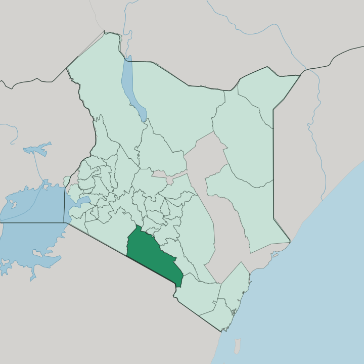


Towns & cities in Kajiado
Pick a town or city — each links to where to stay.
Kajiado splits in two for a visitor. The northern tip, Ongata Rongai, Kitengela and Ngong, is really Nairobi's overflow, a belt of commuter towns whose hotels fill with the capital's workers rather than sightseers. The reason to sleep in Kajiado lies south, inside Amboseli National Park, where a handful of lodges look straight onto Mount Kilimanjaro and the elephants come to drink at dawn.
If you want Maasai savannah and the mountain, base yourself there. The town of Loitokitok, on Kilimanjaro's lower slopes near the Kimana gate, is the everyday hub for that corner.
About Kajiado
What is Kajiado known for?
Two things put Kajiado on the map: the Maasai and their plains. Amboseli National Park sits in the county's south, and from its swamps the snows of Mount Kilimanjaro rise across the border in Tanzania, the classic backdrop of every Kenyan safari poster. The great elephant herds of Amboseli move between those swamps and the open savannah.
Closer to Nairobi, the four peaks of the Ngong Hills mark the county's northern edge, the ridge Karen Blixen wrote into Out of Africa. Down on the Rift Valley floor lies Lake Magadi, a blinding pan of pink-white soda. Wildlife and the Maasai define it.
Where is Kajiado?
Kajiado is the wedge of southern Kenya between Nairobi and the Tanzanian border. It is one of the largest counties in the country, a right-angled triangle whose long side runs down the frontier with Tanzania. The land tilts and folds.
In the north the Ngong Hills rise to a four-peaked ridge above the capital; westward the ground collapses into the Great Rift Valley, dropping toward the flat, blistering pan of Lake Magadi, one of the lowest points in the county. Most of what lies between is open savannah, the Athi-Kaputiei plains and the Amboseli basin, grazed by Maasai cattle and wildlife alike. South and east the country climbs again toward Mount Kilimanjaro, whose meltwater feeds the springs and swamps of Amboseli National Park just inside Kenya.
The mountain itself stands over the border in Tanzania. Nairobi presses hard on the northern boundary, and its suburbs have spilled across it into Ongata Rongai, Kitengela and Ngong. The paved A104 highway runs the length of the county, carrying traffic from Nairobi down through Kajiado town to the Tanzanian border post at Namanga.
Go a short way south of those towns and the tarmac gives way to dust, acacia and herds. That contrast is the whole county in miniature.
What is Kajiado like?
Kajiado is Maasai country, and that identity runs deeper than anything else in the county. Cattle are wealth here. The Maasai measure a family's standing by its herds, and those herds set the rhythm of the year as households move their stock between wet-season and dry-season grazing across the open plains.
Red shuka cloth, silver beadwork and the bonds of age-set and clan still order daily life across the rural south. Maa is the mother tongue of these plains, spoken beside the Swahili and English that carry across the rest of Kenya. Elders still settle disputes and grazing rights under the acacia.
The county is not one thing. Its northern rim has turned suburban at speed, as Nairobi's growth pushes estates and shopping malls out across Ongata Rongai, Kitengela and Ngong. Between the two worlds sit the livestock markets of Kajiado town and Namanga, where Maasai herders bring cattle down off the plains to sell.
Amboseli has added another layer entirely, tourism, and Maasai villages by the park open their homesteads to visitors while running community conservancies on land they still graze. Tradition and tarmac share one county.
What is the history of Kajiado?
The Maasai have grazed these plains for centuries, long before any border split their pastures. British rule redrew the map. Under a treaty of 1904 and a second move in 1911, the colonial administration pushed the southern Maasai onto a reserve covering much of what became Kajiado, and cleared the higher land to the north for settler farms.
Industry followed the minerals, the Magadi railway, opened in 1915, was laid to haul soda ash from Lake Magadi to the coast. For decades the area sat within the old Rift Valley Province. Kajiado became a county in its own right in 2013, under the constitution Kenya passed in 2010.
What is the climate of Kajiado?
Kajiado is mostly semi-arid, but height changes everything. The rains come in two spells, the long rains from March to May, the shorter ones toward the close of the year. Altitude decides the rest.
The Ngong Hills catch cloud and stay green and cool; down on the Rift Valley floor, Lake Magadi bakes as one of the hottest, driest corners of the county. Loitokitok, high on Kilimanjaro's northern slopes, is wetter and cooler again. Between the wet spells the plains turn tawny and dust-dry, and the herds and the elephants track the last water.
How do you get to Kajiado?
Almost everyone starts in Nairobi. Jomo Kenyatta International Airport, just north of the county line, is Kenya's main doorway, and from there the roads fan south. The paved A104 highway runs the length of Kajiado, carrying buses and shuttles down through Kajiado town to the Tanzanian border at Namanga, the busiest crossing between Nairobi and Arusha.
Amboseli sits farther out, a drive of several hours by way of Emali and the Kimana gate, though safari-goers pressed for time fly straight into the park's airstrips. The northern towns are simply a matatu ride from the capital.
Good for
Updated July 2026