Kenya
Samburu, Kenya — Towns & Travel Guide


Samburu is a semi-arid county in northern Kenya where the Ewaso Ng'iro river draws elephants and the Special Five to its riverside reserves.
About Samburu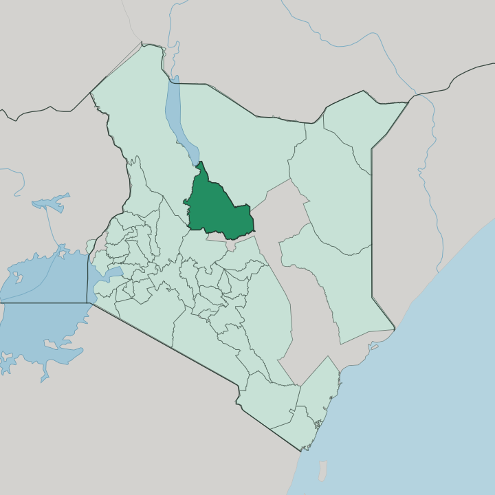


Towns & cities in Samburu
Pick a town or city — each links to where to stay.
Most safari beds cluster along the Ewaso Ng'iro, where lodges and tented camps line the river inside Samburu National Reserve. Base there for the game. Buffalo Springs National Reserve faces it across the south bank, an easy add to the same circuit.
Maralal, the county capital up on the Loroghi Plateau, suits a slower stop built around its markets, the Maralal International Camel Derby, and the cedar highlands of the Kirisia forest. For forest and quiet, the camps below the Ndoto Mountains near Wamba trade the river crowds for cool wooded slopes.
About Samburu
The name carries wildlife weight.
What is Samburu known for?
Samburu National Reserve sits on the north bank of the Ewaso Ng'iro river, and its dry-country game is the main draw. Here roam the Special Five, the Grevy's zebra, reticulated giraffe, Somali ostrich, gerenuk, and Beisa oryx, species scarce or absent farther south in Kenya. Large herds of elephant work the doum palms along the water.
The Samburu people give the county its other face, herders in red cloth and stacked beadwork whose camel derby at Maralal draws racers from far off.
Where is Samburu?
Samburu spreads across the dry north of Kenya, one of the counties of the former Rift Valley Province. It lies just north of the Equator. The land runs high and open, broken by mountains, savanna plain and forested range together, out on the eastern flank of the Great Rift Valley.
The Ewaso Ng'iro river marks much of the southern boundary, flowing east off the Laikipia highlands before it bends away toward the Lorian Swamp. From that water the county reaches north across thornbush and bare rock toward the southern shore of Lake Turkana. Relief sorts the county in two.
High ground rises in the west and centre, the Loroghi Plateau above Maralal, the Kirisia Hills, and their cedar forest, while hot lowland plains fall away to the north and east. Sharp desert ranges stud those plains. The Ndoto Mountains, the long wall of the Mathews Range, and the sacred mass of Mount Ng'iro climb straight from the flats, and the flat-topped Ol Doinyo Sabache stands over the reserves near Archers Post.
Maralal, the capital, sits up in the western highlands, a long day's drive north of Nairobi.
What is Samburu like?
Samburu takes its character from the people who share its name. They are the Samburu people, Maa-speaking herders. Cousins to the Maasai farther south, the Samburu keep to a semi-nomadic life built on cattle, goats, and the camels that suit this dry country, moving stock with the seasons between grazing grounds.
Wealth is counted in animals, not money. Society runs on age-sets, and young men pass years as moran, warriors who guard the herds, grow their hair long in ochre, and dance the high leaping dances that carry across the plains. Dress is unmistakable: men in red shukas, women in broad beaded collars whose colours mark age and marriage.
The county's other life grew up around its wildlife. Along the Ewaso Ng'iro, tourism and elephant research sit beside the herding world, and the Save the Elephants project has tracked the river's elephants from a camp inside Samburu National Reserve for decades. Faith leans Christian, mostly Catholic.
Each August the county capital fills for the Maralal International Camel Derby, when herders, tourists, and long-distance riders race camels across the Loroghi grasslands in one of Kenya's odder sporting weekends.
What is the history of Samburu?
The Samburu people reached these highlands generations ago, part of the southward drift of Maa-speaking herders down the Rift. Under British rule the whole dry north was sealed off as the Northern Frontier District, held apart from the rest of the colony and left largely to its pastoralists. Maralal keeps a sharper mark.
Jomo Kenyatta, later Kenya's first president, was held under guard in a tin-roofed house there in 1961, in the last stretch before independence. The modern county dates only to 2013, when Kenya's devolution turned the old Samburu District into a county in its own right.
What is the climate of Samburu?
Heat and drought define most of Samburu County. Most of the county is semi-arid plain, where thin rains fall in two seasons, the long rains around March to May, the short rains late in the year, and the months between bake brown. Altitude changes everything.
Up on the Loroghi Plateau, Maralal stays markedly cooler and greener than the lowland thornbush baking below. When the plains dry out, game crowds the Ewaso Ng'iro, which holds water when the seasonal streams have long since quit.
How do you get to Samburu?
Samburu lies well north of Nairobi. Most safari visitors fly the short hop from Wilson Airport in Nairobi to airstrips beside the reserves. Drivers take the tarmac road up through Nanyuki and Isiolo, then on to Archers Post at the reserve gates, a long half-day at the wheel.
A second route climbs west: the A4 highway runs from Rumuruti up onto the plateau to Maralal, and gravel carries on north to Baragoi. Past the towns the surface turns to dust, and a high-clearance vehicle earns its keep.
Good for
Updated July 2026